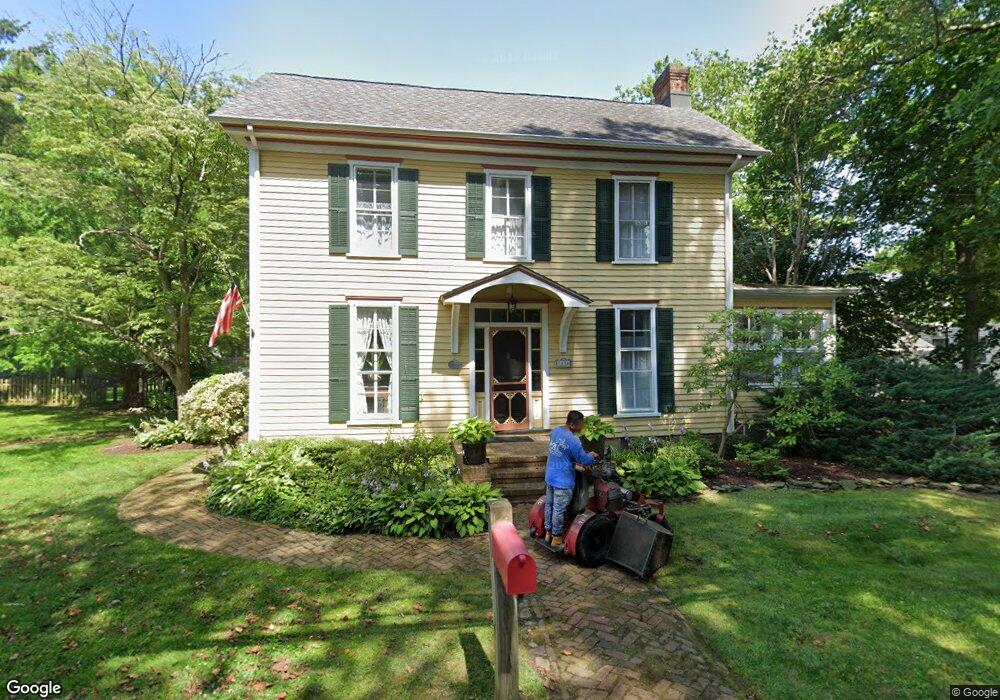
1036 Maple Ave Linwood, NJ 08221
Estimated Value: $507,000 - $608,000
--
Bed
--
Bath
2,086
Sq Ft
$273/Sq Ft
Est. Value
About This Home
This home is located at 1036 Maple Ave, Linwood, NJ 08221 and is currently estimated at $568,938, approximately $272 per square foot. 1036 Maple Ave is a home located in Atlantic County with nearby schools including Seaview Elementary School, Belhaven Middle School, and Mainland Regional High School.
Ownership History
Date
Name
Owned For
Owner Type
Purchase Details
Closed on
Aug 2, 2001
Sold by
Gaskill Kenneth E and Gaskill Debra A
Bought by
Kohler William J and Kohler Gail G
Current Estimated Value
Home Financials for this Owner
Home Financials are based on the most recent Mortgage that was taken out on this home.
Original Mortgage
$212,000
Outstanding Balance
$82,160
Interest Rate
7.06%
Mortgage Type
Purchase Money Mortgage
Estimated Equity
$486,778
Purchase Details
Closed on
Sep 30, 1992
Sold by
Gaskill Sr Kenneth E
Bought by
Gaskill Kenneth E and Gaskill Debra A
Create a Home Valuation Report for This Property
The Home Valuation Report is an in-depth analysis detailing your home's value as well as a comparison with similar homes in the area
Home Values in the Area
Average Home Value in this Area
Purchase History
| Date | Buyer | Sale Price | Title Company |
|---|---|---|---|
| Kohler William J | $265,000 | -- | |
| Gaskill Kenneth E | -- | -- |
Source: Public Records
Mortgage History
| Date | Status | Borrower | Loan Amount |
|---|---|---|---|
| Open | Kohler William J | $212,000 |
Source: Public Records
Tax History Compared to Growth
Tax History
| Year | Tax Paid | Tax Assessment Tax Assessment Total Assessment is a certain percentage of the fair market value that is determined by local assessors to be the total taxable value of land and additions on the property. | Land | Improvement |
|---|---|---|---|---|
| 2025 | $11,670 | $305,900 | $120,500 | $185,400 |
| 2024 | $11,670 | $305,900 | $120,500 | $185,400 |
| 2023 | $11,129 | $305,900 | $120,500 | $185,400 |
| 2022 | $11,129 | $305,900 | $120,500 | $185,400 |
| 2021 | $11,031 | $305,900 | $120,500 | $185,400 |
| 2020 | $10,878 | $305,900 | $120,500 | $185,400 |
| 2019 | $10,645 | $305,900 | $120,500 | $185,400 |
| 2018 | $10,407 | $305,900 | $120,500 | $185,400 |
| 2017 | $10,199 | $305,900 | $120,500 | $185,400 |
| 2016 | $9,856 | $305,900 | $120,500 | $185,400 |
| 2015 | $9,865 | $305,900 | $120,500 | $185,400 |
| 2014 | $9,517 | $307,000 | $120,500 | $186,500 |
Source: Public Records
Map
Nearby Homes
- 1050 Shore Rd
- 104 W Poplar Ave
- 105 W Edgewood Ave
- 110 W Poplar Ave
- 130 Wilson Ave
- 1201 Woodlynne Blvd
- 605 Shore Rd
- 901 Oak Ave
- 7 Woodstock Dr
- 210 Haines Ave
- 1011 New Rd
- 309 Haines Ave
- 1016 Richard Dr
- 500 Davis Ave
- 1917 Ventnor Ave
- 911 Bartlett Ave
- 1005 Bartlett Ave
- 301 Wabash Ave
- 1026 Bartlett Dr
- 1026 Bartlett Ave