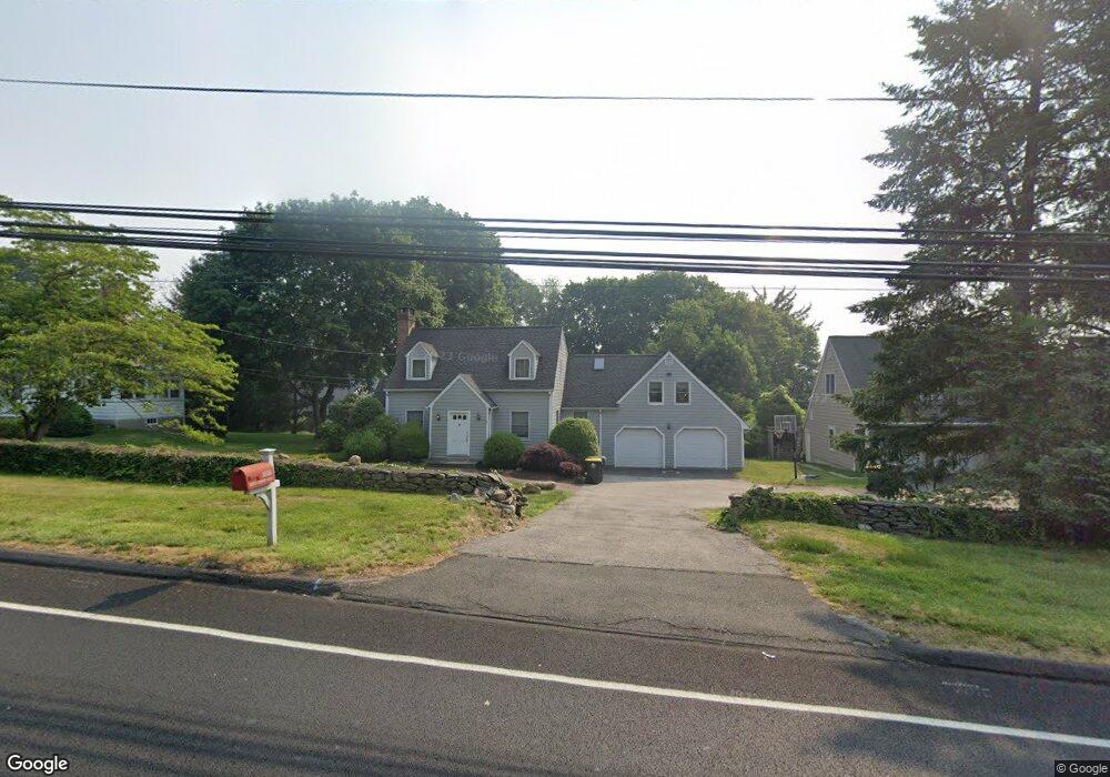
1036 N Benson Rd Fairfield, CT 06824
University NeighborhoodEstimated Value: $886,000 - $988,000
5
Beds
4
Baths
2,490
Sq Ft
$376/Sq Ft
Est. Value
About This Home
This home is located at 1036 N Benson Rd, Fairfield, CT 06824 and is currently estimated at $935,398, approximately $375 per square foot. 1036 N Benson Rd is a home located in Fairfield County with nearby schools including Osborn Hill Elementary School, Fairfield Woods Middle School, and Fairfield Ludlowe High School.
Ownership History
Date
Name
Owned For
Owner Type
Purchase Details
Closed on
Nov 9, 2009
Sold by
Pipala Michael and Pipala Kathleen
Bought by
Fairfield University
Current Estimated Value
Purchase Details
Closed on
Nov 16, 2006
Sold by
French Harry B and French Gloria A
Bought by
Pipala Michael and Pipala Kathleen
Create a Home Valuation Report for This Property
The Home Valuation Report is an in-depth analysis detailing your home's value as well as a comparison with similar homes in the area
Home Values in the Area
Average Home Value in this Area
Purchase History
| Date | Buyer | Sale Price | Title Company |
|---|---|---|---|
| Fairfield University | $565,000 | -- | |
| Fairfield University | $565,000 | -- | |
| Pipala Michael | $654,000 | -- | |
| Pipala Michael | $654,000 | -- |
Source: Public Records
Mortgage History
| Date | Status | Borrower | Loan Amount |
|---|---|---|---|
| Previous Owner | Pipala Michael | $91,000 | |
| Previous Owner | Pipala Michael | $631,000 |
Source: Public Records
Tax History Compared to Growth
Tax History
| Year | Tax Paid | Tax Assessment Tax Assessment Total Assessment is a certain percentage of the fair market value that is determined by local assessors to be the total taxable value of land and additions on the property. | Land | Improvement |
|---|---|---|---|---|
| 2025 | $11,550 | $406,840 | $262,640 | $144,200 |
| 2024 | $11,351 | $406,840 | $262,640 | $144,200 |
| 2023 | $11,192 | $406,840 | $262,640 | $144,200 |
| 2022 | $11,082 | $406,840 | $262,640 | $144,200 |
| 2021 | $10,977 | $406,840 | $262,640 | $144,200 |
| 2020 | $11,211 | $418,460 | $259,910 | $158,550 |
| 2019 | $11,211 | $418,460 | $259,910 | $158,550 |
| 2018 | $11,031 | $418,460 | $259,910 | $158,550 |
| 2017 | $0 | $418,460 | $259,910 | $158,550 |
| 2016 | $10,750 | $418,460 | $259,910 | $158,550 |
| 2015 | $10,750 | $433,650 | $308,140 | $125,510 |
| 2014 | -- | $433,650 | $308,140 | $125,510 |
Source: Public Records
Map
Nearby Homes
- 168 Wormwood Rd
- 133 Green Acre Ln
- 15 Barton Rd
- 478 Crestwood Rd
- 44 Deer Run Rd
- 68 Figlar Ave
- 122 Colony St
- 105 Charter Oak Rd
- 38 Edge Hill Rd
- 20 Ermine St
- 45 Robin Cir
- 42 Robin Cir
- 274 High St
- 109 Jeniford Rd
- 83 Pell Meadow Dr
- 2180 Kings Hwy Unit 1
- 359 Reid St
- 338 Orchard Hill Ln
- 232 Pell Meadow Dr
- 1207 Stillson Rd
- 1014 N Benson Rd
- 1058 N Benson Rd
- 994 N Benson Rd
- 1062 N Benson Rd
- 152 Dill Rd
- 363 Wormwood Rd
- 379 Wormwood Rd
- 175 Dill Rd
- 331 Wormwood Rd
- 1082 N Benson Rd
- 136 Dill Rd
- 347 Wormwood Rd
- 133 Dill Rd
- 960 N Benson Rd
- 948 N Benson Rd
- 147 Dill Rd
- 395 Wormwood Rd
- 348 Wormwood Rd
- 1102 N Benson Rd
- 330 Wormwood Rd