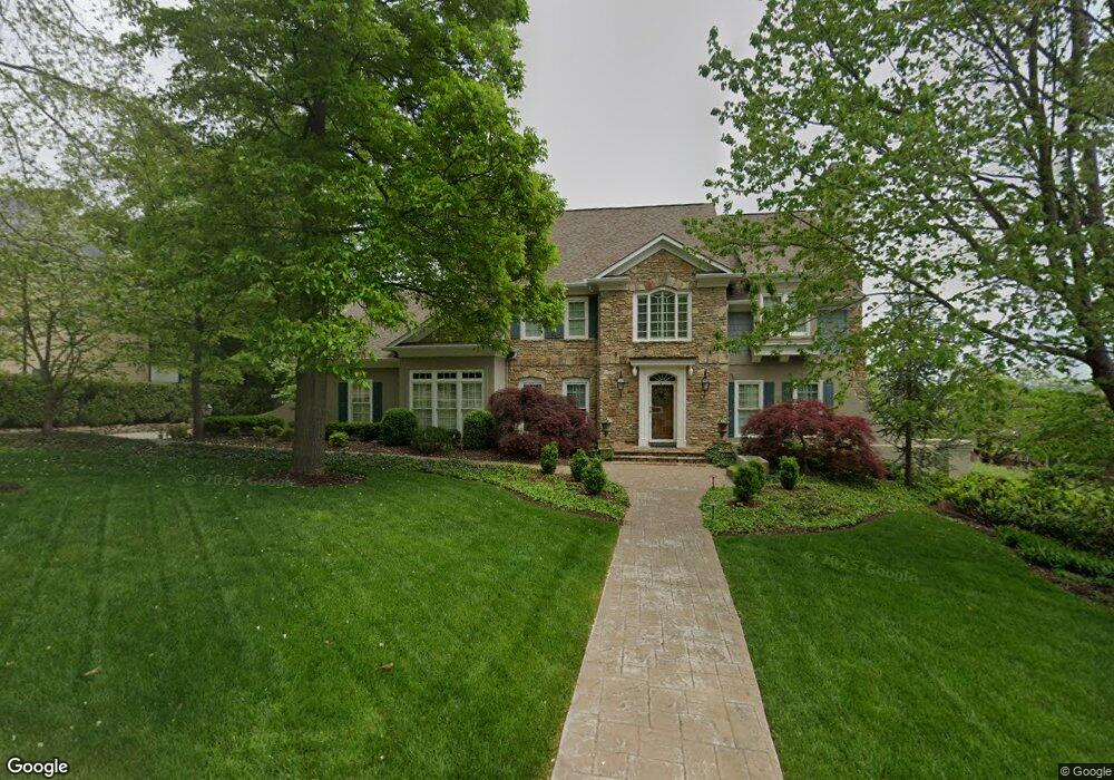
1036 St Ives Ct Morristown, TN 37814
Estimated Value: $576,047 - $841,000
--
Bed
5
Baths
4,144
Sq Ft
$169/Sq Ft
Est. Value
About This Home
This home is located at 1036 St Ives Ct, Morristown, TN 37814 and is currently estimated at $699,262, approximately $168 per square foot. 1036 St Ives Ct is a home located in Hamblen County with nearby schools including Manley Elementary School, West View Middle School, and Morristown West High School.
Ownership History
Date
Name
Owned For
Owner Type
Purchase Details
Closed on
Jan 22, 2001
Sold by
Lisa Ellis
Bought by
Hale William T
Current Estimated Value
Purchase Details
Closed on
Jul 10, 2000
Sold by
Ellis Frank S and Ellis Lisa W
Bought by
Ellis Lisa W
Purchase Details
Closed on
Jun 1, 1994
Bought by
Ellis Frank S and Ellis Lisa W
Purchase Details
Closed on
Feb 3, 1993
Bought by
Ellis Frank S and Ellis Lisa W
Purchase Details
Closed on
Mar 26, 1992
Bought by
Skelton Wayman
Purchase Details
Closed on
Jun 27, 1990
Bought by
St Ives Developers
Purchase Details
Closed on
Jan 2, 1985
Bought by
Colonial Standard Ventures Inc
Create a Home Valuation Report for This Property
The Home Valuation Report is an in-depth analysis detailing your home's value as well as a comparison with similar homes in the area
Home Values in the Area
Average Home Value in this Area
Purchase History
| Date | Buyer | Sale Price | Title Company |
|---|---|---|---|
| Hale William T | $420,000 | -- | |
| Ellis Lisa W | -- | -- | |
| Ellis Frank S | $5,400 | -- | |
| Ellis Frank S | $365,100 | -- | |
| Skelton Wayman | $34,500 | -- | |
| St Ives Developers | -- | -- | |
| Colonial Standard Ventures Inc | -- | -- |
Source: Public Records
Tax History Compared to Growth
Tax History
| Year | Tax Paid | Tax Assessment Tax Assessment Total Assessment is a certain percentage of the fair market value that is determined by local assessors to be the total taxable value of land and additions on the property. | Land | Improvement |
|---|---|---|---|---|
| 2024 | $1,959 | $111,325 | $11,725 | $99,600 |
| 2023 | $1,959 | $111,325 | $0 | $0 |
| 2022 | $3,518 | $111,325 | $11,725 | $99,600 |
| 2021 | $1,959 | $111,325 | $11,725 | $99,600 |
| 2020 | $3,513 | $111,325 | $11,725 | $99,600 |
| 2019 | $3,305 | $97,225 | $11,550 | $85,675 |
| 2018 | $3,062 | $97,225 | $11,550 | $85,675 |
| 2017 | $3,014 | $97,225 | $11,550 | $85,675 |
| 2016 | $2,878 | $97,225 | $11,550 | $85,675 |
| 2015 | $2,678 | $97,225 | $11,550 | $85,675 |
| 2014 | -- | $97,225 | $11,550 | $85,675 |
| 2013 | -- | $121,350 | $0 | $0 |
Source: Public Records
Map
Nearby Homes
- 1054 Colonial Dr
- 1086 St Ives Ct
- 2978 Wilshire Blvd
- 801 Colonial Dr
- 700 Drinnon Dr
- 3471 Walden Dr
- 3475 Walden Dr
- 400 Drinnon Dr
- 3542 Wedgewood Dr
- 3641 Meadowland Dr
- 1736 Jellicorse Rd
- 725 Barton Dr
- 490 E Sunset Hills
- 2444 Sandstone Dr
- 2454 Sandstone Dr
- 2430 Sandstone Dr
- 2310 Sandstone Dr
- 837 Foxglove Ln
- 1701 Old Oak Ln
- 0 Mcbride Rd
- 1024 St Ives Ct
- 1042 St Ives Ct
- 1033 St Ives
- 1050 St Ives Ct
- 1019 St Ives Ct
- 1050 Saint Ives Ct
- 1010 St Ives Ct
- 1065 St Ives Ct
- 1056 St Ives Ct
- 3030 Wilshire Blvd
- 3024 Wilshire Blvd
- 3018 Wilshire Blvd
- 3043 Wilshire Blvd
- 1062 St Ives Ct
- 1075 St Ives Ct
- 948 Colonial Dr
- 1021 Colonial Dr
- 3109 Catron Ln
- 3007 Wilshire Blvd
- 1038 Colonial Dr