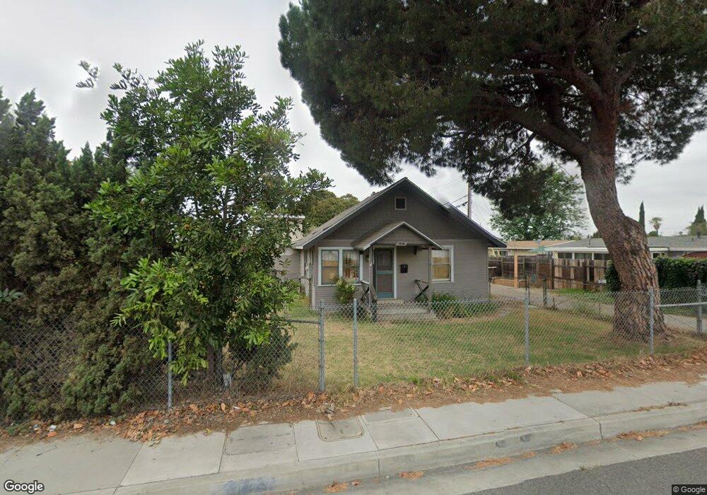
10361 Brookhurst St Anaheim, CA 92804
West Anaheim NeighborhoodEstimated Value: $753,000 - $984,315
2
Beds
1
Bath
1,081
Sq Ft
$821/Sq Ft
Est. Value
About This Home
This home is located at 10361 Brookhurst St, Anaheim, CA 92804 and is currently estimated at $887,079, approximately $820 per square foot. 10361 Brookhurst St is a home located in Orange County with nearby schools including Jonas E. Salk Elementary School, Dale Jr High School, and Magnolia High.
Ownership History
Date
Name
Owned For
Owner Type
Purchase Details
Closed on
May 10, 2024
Sold by
Smith Family Living Trust and Smith Jerry A
Bought by
Smith Family Living Trust and Smith
Current Estimated Value
Purchase Details
Closed on
Oct 29, 2015
Sold by
Smith Charles F
Bought by
Smith Charles F
Purchase Details
Closed on
Jul 16, 2002
Sold by
Reade Thelma J
Bought by
Smith Charles F
Purchase Details
Closed on
Jul 15, 2002
Sold by
Holliday Elaine M
Bought by
Smith Charles F
Purchase Details
Closed on
Aug 4, 1999
Sold by
Smith Jerry A
Bought by
Smith Charles F
Create a Home Valuation Report for This Property
The Home Valuation Report is an in-depth analysis detailing your home's value as well as a comparison with similar homes in the area
Home Values in the Area
Average Home Value in this Area
Purchase History
| Date | Buyer | Sale Price | Title Company |
|---|---|---|---|
| Smith Family Living Trust | -- | None Listed On Document | |
| Smith Charles F | -- | None Available | |
| Smith Charles F | $45,000 | -- | |
| Smith Charles F | $45,000 | -- | |
| Smith Charles F | $45,000 | -- | |
| Smith Charles F | -- | First American Title Ins Co |
Source: Public Records
Tax History Compared to Growth
Tax History
| Year | Tax Paid | Tax Assessment Tax Assessment Total Assessment is a certain percentage of the fair market value that is determined by local assessors to be the total taxable value of land and additions on the property. | Land | Improvement |
|---|---|---|---|---|
| 2025 | $2,968 | $273,921 | $246,217 | $27,704 |
| 2024 | $2,968 | $268,550 | $241,389 | $27,161 |
| 2023 | $2,883 | $263,285 | $236,656 | $26,629 |
| 2022 | $2,828 | $258,123 | $232,016 | $26,107 |
| 2021 | $2,795 | $253,062 | $227,466 | $25,596 |
| 2020 | $2,781 | $250,468 | $225,134 | $25,334 |
| 2019 | $2,707 | $245,557 | $220,719 | $24,838 |
| 2018 | $2,674 | $240,743 | $216,392 | $24,351 |
| 2017 | $2,576 | $236,023 | $212,149 | $23,874 |
| 2016 | $2,565 | $231,396 | $207,990 | $23,406 |
| 2015 | $2,541 | $227,921 | $204,866 | $23,055 |
| 2014 | $2,407 | $223,457 | $200,853 | $22,604 |
Source: Public Records
Map
Nearby Homes
- 10301 Antigua St
- 1350 S Ashington Ln
- 10301 Rhiems Rd
- 1250 S Brookhurst St Unit 1059
- 1250 S Brookhurst St Unit 2028
- 1250 S Brookhurst St Unit 2080
- 1250 S Brookhurst St
- 1250 S Brookhurst St Unit 2033
- 1944 W Lullaby Ln
- 994 S Sutter Creek Rd Unit 60
- 938 S Sutter Creek Rd Unit 54
- 998 S Crossbow Ln Unit 12D
- 917 S Sutter Creek Rd Unit 46
- 1737 S Garden Dr
- 958 S Crossbow Ln Unit 8
- 1765 S Biscayne Ct
- 2011 W Katella Ave Unit 61
- 930 S Emerald St
- 9272 Cerritos Ave
- 10112 Becca Dr
- 9972 Chanticleer Rd
- 9962 Chanticleer Rd
- 9942 Chanticleer Rd
- 1421 S Pembrooke Ln
- 10392 Poona Dr
- 9932 Chanticleer Rd
- 1417 S Pembrooke Ln
- 10411 Brookhurst St
- 9921 Harriet Ln
- 2172 W Harriet Ln
- 1411 S Pembrooke Ln
- 9922 Chanticleer Rd
- 10412 Poona Dr
- 9971 Chanticleer Rd
- 9951 Chanticleer Rd
- 10421 Brookhurst St
- 9941 Chanticleer Rd
- 9911 Harriet Ln
- 2168 W Harriet Ln
- 1405 S Pembrooke Ln