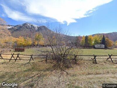
10365 E Highway 39 Huntsville, UT 84317
Estimated Value: $1,476,000 - $1,669,020
5
Beds
5
Baths
3,727
Sq Ft
$422/Sq Ft
Est. Value
About This Home
This home is located at 10365 E Highway 39, Huntsville, UT 84317 and is currently estimated at $1,572,510, approximately $421 per square foot. 10365 E Highway 39 is a home located in Weber County with nearby schools including Valley Elementary School, Snowcrest Junior High School, and Weber High School.
Ownership History
Date
Name
Owned For
Owner Type
Purchase Details
Closed on
Nov 1, 2019
Sold by
Golding James D and Golding Kristi J
Bought by
Golding James D and Golding Kristi J
Current Estimated Value
Purchase Details
Closed on
Sep 19, 2012
Sold by
Christesen Cody and Christesen Sheila
Bought by
Golding James D and Golding Kristi J
Home Financials for this Owner
Home Financials are based on the most recent Mortgage that was taken out on this home.
Original Mortgage
$388,000
Outstanding Balance
$273,925
Interest Rate
3.55%
Mortgage Type
New Conventional
Estimated Equity
$1,298,585
Purchase Details
Closed on
Sep 12, 1996
Sold by
Starks Steven and Starks Deborah
Bought by
Christensen Cody and Christensen Shiela
Home Financials for this Owner
Home Financials are based on the most recent Mortgage that was taken out on this home.
Original Mortgage
$25,000
Interest Rate
8.23%
Mortgage Type
Seller Take Back
Create a Home Valuation Report for This Property
The Home Valuation Report is an in-depth analysis detailing your home's value as well as a comparison with similar homes in the area
Home Values in the Area
Average Home Value in this Area
Purchase History
| Date | Buyer | Sale Price | Title Company |
|---|---|---|---|
| Golding James D | -- | None Available | |
| Golding James D | -- | Metro National Title | |
| Christensen Cody | -- | -- |
Source: Public Records
Mortgage History
| Date | Status | Borrower | Loan Amount |
|---|---|---|---|
| Open | Golding James D | $388,000 | |
| Previous Owner | Christensen Cody | $25,000 |
Source: Public Records
Tax History Compared to Growth
Tax History
| Year | Tax Paid | Tax Assessment Tax Assessment Total Assessment is a certain percentage of the fair market value that is determined by local assessors to be the total taxable value of land and additions on the property. | Land | Improvement |
|---|---|---|---|---|
| 2024 | $7,570 | $760,851 | $232,880 | $527,971 |
| 2023 | $12,218 | $1,238,213 | $342,355 | $895,858 |
| 2022 | $12,309 | $1,271,632 | $302,302 | $969,330 |
| 2021 | $9,412 | $894,000 | $210,266 | $683,734 |
| 2020 | $9,565 | $835,084 | $190,268 | $644,816 |
| 2019 | $5,657 | $772,999 | $170,268 | $602,731 |
| 2018 | $5,737 | $771,418 | $136,150 | $635,268 |
| 2017 | $5,129 | $668,001 | $136,150 | $531,851 |
| 2016 | $5,146 | $390,758 | $91,150 | $299,608 |
| 2015 | $4,565 | $341,581 | $91,150 | $250,431 |
| 2014 | $4,061 | $285,773 | $91,150 | $194,623 |
Source: Public Records
Map
Nearby Homes
- 10360 E Highway 39
- 260 S 10450 E
- 9783 E Highway 39
- 11265 E Highway 39
- 9658 E Kelley Dr Unit 65
- 1331 N Maple Dr Unit 99
- 9055 E 1800 S
- 8307 Utah 39
- 2334 S Falcon Way
- 224 S 7900 E Unit 1
- 423 S 7900 E Unit 12
- 249 S 7900 E Unit 18
- 439 S 7900 E Unit 11
- 387 S 7900 E Unit 13
- 260 S 7900 E Unit 3
- 452 S 7900 E Unit 8
- 288 S 7900 E Unit 4
- 11857 E Falcon Point Unit H20
- 7347 E Jim Bridger Dr S Unit H47
- 5762 N Aspen Way Unit 20
- 10365 E Highway 39
- 10365 Utah 39
- 10397 E Highway 39
- 163 S 10450 E
- 145 S 10450 E
- 10448 E Hwy 39 S
- 10350 E Highway 39
- 225 S 10450 E
- 176 S 10450 E
- 10331 E Highway 39
- 142 S 10450 E
- 208 S 10450 E
- 10452 E Highway 39
- 10300 E 200 S
- 225 N Ella Way E
- 241 S 10450 E
- 235 N Ella Way E
- 10250 E 200 S
- 10200 E 200 S
- 257 S 10450 E