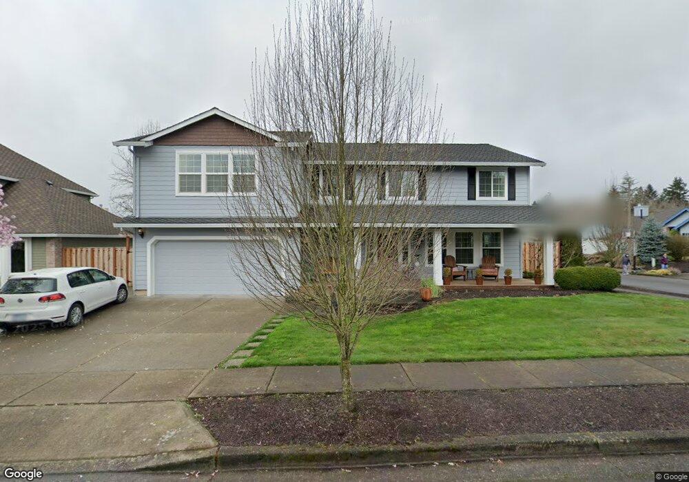
10365 SW 133rd Ave Beaverton, OR 97008
South Beaverton NeighborhoodEstimated Value: $710,073 - $748,000
4
Beds
3
Baths
2,057
Sq Ft
$351/Sq Ft
Est. Value
About This Home
This home is located at 10365 SW 133rd Ave, Beaverton, OR 97008 and is currently estimated at $722,018, approximately $351 per square foot. 10365 SW 133rd Ave is a home located in Washington County with nearby schools including Hiteon Elementary School, Conestoga Middle School, and Southridge High School.
Ownership History
Date
Name
Owned For
Owner Type
Purchase Details
Closed on
May 6, 2015
Sold by
Patokoski T Mikko and Patokoski Nicole
Bought by
Patokoski Living Trust
Current Estimated Value
Purchase Details
Closed on
Mar 5, 2004
Sold by
Huang Ton and Wang Ying Shih
Bought by
Patokoski T Mikko and Patokoski Nicole
Home Financials for this Owner
Home Financials are based on the most recent Mortgage that was taken out on this home.
Original Mortgage
$208,720
Outstanding Balance
$95,914
Interest Rate
5.65%
Mortgage Type
Unknown
Estimated Equity
$626,104
Create a Home Valuation Report for This Property
The Home Valuation Report is an in-depth analysis detailing your home's value as well as a comparison with similar homes in the area
Home Values in the Area
Average Home Value in this Area
Purchase History
| Date | Buyer | Sale Price | Title Company |
|---|---|---|---|
| Patokoski Living Trust | -- | None Available | |
| Patokoski T Mikko | $260,900 | Stewart |
Source: Public Records
Mortgage History
| Date | Status | Borrower | Loan Amount |
|---|---|---|---|
| Open | Patokoski T Mikko | $208,720 | |
| Closed | Patokoski T Mikko | $52,180 |
Source: Public Records
Tax History Compared to Growth
Tax History
| Year | Tax Paid | Tax Assessment Tax Assessment Total Assessment is a certain percentage of the fair market value that is determined by local assessors to be the total taxable value of land and additions on the property. | Land | Improvement |
|---|---|---|---|---|
| 2026 | $8,521 | $415,990 | -- | -- |
| 2025 | $8,521 | $403,880 | -- | -- |
| 2024 | $8,045 | $392,120 | -- | -- |
| 2023 | $8,045 | $380,700 | $0 | $0 |
| 2022 | $7,700 | $380,700 | $0 | $0 |
| 2021 | $7,431 | $358,860 | $0 | $0 |
| 2020 | $7,205 | $348,410 | $0 | $0 |
| 2019 | $6,977 | $338,270 | $0 | $0 |
| 2018 | $6,754 | $328,420 | $0 | $0 |
| 2017 | $6,502 | $318,860 | $0 | $0 |
| 2016 | $6,019 | $296,920 | $0 | $0 |
| 2015 | $5,795 | $288,280 | $0 | $0 |
| 2014 | -- | $279,890 | $0 | $0 |
Source: Public Records
Map
Nearby Homes
- 13180 SW Haystack Dr
- 13250 SW Weir Rd
- 9965 SW Pimlico Terrace
- 9970 SW Silver Place
- 10820 SW Huntington Ave
- 10835 SW Huntington Ave
- 10830 SW Briarwood Place
- 10910 SW Huntington Ave
- 10845 SW Summer Lake Dr
- 13775 SW Scholls Ferry Rd Unit 205
- 13775 SW Scholls Ferry Rd Unit 3
- 13775 SW Scholls Ferry Rd Unit 212
- 9625 SW 130th Ave
- 0 SW Scholls Ferry Rd
- 13850 SW Scholls Ferry Rd Unit 102
- 11325 SW Eucalyptus Place
- 13140 SW Madison Ct
- 9750 SW Lookout Terrace
- 12062 SW Conestoga Dr Unit 6
- 12145 SW Gingham Ln
- 10395 SW 133rd Ave
- 13360 SW Angora Ln
- 13315 SW Angora Ln
- 13365 SW Snowshoe Ln
- 13345 SW Angora Ln
- 10435 SW 133rd Ave
- 10380 SW 133rd Ave
- 10340 SW 133rd Ave
- 13285 SW Angora Ln
- 13380 SW Angora Ln
- 10400 SW 133rd Ave
- 13375 SW Angora Ln
- 10320 SW 133rd Ave
- 13385 SW Snowshoe Ln
- 10420 SW 133rd Ave
- 13320 SW Haystack Dr
- 13395 SW Angora Ln
- 13280 SW Haystack Dr
- 13175 SW Combine Ct
- 13180 SW Combine Ct