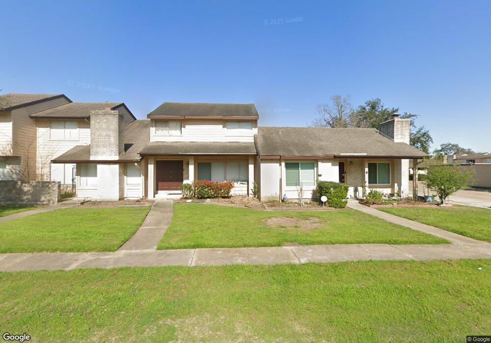
10366 Cook Rd Unit 366 Houston, TX 77099
Alief NeighborhoodEstimated Value: $169,797 - $203,000
3
Beds
3
Baths
1,472
Sq Ft
$123/Sq Ft
Est. Value
About This Home
This home is located at 10366 Cook Rd Unit 366, Houston, TX 77099 and is currently estimated at $180,949, approximately $122 per square foot. 10366 Cook Rd Unit 366 is a home located in Harris County with nearby schools including Kennedy Elementary School, Holub Middle School, and Mata Intermediate School.
Ownership History
Date
Name
Owned For
Owner Type
Purchase Details
Closed on
Nov 18, 2002
Sold by
Kinder Deborah and Steen Deborah K
Bought by
Garza Julia
Current Estimated Value
Home Financials for this Owner
Home Financials are based on the most recent Mortgage that was taken out on this home.
Original Mortgage
$67,260
Outstanding Balance
$27,903
Interest Rate
5.89%
Mortgage Type
Stand Alone First
Estimated Equity
$153,046
Purchase Details
Closed on
Jan 25, 1999
Sold by
Hodges Betty A and Hodges Steven W
Bought by
Steen Deborah K
Home Financials for this Owner
Home Financials are based on the most recent Mortgage that was taken out on this home.
Original Mortgage
$44,150
Interest Rate
6.68%
Create a Home Valuation Report for This Property
The Home Valuation Report is an in-depth analysis detailing your home's value as well as a comparison with similar homes in the area
Home Values in the Area
Average Home Value in this Area
Purchase History
| Date | Buyer | Sale Price | Title Company |
|---|---|---|---|
| Garza Julia | -- | Houston Title | |
| Steen Deborah K | -- | -- |
Source: Public Records
Mortgage History
| Date | Status | Borrower | Loan Amount |
|---|---|---|---|
| Open | Garza Julia | $67,260 | |
| Previous Owner | Steen Deborah K | $44,150 |
Source: Public Records
Tax History Compared to Growth
Tax History
| Year | Tax Paid | Tax Assessment Tax Assessment Total Assessment is a certain percentage of the fair market value that is determined by local assessors to be the total taxable value of land and additions on the property. | Land | Improvement |
|---|---|---|---|---|
| 2025 | $2,097 | $149,033 | $27,375 | $121,658 |
| 2024 | $2,097 | $160,538 | $27,375 | $133,163 |
| 2023 | $2,097 | $160,538 | $27,375 | $133,163 |
| 2022 | $2,978 | $131,544 | $27,375 | $104,169 |
| 2021 | $2,841 | $119,677 | $27,375 | $92,302 |
| 2020 | $2,676 | $109,982 | $27,375 | $82,607 |
| 2019 | $2,553 | $99,681 | $27,375 | $72,306 |
| 2018 | $830 | $93,463 | $27,375 | $66,088 |
| 2017 | $2,088 | $97,881 | $18,597 | $79,284 |
| 2016 | $1,898 | $82,816 | $15,735 | $67,081 |
| 2015 | $1,235 | $82,816 | $15,735 | $67,081 |
| 2014 | $1,235 | $59,725 | $11,348 | $48,377 |
Source: Public Records
Map
Nearby Homes
- 10362 Cook Rd Unit 187
- 10366 Panther Point Dr
- 10355 Panther Point Dr
- 10327 Panther Point Dr
- 12419 Longbrook Dr
- 10325 Huntington Place Dr Unit 325
- 10327 Huntington Place Dr Unit 327
- 12510 Panther Place Dr
- 12166 Huntington Venture Dr
- 10518 Huntington Dale Dr
- 12623 S Dairy Ashford Rd
- 10534 Huntington Wood Dr
- 12122 Plumbrook Dr
- 12123 Plumpoint Dr
- 10530 Farmingham Dr
- 10602 Tenneta Dr
- 12346 Huntington Venture Dr
- 12431 Huntington Field Dr
- 12310 Pine Knoll Dr
- 12211 Pine Knoll Dr
- 10368 Cook Rd
- 10368 Cook Rd Unit 155
- 10364 Cook Rd Unit 364
- 10370 Cook Rd Unit 370
- 10372 Cook Rd Unit 372
- 10372 Cook Rd Unit 153
- 10374 Cook Rd Unit 374
- 10374 Cook Rd Unit 152
- 10378 Cook Rd Unit 378
- 10378 Cook Rd Unit 141
- 10380 Cook Rd Unit 380
- 10380 Cook Rd Unit 142
- 10334 Cook Rd Unit 334
- 10382 Cook Rd Unit 382
- 10382 Cook Rd Unit 143
- 10376 Cook Rd Unit 376
- 10376 Cook Rd Unit 151
- 10384 Cook Rd Unit 6384
- 10384 Cook Rd Unit 144
- 10386 Cook Rd Unit 386