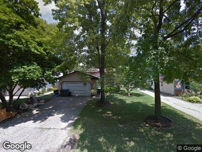
10367 Greenview Dr Columbia Station, OH 44028
Estimated Value: $242,000 - $272,000
3
Beds
2
Baths
1,796
Sq Ft
$143/Sq Ft
Est. Value
About This Home
This home is located at 10367 Greenview Dr, Columbia Station, OH 44028 and is currently estimated at $257,476, approximately $143 per square foot. 10367 Greenview Dr is a home located in Lorain County with nearby schools including Copopa Elementary School, Columbia Middle School, and Columbia High School.
Ownership History
Date
Name
Owned For
Owner Type
Purchase Details
Closed on
May 26, 1999
Sold by
Blair Thomas G and Blair Michele A
Bought by
Schroder Scott L and Schroder Victoria L
Current Estimated Value
Home Financials for this Owner
Home Financials are based on the most recent Mortgage that was taken out on this home.
Original Mortgage
$118,050
Interest Rate
6.92%
Mortgage Type
FHA
Create a Home Valuation Report for This Property
The Home Valuation Report is an in-depth analysis detailing your home's value as well as a comparison with similar homes in the area
Home Values in the Area
Average Home Value in this Area
Purchase History
| Date | Buyer | Sale Price | Title Company |
|---|---|---|---|
| Schroder Scott L | $121,000 | Land Title Agency Inc |
Source: Public Records
Mortgage History
| Date | Status | Borrower | Loan Amount |
|---|---|---|---|
| Closed | Schroder Scott L | $85,630 | |
| Closed | Schroder Scott L | $11,000 | |
| Closed | Schroder Scott L | $118,050 |
Source: Public Records
Tax History Compared to Growth
Tax History
| Year | Tax Paid | Tax Assessment Tax Assessment Total Assessment is a certain percentage of the fair market value that is determined by local assessors to be the total taxable value of land and additions on the property. | Land | Improvement |
|---|---|---|---|---|
| 2024 | $2,648 | $61,548 | $17,493 | $44,055 |
| 2023 | $2,373 | $48,167 | $11,263 | $36,904 |
| 2022 | $2,314 | $48,167 | $11,263 | $36,904 |
| 2021 | $2,338 | $48,167 | $11,263 | $36,904 |
| 2020 | $2,193 | $40,540 | $9,480 | $31,060 |
| 2019 | $2,181 | $40,540 | $9,480 | $31,060 |
| 2018 | $2,235 | $40,540 | $9,480 | $31,060 |
| 2017 | $2,270 | $38,810 | $6,020 | $32,790 |
| 2016 | $2,287 | $38,810 | $6,020 | $32,790 |
| 2015 | $2,325 | $38,810 | $6,020 | $32,790 |
| 2014 | $2,331 | $38,810 | $6,020 | $32,790 |
| 2013 | $2,340 | $38,810 | $6,020 | $32,790 |
Source: Public Records
Map
Nearby Homes
- 10204 Valleyview Dr
- 23570 Eastbrook Dr
- 8981 Leatherleaf Dr
- 23504 Marshcreek Way
- 23505 Marshcreek Way
- 23509 Marshcreek Way Unit S/L 77
- 1046 Ashford Ct
- 10444 E River Rd
- 25077 Saddlehorn Cir
- 10261 Baker Creek Ln
- 9760 Tannery Way
- 25362 Tyndall Falls Dr
- 0 E River Rd Unit 5120285
- 9521 Charney Cir
- 9384 N Marks Rd
- 23275 Chandlers Ln
- 8599 Marks Rd
- 23474 Grist Mill Ct Unit 1
- 23789 Snell Rd
- 12136 White Tail Run
- 10367 Greenview Dr
- 10385 Greenview Dr
- 10353 Greenview Dr
- 10399 Greenview Dr
- 10384 Westwood Rd
- 10396 Westwood Rd
- 10368 Westwood Rd
- 10423 Greenview Dr
- 10335 Greenview Dr
- 10414 Westwood Rd
- 10380 Greenview Dr
- 10354 Greenview Dr
- 10440 Westwood Rd
- 10342 Westwood Rd
- 10439 Greenview Dr
- 10410 Greenview Dr
- 10323 Greenview Dr
- 10428 Greenview Dr
- 10322 Westwood Rd
- 10330 Greenview Dr