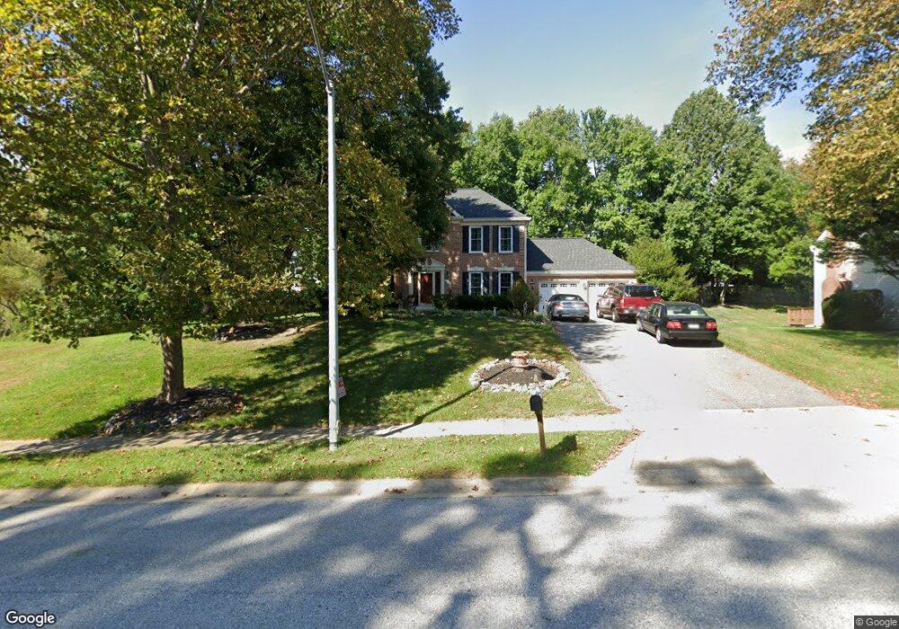
10368 Stansfield Rd Laurel, MD 20723
Estimated Value: $726,000 - $775,000
--
Bed
3
Baths
2,192
Sq Ft
$346/Sq Ft
Est. Value
About This Home
This home is located at 10368 Stansfield Rd, Laurel, MD 20723 and is currently estimated at $757,879, approximately $345 per square foot. 10368 Stansfield Rd is a home located in Howard County with nearby schools including Hammond Elementary School, Hammond Middle School, and Reservoir High School.
Ownership History
Date
Name
Owned For
Owner Type
Purchase Details
Closed on
Feb 19, 1999
Sold by
G E Capital Mortgage Ser
Bought by
Dana Axtell and Dana Axtell Laurie
Current Estimated Value
Purchase Details
Closed on
Nov 4, 1997
Sold by
Wilmer Lawrence F
Bought by
State Street Bank & Trust Co
Create a Home Valuation Report for This Property
The Home Valuation Report is an in-depth analysis detailing your home's value as well as a comparison with similar homes in the area
Home Values in the Area
Average Home Value in this Area
Purchase History
| Date | Buyer | Sale Price | Title Company |
|---|---|---|---|
| Dana Axtell | $251,000 | -- | |
| G E Capital Mortgage Ser | -- | -- | |
| State Street Bank & Trust Co | $259,000 | -- |
Source: Public Records
Mortgage History
| Date | Status | Borrower | Loan Amount |
|---|---|---|---|
| Closed | Dana Axtell | -- |
Source: Public Records
Tax History Compared to Growth
Tax History
| Year | Tax Paid | Tax Assessment Tax Assessment Total Assessment is a certain percentage of the fair market value that is determined by local assessors to be the total taxable value of land and additions on the property. | Land | Improvement |
|---|---|---|---|---|
| 2025 | $8,532 | $591,700 | $248,200 | $343,500 |
| 2024 | $8,532 | $560,600 | $0 | $0 |
| 2023 | $7,987 | $529,500 | $0 | $0 |
| 2022 | $7,577 | $498,400 | $218,200 | $280,200 |
| 2021 | $7,430 | $484,733 | $0 | $0 |
| 2020 | $7,430 | $471,067 | $0 | $0 |
| 2019 | $7,233 | $457,400 | $231,100 | $226,300 |
| 2018 | $6,882 | $457,400 | $231,100 | $226,300 |
| 2017 | $6,859 | $457,400 | $0 | $0 |
| 2016 | -- | $475,700 | $0 | $0 |
| 2015 | -- | $463,000 | $0 | $0 |
| 2014 | -- | $450,300 | $0 | $0 |
Source: Public Records
Map
Nearby Homes
- 8719 Susini Dr
- 9256 Laurens Way
- 10681 Old Bond Mill Rd
- 9260 Old Scaggsville Rd
- 10417 Leslie Dr
- 7209 Brooklyn Bridge Rd
- Dorchester IV Plan at Cole's Manor
- Tidewater Plan at Cole's Manor
- Stratton Plan at Cole's Manor
- Adrienne's Honneur II Plan at Cole's Manor
- Mount Vernon IV Villa 2 Plan at Cole's Manor
- Federal Hill II Plan at Cole's Manor
- 7709 Brooklyn Bridge Rd
- 10520 Scaggsville Rd
- 10571 Scaggsville Rd
- 9420 Fairview Ave
- 9422 Fairview Ave
- 211 Patuxent Rd
- 7616 Woodbine Dr
- 7619 Woodbine Dr
- 10364 Stansfield Rd
- 8823 Bluebird Trace
- 8816 Bluebird Trace
- 10360 Stansfield Rd
- 8810 Bluebird Trace
- 8819 Bluebird Trace
- 10305 Stansfield Rd
- 10374 Stansfield Rd
- 8815 Bluebird Trace
- 8806 Bluebird Trace
- 10320 Stansfield Rd
- 10324 Stansfield Rd
- 8845 Doves Fly Way
- 8818 Cardinal Ct
- 8811 Bluebird Trace
- 10378 Stansfield Rd
- 10311 Stansfield Rd
- 8807 Bluebird Trace
- 8849 Doves Fly Way
- 8802 Bluebird Trace