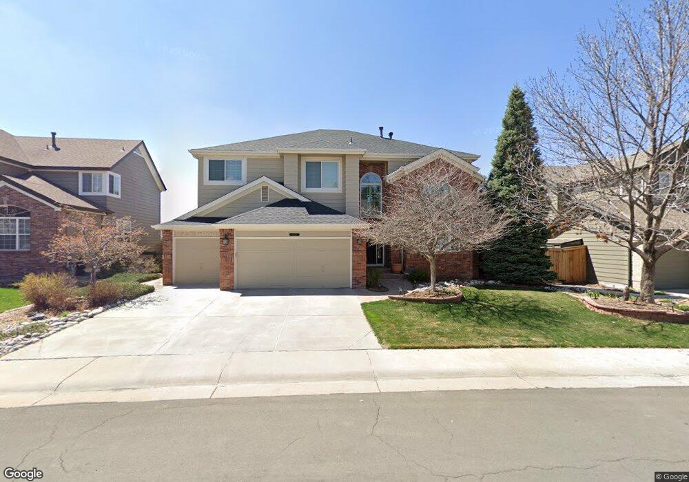
10369 Lions Path Lone Tree, CO 80124
Southridge NeighborhoodEstimated Value: $866,647 - $937,000
5
Beds
4
Baths
3,179
Sq Ft
$284/Sq Ft
Est. Value
About This Home
This home is located at 10369 Lions Path, Lone Tree, CO 80124 and is currently estimated at $901,824, approximately $283 per square foot. 10369 Lions Path is a home located in Douglas County with nearby schools including Wildcat Mountain Elementary School, Rocky Heights Middle School, and Rock Canyon High School.
Ownership History
Date
Name
Owned For
Owner Type
Purchase Details
Closed on
Apr 19, 1996
Sold by
Kdb Homes Inc
Bought by
Uselman John P and Uselman Kimberly R
Current Estimated Value
Home Financials for this Owner
Home Financials are based on the most recent Mortgage that was taken out on this home.
Original Mortgage
$207,000
Interest Rate
7.78%
Create a Home Valuation Report for This Property
The Home Valuation Report is an in-depth analysis detailing your home's value as well as a comparison with similar homes in the area
Home Values in the Area
Average Home Value in this Area
Purchase History
| Date | Buyer | Sale Price | Title Company |
|---|---|---|---|
| Uselman John P | $290,641 | -- |
Source: Public Records
Mortgage History
| Date | Status | Borrower | Loan Amount |
|---|---|---|---|
| Closed | Uselman John P | $207,000 |
Source: Public Records
Tax History
| Year | Tax Paid | Tax Assessment Tax Assessment Total Assessment is a certain percentage of the fair market value that is determined by local assessors to be the total taxable value of land and additions on the property. | Land | Improvement |
|---|---|---|---|---|
| 2025 | $5,616 | $61,880 | $10,580 | $51,300 |
| 2024 | $5,616 | $64,320 | $12,120 | $52,200 |
| 2023 | $5,668 | $64,320 | $12,120 | $52,200 |
| 2022 | $4,026 | $46,660 | $8,810 | $37,850 |
| 2021 | $4,183 | $46,660 | $8,810 | $37,850 |
| 2020 | $3,461 | $40,850 | $6,850 | $34,000 |
| 2019 | $3,472 | $40,850 | $6,850 | $34,000 |
| 2018 | $3,935 | $40,560 | $6,600 | $33,960 |
| 2017 | $3,991 | $40,560 | $6,600 | $33,960 |
| 2016 | $3,991 | $39,800 | $6,490 | $33,310 |
| 2015 | $2,033 | $43,440 | $6,490 | $36,950 |
| 2014 | $3,435 | $31,720 | $5,030 | $26,690 |
Source: Public Records
Map
Nearby Homes
- 10330 Lions Path
- 10499 Cheetah Winds
- 10292 Nickolas Ave
- 10146 Jill Ave
- 10232 Nickolas Ave
- 10439 Cheetah Winds
- 10155 Joseph Dr
- 10541 Jaguar Glen
- 10445 Cheetah Winds
- 5639 Jaguar Way
- 10102 Glenstone Cir
- 7053 Leopard Dr
- 7093 Leopard Dr
- 7085 Leopard Gate
- 10660 Jewelberry Cir
- 5341 Windflower Ln
- 10468 Wagon Box Cir
- 9845 Keenan St
- 10899 Bobcat Terrace
- 9943 Cottoncreek Dr
- 10377 Lions Path
- 10361 Lions Path
- 10387 Lions Path
- 10370 Lions Path
- 6204 Lions Point
- 6224 Lions Point
- 10378 Lions Path
- 10362 Lions Path
- 10393 Lions Path
- 6244 Lions Point
- 10354 Lions Path
- 10401 Lions Path
- 10394 Lions Path
- 10365 Lions Heart
- 10355 Lions Heart
- 10344 Lions Path
- 10385 Lions Heart
- 10409 Lions Path
- 10402 Lions Path
- 10395 Lions Heart
Your Personal Tour Guide
Ask me questions while you tour the home.