
Seller's Agent in 2025
Jameson Melbye
RE/MAX Results
(651) 764-8933
112 in this area
168 Total Sales
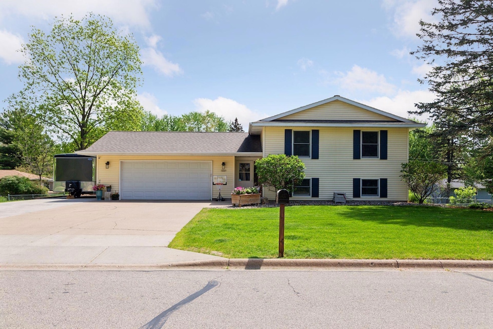
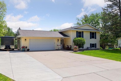
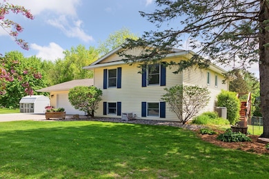
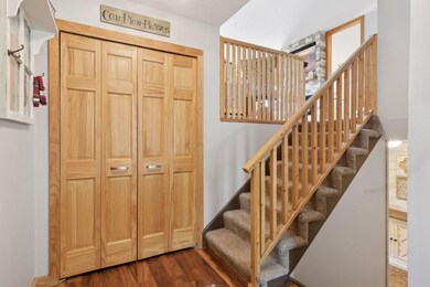
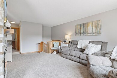
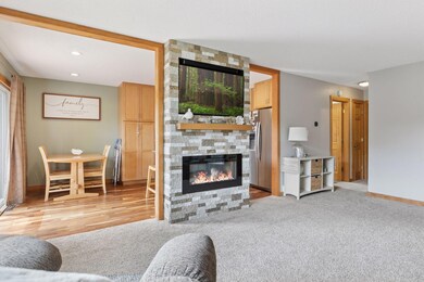
Enjoy the feel of an "Almost Country" setting with this beautifully maintained 4-bedroom, 2-bath home situated on a spacious double lot (0.52 acres)! The park-like yard offers plenty of space for gardening, entertaining, or playing - plus, the playset stays! The heated and insulated 2-car attached garage adds year-round comfort and convenience.
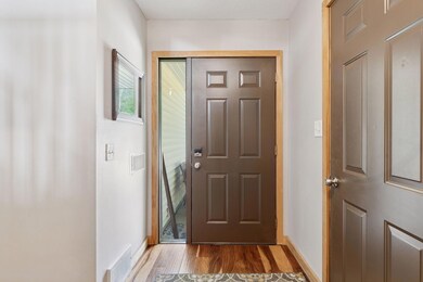
Inside, you'll find an updated kitchen and remodeled upstairs bathroom, fresh paint throughout, and a move-in ready layout. Step outside to a large 12x28 deck (new in 2022), perfect for outdoor dining and relaxing. The home features a newer A/C unit (2018), water heater (2019), and a brand-new yard barn/storage shed added in 2024.
Additional upgrades include a new roof in 2019, an updated/enlarged electrical breaker box, and an expanded driveway with a retaining wall completed in 2021-ideal for extra parking or improved curb appeal.
Located in a commuter-friendly area that offers a peaceful setting without sacrificing accessibility, this home checks all the boxes. Don't miss this move-in ready gem with room to grow inside and out.
| Date | Type | Sale Price | Title Company |
|---|---|---|---|
| Warranty Deed | $355,000 | Knight Barry Title | |
| Warranty Deed | $205,600 | Goodhue County Abstract | |
| Warranty Deed | $180,000 | -- | |
| Warranty Deed | $185,500 | -- |
| Date | Status | Loan Amount | Loan Type |
|---|---|---|---|
| Open | $240,000 | Credit Line Revolving |
| Date | Event | Price | List to Sale | Price per Sq Ft |
|---|---|---|---|---|
| 06/18/2025 06/18/25 | Sold | $355,000 | +7.6% | $178 / Sq Ft |
| 05/27/2025 05/27/25 | Pending | -- | -- | -- |
| 05/14/2025 05/14/25 | For Sale | $329,900 | -- | $165 / Sq Ft |
| Year | Tax Paid | Tax Assessment Tax Assessment Total Assessment is a certain percentage of the fair market value that is determined by local assessors to be the total taxable value of land and additions on the property. | Land | Improvement |
|---|---|---|---|---|
| 2025 | $3,394 | $272,300 | $65,200 | $207,100 |
| 2024 | -- | $267,500 | $65,200 | $202,300 |
| 2023 | $3,220 | $252,800 | $65,200 | $187,600 |
| 2022 | $2,970 | $249,900 | $65,200 | $184,700 |
| 2021 | $2,726 | $213,900 | $65,200 | $148,700 |
| 2020 | $2,728 | $200,700 | $65,200 | $135,500 |
| 2019 | $2,722 | $188,900 | $65,200 | $123,700 |
| 2018 | $2,228 | $190,600 | $63,300 | $127,300 |
| 2017 | $2,166 | $170,300 | $63,300 | $107,000 |
| 2016 | $2,288 | $168,000 | $63,300 | $104,700 |
| 2015 | $1,942 | $164,200 | $63,300 | $100,900 |
| 2014 | -- | $156,100 | $63,300 | $92,800 |
Seller's Agent in 2025
Jameson Melbye
RE/MAX Results
(651) 764-8933
112 in this area
168 Total Sales
J
Buyer's Agent in 2025
Jenna Johnson
Trust Realty
(507) 382-2496
13 in this area
15 Total Sales
Source: NorthstarMLS
MLS Number: 6721063
APN: 55.850.0210
Disclaimer: Certain information contained herein is derived from information provided by parties other than Homes.com. All information provided is deemed reliable, but is not guaranteed to be accurate and should be independently verified.
![]() Based on information submitted to the MLS GRID. All data is obtained from various sources and may not have been verified by broker or MLS GRID. Supplied Open House Information is subject to change without notice. All information should be independently reviewed and verified for accuracy. Properties may or may not be listed by the office/agent presenting the information. Some IDX listings have been excluded from this website.
Based on information submitted to the MLS GRID. All data is obtained from various sources and may not have been verified by broker or MLS GRID. Supplied Open House Information is subject to change without notice. All information should be independently reviewed and verified for accuracy. Properties may or may not be listed by the office/agent presenting the information. Some IDX listings have been excluded from this website.
Listings courtesy of NorthstarMLS as distributed by MLS GRID
Ask me questions while you tour the home.