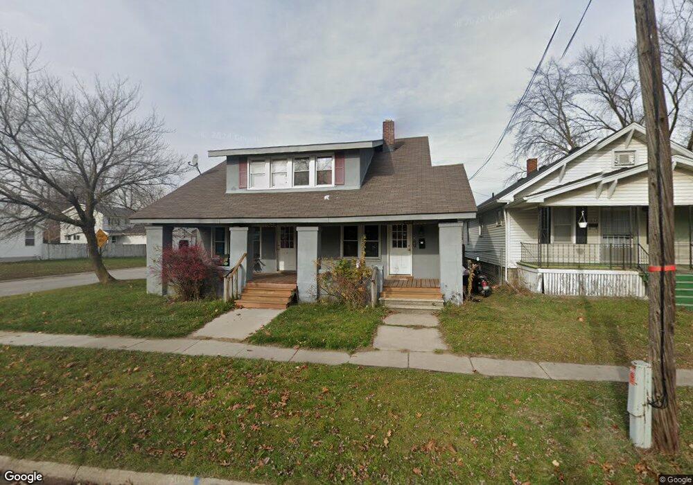
1037 Beard St Port Huron, MI 48060
Estimated Value: $116,000 - $190,000
--
Bed
--
Bath
1,681
Sq Ft
$91/Sq Ft
Est. Value
About This Home
This home is located at 1037 Beard St, Port Huron, MI 48060 and is currently estimated at $153,421, approximately $91 per square foot. 1037 Beard St is a home located in St. Clair County with nearby schools including Michigamme Elementary School, Central Middle School, and Port Huron High School.
Ownership History
Date
Name
Owned For
Owner Type
Purchase Details
Closed on
Sep 26, 2025
Sold by
Haufschild Brian
Bought by
Haufschild Enterprises 3 Llc
Current Estimated Value
Purchase Details
Closed on
Mar 7, 2025
Sold by
Haufschild Enterprises 3 Llc
Bought by
Haufschild Brian
Home Financials for this Owner
Home Financials are based on the most recent Mortgage that was taken out on this home.
Original Mortgage
$112,000
Interest Rate
6.96%
Mortgage Type
New Conventional
Purchase Details
Closed on
Aug 26, 2014
Sold by
Haufschild Enterprises Llc
Bought by
Haufschild Enterprises 3 Llc
Purchase Details
Closed on
Jun 24, 2013
Sold by
Millsap Raymond L and Millsap Dorothy A
Bought by
Haufschild Enterprises Llc
Purchase Details
Closed on
Jan 1, 2010
Sold by
Haufschild Enterprises 2 Llc
Bought by
Haufschild Enterprises Llc
Purchase Details
Closed on
Jul 1, 2008
Sold by
Millsap Raymond and Millsap Dorothy
Bought by
Haufschild Enterprises 2 Llc
Home Financials for this Owner
Home Financials are based on the most recent Mortgage that was taken out on this home.
Original Mortgage
$19,000
Interest Rate
6.15%
Mortgage Type
Seller Take Back
Purchase Details
Closed on
Jun 13, 2008
Sold by
Mitchell William Thomas and Warshefski Theresa Marie
Bought by
Millsap Raymond L and Millsap Dorothy A
Home Financials for this Owner
Home Financials are based on the most recent Mortgage that was taken out on this home.
Original Mortgage
$19,000
Interest Rate
6.15%
Mortgage Type
Seller Take Back
Purchase Details
Closed on
May 22, 2008
Sold by
Vansteel Thomas G and Vansteel Christina L
Bought by
Millsap Raymond L and Millsap Dorothy A
Home Financials for this Owner
Home Financials are based on the most recent Mortgage that was taken out on this home.
Original Mortgage
$19,000
Interest Rate
6.15%
Mortgage Type
Seller Take Back
Create a Home Valuation Report for This Property
The Home Valuation Report is an in-depth analysis detailing your home's value as well as a comparison with similar homes in the area
Home Values in the Area
Average Home Value in this Area
Purchase History
| Date | Buyer | Sale Price | Title Company |
|---|---|---|---|
| Haufschild Enterprises 3 Llc | -- | None Listed On Document | |
| Haufschild Brian | -- | None Listed On Document | |
| Haufschild Brian | -- | None Listed On Document | |
| Haufschild Enterprises 3 Llc | -- | None Available | |
| Haufschild Enterprises Llc | $20,000 | None Available | |
| Haufschild Enterprises Llc | -- | None Available | |
| Haufschild Enterprises 2 Llc | $20,000 | None Available | |
| Millsap Raymond L | -- | Huron Title Company | |
| Millsap Raymond L | -- | None Available | |
| Vansteel Thomas G | -- | None Available |
Source: Public Records
Mortgage History
| Date | Status | Borrower | Loan Amount |
|---|---|---|---|
| Previous Owner | Haufschild Brian | $112,000 | |
| Previous Owner | Haufschild Enterprises 2 Llc | $19,000 |
Source: Public Records
Tax History Compared to Growth
Tax History
| Year | Tax Paid | Tax Assessment Tax Assessment Total Assessment is a certain percentage of the fair market value that is determined by local assessors to be the total taxable value of land and additions on the property. | Land | Improvement |
|---|---|---|---|---|
| 2025 | $1,525 | $52,000 | $0 | $0 |
| 2024 | $1,293 | $49,100 | $0 | $0 |
| 2023 | $1,224 | $44,000 | $0 | $0 |
| 2022 | $1,181 | $36,400 | $0 | $0 |
| 2021 | $1,128 | $27,800 | $0 | $0 |
| 2020 | $1,133 | $24,600 | $24,600 | $0 |
| 2019 | $1,113 | $17,400 | $0 | $0 |
| 2018 | $1,088 | $17,400 | $0 | $0 |
| 2017 | $999 | $16,400 | $0 | $0 |
| 2016 | $880 | $16,400 | $0 | $0 |
| 2015 | $894 | $16,300 | $16,300 | $0 |
| 2014 | $894 | $16,600 | $16,600 | $0 |
| 2013 | -- | $17,400 | $0 | $0 |
Source: Public Records
Map
Nearby Homes
- 2411 10th St
- 823 Beard St
- 1414 Beard St
- 1403 Catherine McAuley Dr
- 2710 Electric Ave
- 913 Tunnel St
- 2718 Electric Ave
- 2444 Military St
- 2430 Military St Unit 2434
- 730 Jenkinson St
- 1112 Minnie St
- 2704 Military St
- 2724 Military St
- 1127 Minnie St
- 831 Bancroft St
- 1319 Minnie St
- 2815 Military St
- 1322 Division St
- 1309 Division St
- 1815 8th St
- 1033 Beard St
- 1023 Beard St
- 1103 Beard St
- 1040 Beard St
- 1019 Beard St
- 2410 11th St
- 2403 11th St
- 2315 11th St Unit 2319
- 1024 Beard St
- 2300 11th St
- 1107 Beard St
- 1013 Beard St Unit Bldg-Unit
- 1013 Beard St
- 2311 11th St Unit 2313
- 2325 10th St
- 1113 Beard St
- 2405 11th St
- 2309 11th St Unit 2307
- 1020 Beard St
- 2416 11th St