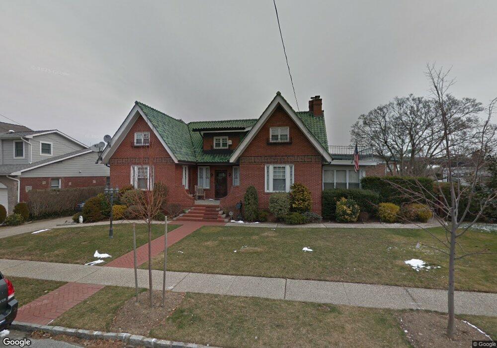
1037 Totten St Whitestone, NY 11357
Whitestone NeighborhoodEstimated Value: $1,795,000 - $2,047,000
--
Bed
--
Bath
2,310
Sq Ft
$835/Sq Ft
Est. Value
About This Home
This home is located at 1037 Totten St, Whitestone, NY 11357 and is currently estimated at $1,929,927, approximately $835 per square foot. 1037 Totten St is a home located in Queens County with nearby schools including J.H.S. 194 William Carr, Bayside High School, and Circle Academy - Whitestone.
Ownership History
Date
Name
Owned For
Owner Type
Purchase Details
Closed on
Sep 8, 2023
Sold by
Locosa Joseph and Locosa Laura E
Bought by
Tam Matthew
Current Estimated Value
Purchase Details
Closed on
Mar 1, 1999
Sold by
Carleo Rose and Carleo James A
Bought by
Locosa Joseph and Locosa Laura E
Home Financials for this Owner
Home Financials are based on the most recent Mortgage that was taken out on this home.
Original Mortgage
$227,150
Interest Rate
6.68%
Mortgage Type
Purchase Money Mortgage
Create a Home Valuation Report for This Property
The Home Valuation Report is an in-depth analysis detailing your home's value as well as a comparison with similar homes in the area
Home Values in the Area
Average Home Value in this Area
Purchase History
| Date | Buyer | Sale Price | Title Company |
|---|---|---|---|
| Tam Matthew | $1,956,000 | -- | |
| Locosa Joseph | $590,000 | -- |
Source: Public Records
Mortgage History
| Date | Status | Borrower | Loan Amount |
|---|---|---|---|
| Previous Owner | Locosa Joseph | $227,150 |
Source: Public Records
Tax History Compared to Growth
Tax History
| Year | Tax Paid | Tax Assessment Tax Assessment Total Assessment is a certain percentage of the fair market value that is determined by local assessors to be the total taxable value of land and additions on the property. | Land | Improvement |
|---|---|---|---|---|
| 2025 | $15,003 | $79,179 | $18,453 | $60,726 |
| 2024 | $15,003 | $74,697 | $20,719 | $53,978 |
| 2023 | $14,312 | $70,469 | $20,399 | $50,070 |
| 2022 | $13,501 | $66,480 | $23,100 | $43,380 |
| 2021 | $14,041 | $66,720 | $23,100 | $43,620 |
| 2020 | $14,862 | $73,320 | $23,100 | $50,220 |
| 2019 | $13,857 | $80,760 | $23,100 | $57,660 |
| 2018 | $13,503 | $66,240 | $16,712 | $49,528 |
| 2017 | $13,402 | $65,743 | $22,399 | $43,344 |
| 2016 | $12,399 | $65,743 | $22,399 | $43,344 |
| 2015 | $7,644 | $58,512 | $23,760 | $34,752 |
| 2014 | $7,644 | $55,200 | $25,680 | $29,520 |
Source: Public Records
Map
Nearby Homes
- 16801 12th Ave Unit 3A
- 168-11 12th Ave Unit 3D
- 168-01 12th Ave Unit 7B
- 16803 Cryders Ln
- 1009 166th St
- 166-31 9th Ave Unit 6A
- 10-24 166th St Unit 5D
- 166-40 Powells Cove Blvd Unit 9B
- 166-40 Powells Cove Blvd Unit 2A
- 166-26 Powells Cove Blvd Unit 9A
- 7-25 166th St Unit 2B
- 162-49 13th Ave
- 168-03 Powells Cove Blvd Unit 13
- 166-10 Powells Cove Blvd Unit 2C
- 166-10 Powells Cove Blvd Unit 4C
- 166-10 Powells Cove Blvd Unit 3D
- 162-40 9th Ave Unit 7A
- 162-40 9th Ave Unit 3B
- 162-40 9th Ave Unit 8B
- 7-24 166th St Unit 7A
- 10-37 Totten St
- 10-45 Totten St
- 1045 Totten St
- 1031 Totten St
- 1032 Utopia Pkwy
- 1032 Utopia Pkwy
- 1036 Utopia Pkwy
- 1024 Utopia Pkwy
- 1027 Totten St
- 10-54 Totten St
- 10-17 Totten St
- 1053 Totten St
- 1027 Utopia Pkwy
- 1017 Totten St
- 16811 12th Rd
- 1044 Totten St
- 10-44 Totten St
- 1038 Totten St
- 1048 Totten St
- 1032 Totten St