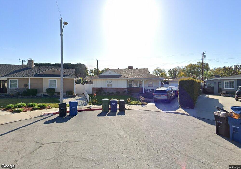
10372 Woodstead Ave Whittier, CA 90603
South Whittier NeighborhoodEstimated Value: $861,000 - $958,715
3
Beds
2
Baths
1,667
Sq Ft
$547/Sq Ft
Est. Value
About This Home
This home is located at 10372 Woodstead Ave, Whittier, CA 90603 and is currently estimated at $912,179, approximately $547 per square foot. 10372 Woodstead Ave is a home located in Los Angeles County with nearby schools including Leffingwell Elementary School, Granada Middle School, and La Serna High School.
Ownership History
Date
Name
Owned For
Owner Type
Purchase Details
Closed on
Apr 16, 2008
Sold by
Niz John T and Niz Kim
Bought by
Warner Kelly D and Warner Stephanie
Current Estimated Value
Home Financials for this Owner
Home Financials are based on the most recent Mortgage that was taken out on this home.
Original Mortgage
$368,000
Outstanding Balance
$232,016
Interest Rate
5.88%
Mortgage Type
Purchase Money Mortgage
Estimated Equity
$680,163
Purchase Details
Closed on
Mar 13, 1997
Sold by
Velez Elar M and Velez Margaret L
Bought by
Niz John T and Niz Kim
Home Financials for this Owner
Home Financials are based on the most recent Mortgage that was taken out on this home.
Original Mortgage
$173,600
Interest Rate
9.99%
Create a Home Valuation Report for This Property
The Home Valuation Report is an in-depth analysis detailing your home's value as well as a comparison with similar homes in the area
Home Values in the Area
Average Home Value in this Area
Purchase History
| Date | Buyer | Sale Price | Title Company |
|---|---|---|---|
| Warner Kelly D | $460,000 | Fidelity National Title Co | |
| Niz John T | $193,000 | Gateway Title Company |
Source: Public Records
Mortgage History
| Date | Status | Borrower | Loan Amount |
|---|---|---|---|
| Open | Warner Kelly D | $368,000 | |
| Previous Owner | Niz John T | $173,600 |
Source: Public Records
Tax History Compared to Growth
Tax History
| Year | Tax Paid | Tax Assessment Tax Assessment Total Assessment is a certain percentage of the fair market value that is determined by local assessors to be the total taxable value of land and additions on the property. | Land | Improvement |
|---|---|---|---|---|
| 2025 | $7,388 | $604,205 | $396,938 | $207,267 |
| 2024 | $7,388 | $592,358 | $389,155 | $203,203 |
| 2023 | $7,256 | $580,744 | $381,525 | $199,219 |
| 2022 | $7,121 | $569,358 | $374,045 | $195,313 |
| 2021 | $6,979 | $558,195 | $366,711 | $191,484 |
| 2019 | $6,846 | $541,640 | $355,835 | $185,805 |
| 2018 | $6,535 | $531,020 | $348,858 | $182,162 |
| 2016 | $6,186 | $510,402 | $335,312 | $175,090 |
| 2015 | $6,126 | $502,736 | $330,276 | $172,460 |
| 2014 | $6,054 | $492,889 | $323,807 | $169,082 |
Source: Public Records
Map
Nearby Homes
- 15413 Ashley Ct
- 10517 La Serna Dr
- 16428 Whittier Blvd Unit 2
- 15309 Jenkins Dr
- 10010 Cole Rd
- 15914 Lashburn St
- 16046 Gables Loop
- 15069 Mulberry Dr
- 16121 Lisco St
- 16164 Leffco Rd
- 11237 Gladhill Rd Unit 3
- 11237 Gladhill Rd Unit 12
- 11237 Gladhill Rd Unit 5
- 11237 Gladhill Rd Unit 15
- 10930 Groveland Ave
- 15246 Mystic St
- 11245 Gladhill Rd Unit 10
- 10931 Groveside Ave
- 11124 Stamy Rd
- 11548 Kibbee Ave
- 10376 Woodstead Ave
- 10409 Messina Dr
- 10370 Woodstead Ave
- 10415 Messina Dr
- 10403 Messina Dr
- 10421 Messina Dr
- 10382 Woodstead Ave
- 10412 Woodstead Ave
- 10364 Woodstead Ave
- 10341 Messina Dr
- 10427 Messina Dr
- 10358 Woodstead Ave
- 10418 Woodstead Ave
- 15522 Carnell St
- 10335 Messina Dr
- 15528 Carnell St
- 10403 Kibbee Ave
- 10433 Messina Dr
- 10340 Woodstead Ave
- 10424 El Braso Dr