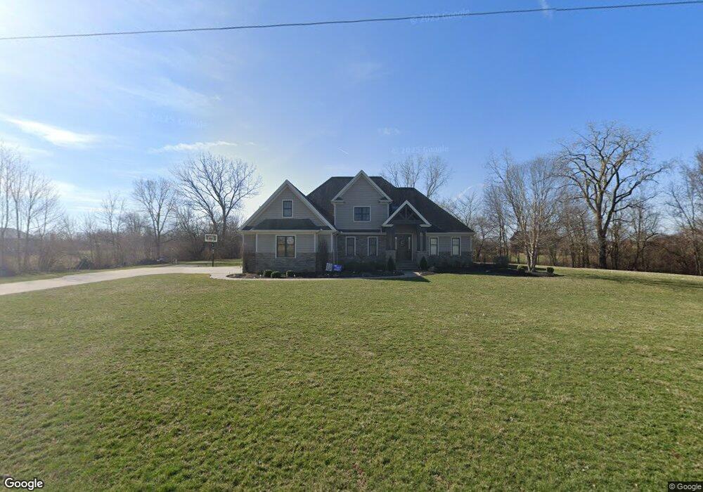
10379 Township Road 94 Findlay, OH 45840
Estimated Value: $452,000 - $993,000
4
Beds
3
Baths
2,586
Sq Ft
$257/Sq Ft
Est. Value
About This Home
This home is located at 10379 Township Road 94, Findlay, OH 45840 and is currently estimated at $665,532, approximately $257 per square foot. 10379 Township Road 94 is a home with nearby schools including Liberty-Benton Elementary School, Liberty-Benton Middle School, and Liberty-Benton High School.
Ownership History
Date
Name
Owned For
Owner Type
Purchase Details
Closed on
Sep 30, 2011
Sold by
Nantahala Llc
Bought by
Gillig Nikki and Gillig Trevor
Current Estimated Value
Home Financials for this Owner
Home Financials are based on the most recent Mortgage that was taken out on this home.
Original Mortgage
$292,000
Interest Rate
4.22%
Mortgage Type
New Conventional
Create a Home Valuation Report for This Property
The Home Valuation Report is an in-depth analysis detailing your home's value as well as a comparison with similar homes in the area
Home Values in the Area
Average Home Value in this Area
Purchase History
| Date | Buyer | Sale Price | Title Company |
|---|---|---|---|
| Gillig Nikki | $60,000 | Mid Am Title Agency |
Source: Public Records
Mortgage History
| Date | Status | Borrower | Loan Amount |
|---|---|---|---|
| Previous Owner | Gillig Nikki | $292,000 |
Source: Public Records
Tax History Compared to Growth
Tax History
| Year | Tax Paid | Tax Assessment Tax Assessment Total Assessment is a certain percentage of the fair market value that is determined by local assessors to be the total taxable value of land and additions on the property. | Land | Improvement |
|---|---|---|---|---|
| 2024 | $6,299 | $169,450 | $7,540 | $161,910 |
| 2023 | $6,150 | $169,450 | $7,540 | $161,910 |
| 2022 | $6,090 | $169,450 | $7,540 | $161,910 |
| 2021 | $5,325 | $130,780 | $6,550 | $124,230 |
| 2020 | $5,370 | $130,780 | $6,550 | $124,230 |
| 2019 | $5,152 | $130,780 | $6,550 | $124,230 |
| 2018 | $4,225 | $118,390 | $5,460 | $112,930 |
| 2017 | $4,359 | $118,390 | $5,460 | $112,930 |
| 2016 | $4,221 | $118,390 | $5,460 | $112,930 |
| 2015 | $3,627 | $99,050 | $5,460 | $93,590 |
| 2014 | $3,660 | $99,050 | $5,460 | $93,590 |
| 2012 | $1,147 | $28,860 | $5,460 | $23,400 |
Source: Public Records
Map
Nearby Homes
- 0 County Road 140
- 6535 Silver Lake Dr
- 0 County Road 223
- 0 County Road 95 Unit 6097574
- 9960 W Us Route 224
- 925 W Melrose Ave
- 933 Laurel Ln
- 905 W Melrose Ave
- 1405 Cypress Lake
- 3106 Saddlebrook
- 3018 Gleneagle Dr
- 643 Edith Ave
- 636 W Melrose Ave
- 1310 Muirfield Dr
- 8179 Hazelwood Dr
- 1005 Broad Ave
- 2613 Eton Place
- 8256 Silverwood Dr
- 604 Davis St
- 405 Clifton Ave
- 0 Township Road 94
- 10398 Township Road 94
- 10472 Township Road 94
- 10475 Township Road 94
- 10295 Township Road 94
- 10269 Township Road 94
- 10272 Township Road 94
- 10522 Township Road 94
- 10200 Township Road 94
- 10245 Township Road 94
- 10565 Township Road 94
- 10257 Township Road 94
- 6830 Silver Lake Dr
- 10610 Township Road 94
- 10186 Township Road 94
- 10186 Township Road 94
- 10595 Township Road 94
- 6794 Silver Lake Dr
- 10345 Wheatfield Dr
- 10321 Wheatfield Dr