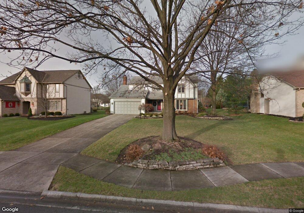
1038 Denman Ct Westerville, OH 43081
Estimated Value: $492,262 - $567,000
4
Beds
3
Baths
2,485
Sq Ft
$216/Sq Ft
Est. Value
About This Home
This home is located at 1038 Denman Ct, Westerville, OH 43081 and is currently estimated at $537,566, approximately $216 per square foot. 1038 Denman Ct is a home located in Franklin County with nearby schools including Mcvay Elementary School, Walnut Springs Middle School, and Westerville-North High School.
Ownership History
Date
Name
Owned For
Owner Type
Purchase Details
Closed on
Mar 26, 2013
Sold by
Herron Michael D and Herron Cathy J
Bought by
Herron Michael D
Current Estimated Value
Home Financials for this Owner
Home Financials are based on the most recent Mortgage that was taken out on this home.
Original Mortgage
$217,175
Outstanding Balance
$153,365
Interest Rate
3.48%
Mortgage Type
New Conventional
Estimated Equity
$384,201
Purchase Details
Closed on
Sep 4, 2009
Sold by
Reinhart Elwood V
Bought by
Herron Michael D and Herron Cathy J
Home Financials for this Owner
Home Financials are based on the most recent Mortgage that was taken out on this home.
Original Mortgage
$229,400
Interest Rate
5.32%
Mortgage Type
New Conventional
Purchase Details
Closed on
Sep 8, 1993
Bought by
Reinhart Elwood
Purchase Details
Closed on
Jul 1, 1987
Create a Home Valuation Report for This Property
The Home Valuation Report is an in-depth analysis detailing your home's value as well as a comparison with similar homes in the area
Home Values in the Area
Average Home Value in this Area
Purchase History
| Date | Buyer | Sale Price | Title Company |
|---|---|---|---|
| Herron Michael D | -- | None Available | |
| Herron Michael D | $269,900 | Real Living | |
| Reinhart Elwood | $207,900 | -- | |
| -- | $169,100 | -- |
Source: Public Records
Mortgage History
| Date | Status | Borrower | Loan Amount |
|---|---|---|---|
| Open | Herron Michael D | $217,175 | |
| Closed | Herron Michael D | $229,400 |
Source: Public Records
Tax History Compared to Growth
Tax History
| Year | Tax Paid | Tax Assessment Tax Assessment Total Assessment is a certain percentage of the fair market value that is determined by local assessors to be the total taxable value of land and additions on the property. | Land | Improvement |
|---|---|---|---|---|
| 2024 | $7,750 | $136,360 | $43,750 | $92,610 |
| 2023 | $7,585 | $136,360 | $43,750 | $92,610 |
| 2022 | $8,540 | $117,220 | $21,000 | $96,220 |
| 2021 | $8,612 | $117,220 | $21,000 | $96,220 |
| 2020 | $8,587 | $117,220 | $21,000 | $96,220 |
| 2019 | $7,554 | $97,340 | $17,500 | $79,840 |
| 2018 | $7,452 | $97,340 | $17,500 | $79,840 |
| 2017 | $7,585 | $97,340 | $17,500 | $79,840 |
| 2016 | $7,742 | $92,340 | $22,230 | $70,110 |
| 2015 | $7,498 | $92,340 | $22,230 | $70,110 |
| 2014 | $7,504 | $92,340 | $22,230 | $70,110 |
| 2013 | $3,569 | $87,955 | $21,175 | $66,780 |
Source: Public Records
Map
Nearby Homes
- 969 Farrington Dr
- 613 Valley Wood Ct
- 1368 Nutmeg Ct
- 858 Knebworth Ct
- 1003 Autumn Meadows Dr
- 857 E Walnut St
- 1015 Autumn Woods Dr
- 994 Autumn Lake Ct
- 1203 Autumn Creek Cir
- 539 Cherrington Rd
- 283 Apache Cir
- 192 Buckeye Ct
- 187 Bernadine Ct
- 768 Collingwood Dr
- 615 Vancouver Dr
- 430 Electric Ave
- 437 Potawatomi Dr
- 393 Sentry Ln
- 974 Timberbank Dr
- 203 Fairdale Ave
- 1046 Denman Ct
- 1030 Denman Ct
- 1059 Farrington Dr
- 1054 Denman Ct
- 1051 Farrington Dr
- 1022 Denman Ct
- 1067 Farrington Dr
- 1043 Farrington Dr
- 1075 Farrington Dr
- 1043 Denman Ct
- 1035 Denman Ct
- 1051 Denman Ct
- 1079 Denman Ct
- 1029 Denman Ct
- 1018 Denman Ct
- 1035 Farrington Dr
- 1059 Denman Ct
- 1087 Denman Ct
- 1025 Denman Ct
- 1062 Farrington Dr