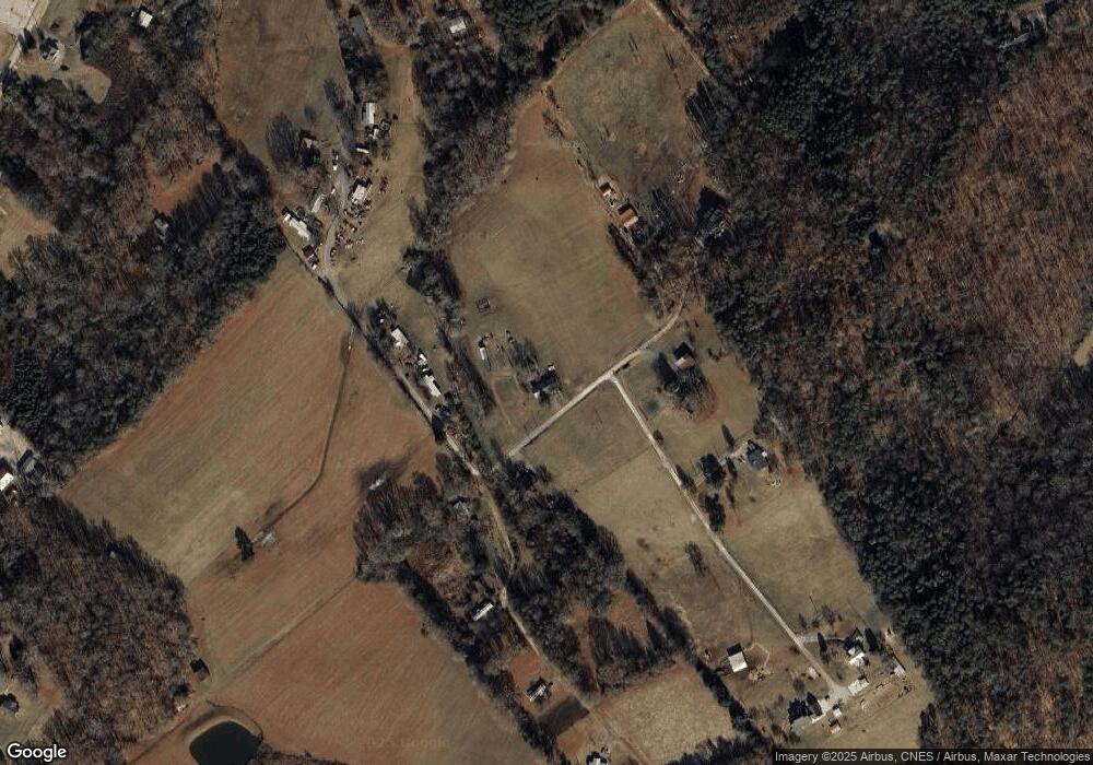
1038 Potts Rd Dandridge, TN 37725
Estimated Value: $256,178 - $536,000
--
Bed
1
Bath
1,456
Sq Ft
$243/Sq Ft
Est. Value
About This Home
This home is located at 1038 Potts Rd, Dandridge, TN 37725 and is currently estimated at $354,045, approximately $243 per square foot. 1038 Potts Rd is a home located in Jefferson County.
Ownership History
Date
Name
Owned For
Owner Type
Purchase Details
Closed on
Nov 3, 2012
Sold by
Lane Jackie Ray
Bought by
Lane Jackie Ray and Lane Theresa K
Current Estimated Value
Home Financials for this Owner
Home Financials are based on the most recent Mortgage that was taken out on this home.
Original Mortgage
$33,500
Outstanding Balance
$23,204
Interest Rate
3.44%
Mortgage Type
Commercial
Estimated Equity
$330,841
Purchase Details
Closed on
Jul 18, 1988
Bought by
Lane Jackie Ray
Purchase Details
Closed on
Jun 14, 1984
Bought by
Lane Jackie Ray and Regina Gail
Purchase Details
Closed on
Apr 30, 1984
Create a Home Valuation Report for This Property
The Home Valuation Report is an in-depth analysis detailing your home's value as well as a comparison with similar homes in the area
Home Values in the Area
Average Home Value in this Area
Purchase History
| Date | Buyer | Sale Price | Title Company |
|---|---|---|---|
| Lane Jackie Ray | -- | -- | |
| Lane Jackie Ray | -- | -- | |
| Lane Jackie Ray | -- | -- | |
| -- | -- | -- |
Source: Public Records
Mortgage History
| Date | Status | Borrower | Loan Amount |
|---|---|---|---|
| Open | Lane Jackie Ray | $33,500 |
Source: Public Records
Tax History Compared to Growth
Tax History
| Year | Tax Paid | Tax Assessment Tax Assessment Total Assessment is a certain percentage of the fair market value that is determined by local assessors to be the total taxable value of land and additions on the property. | Land | Improvement |
|---|---|---|---|---|
| 2025 | $766 | $44,575 | $17,725 | $26,850 |
| 2023 | $766 | $33,300 | $0 | $0 |
| 2022 | $729 | $33,300 | $17,675 | $15,625 |
| 2021 | $729 | $33,300 | $17,675 | $15,625 |
| 2020 | $729 | $33,300 | $17,675 | $15,625 |
| 2019 | $729 | $33,300 | $17,675 | $15,625 |
| 2018 | $726 | $30,900 | $15,375 | $15,525 |
| 2017 | $726 | $30,900 | $15,375 | $15,525 |
| 2016 | $726 | $30,900 | $15,375 | $15,525 |
| 2015 | $726 | $30,900 | $15,375 | $15,525 |
| 2014 | $726 | $30,900 | $15,375 | $15,525 |
Source: Public Records
Map
Nearby Homes
- Lots 3 & 4 Swannsylvania Rd
- 1440 Swannsylvania Rd
- Lot #1 Swannsylvania Rd
- 2943 Flicker Ln
- 1009 Old Newport Hwy
- Lot 69 Deerwood Dr
- Lot 5 Deerwood Dr
- lot 5 Deerwood Dr & Sunset Harbor Dr
- Lot 103 Turtle Dove Trail
- Lot 87 Stone Vista Way
- 0 Sunset Harbor Dr Unit 1308337
- Lot 70r Lakeside Ct
- Lot 111 Tranquility Tr
- 306 Bungalow Dr
- 307 Bungalow Dr
- 2940 Beecarter Rd
- Lot 75 Stone Bridge Dr
- Lot 65 Stone Bridge Dr
- 1015 Potts Rd
- 1009 Potts Rd
- 1045 Potts Rd
- 1004 Potts Rd
- 1039 Potts Rd
- 1050 Potts Rd
- 1011 Potts Rd
- 1041 Potts Rd
- 1042 Potts Rd
- 933 Woody Ln
- 1375 Chrisman Rd
- 1034 Swannsylvania Rd
- 962 Potts Rd
- 986 Swannsylvania Rd
- 990 Swannsylvania Rd
- 935 Woody Ln
- 1018 Swannsylvania Rd
- 0 Swannsylvania Rd
- 0 Swannsylvania Rd Unit 204281
- 1350 Chrisman Rd
