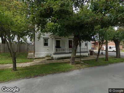
10385 Rowe Run Rd Orrstown, PA 17244
Estimated Value: $133,921 - $195,000
2
Beds
2
Baths
1,580
Sq Ft
$110/Sq Ft
Est. Value
About This Home
This home is located at 10385 Rowe Run Rd, Orrstown, PA 17244 and is currently estimated at $173,480, approximately $109 per square foot. 10385 Rowe Run Rd is a home located in Franklin County with nearby schools including Shippensburg Area Senior High School, Stoney Creek School, and Clearfield Parochial School.
Ownership History
Date
Name
Owned For
Owner Type
Purchase Details
Closed on
Jul 17, 2009
Sold by
Citibank Na
Bought by
Yost Corey M
Current Estimated Value
Home Financials for this Owner
Home Financials are based on the most recent Mortgage that was taken out on this home.
Original Mortgage
$53,775
Interest Rate
5.17%
Mortgage Type
FHA
Purchase Details
Closed on
Feb 20, 2009
Sold by
Katz Andrea M and Blessing Judith L
Bought by
Citibank Na and Chase Manhattan Mortgage 03-1
Create a Home Valuation Report for This Property
The Home Valuation Report is an in-depth analysis detailing your home's value as well as a comparison with similar homes in the area
Home Values in the Area
Average Home Value in this Area
Purchase History
| Date | Buyer | Sale Price | Title Company |
|---|---|---|---|
| Yost Corey M | $52,700 | None Available | |
| Citibank Na | $20,000 | None Available |
Source: Public Records
Mortgage History
| Date | Status | Borrower | Loan Amount |
|---|---|---|---|
| Open | Yost Corey M | $98,400 | |
| Closed | Yost Corey M | $53,775 |
Source: Public Records
Tax History Compared to Growth
Tax History
| Year | Tax Paid | Tax Assessment Tax Assessment Total Assessment is a certain percentage of the fair market value that is determined by local assessors to be the total taxable value of land and additions on the property. | Land | Improvement |
|---|---|---|---|---|
| 2025 | $1,438 | $9,180 | $630 | $8,550 |
| 2024 | $1,268 | $9,180 | $630 | $8,550 |
| 2023 | $1,244 | $9,180 | $630 | $8,550 |
| 2022 | $1,236 | $9,180 | $630 | $8,550 |
| 2021 | $1,202 | $9,180 | $630 | $8,550 |
| 2020 | $1,259 | $9,180 | $630 | $8,550 |
| 2019 | $1,248 | $9,180 | $630 | $8,550 |
| 2018 | $1,270 | $9,180 | $630 | $8,550 |
| 2017 | $1,279 | $9,180 | $630 | $8,550 |
| 2016 | $318 | $9,180 | $630 | $8,550 |
| 2015 | $300 | $9,180 | $630 | $8,550 |
| 2014 | $300 | $9,180 | $630 | $8,550 |
Source: Public Records
Map
Nearby Homes
- 3979 Campbell Cir
- 4560 Orrstown Rd Unit 1
- 2000 Orrstown Rd
- 6108 Orrstown Rd
- 30 Jamestown Rd
- 251 Grove Dr
- 0 Edison Dr
- 1565 Orrstown Rd
- 105 Central Way
- 201 Grove Dr
- 10700 Thornwood Rd
- 0 Central Way
- 10464 Mapleton Rd
- 1078 Celeste Dr
- 1136 Ashton Dr
- 47 Diffys Dr
- 8074 Molly Pitcher Hwy
- 43 Maizefield Dr
- 4057 MacLays Mill Rd
- 54 Lenwood Park Unit 54
- 10385 Rowe Run Rd
- 10375 Rowe Run Rd
- 3642 Orrstown Rd
- 3650 Orrstown Rd
- 10363 Rowe Run Rd
- 10378 Rowe Run Rd
- 10355 Rowe Run Rd
- 3662 Orrstown Rd
- 10372 Rowe Run Rd
- 10390 Rowe Run Rd
- 3666 Orrstown Rd
- 3606 Orrstown Rd
- 3670 Orrstown Rd
- 3680 Orrstown Rd
- 10352 Rowe Run Rd
- 10303 Muddy Run Rd
- 3625 Orrstown Rd
- 0 Orrstown Rd Unit 1006854608
- 0 Orrstown Rd Unit 1006595666
- 0 Orrstown Rd Unit 1006417494