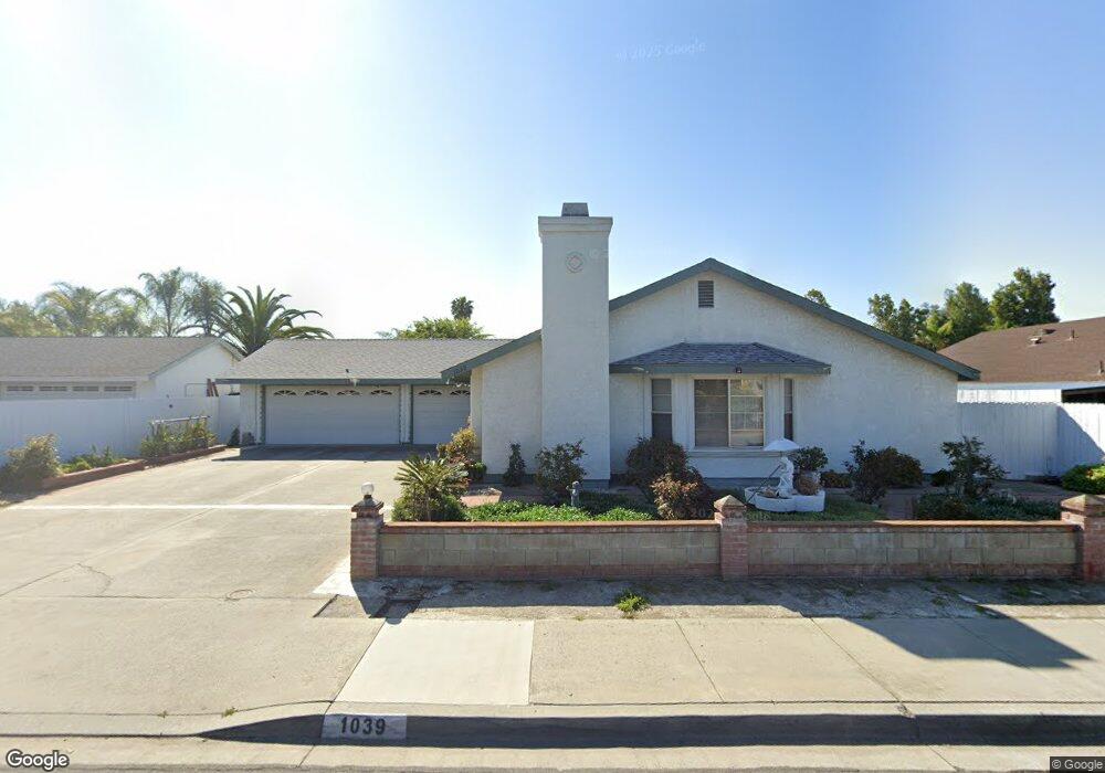
1039 Farr Ave Unit 98 Escondido, CA 92026
Central Escondido NeighborhoodEstimated Value: $758,000 - $788,000
3
Beds
2
Baths
1,541
Sq Ft
$499/Sq Ft
Est. Value
About This Home
This home is located at 1039 Farr Ave Unit 98, Escondido, CA 92026 and is currently estimated at $769,140, approximately $499 per square foot. 1039 Farr Ave Unit 98 is a home located in San Diego County with nearby schools including Farr Avenue Elementary, Mission Middle, and Escondido High School.
Ownership History
Date
Name
Owned For
Owner Type
Purchase Details
Closed on
Dec 27, 2021
Sold by
Le Son Q and Le Hoang Kim
Bought by
Le Son Qui and Le Hoang Kim
Current Estimated Value
Purchase Details
Closed on
Jul 31, 2009
Sold by
Le Son and Le Hoang
Bought by
Le Son Q and Le Hoang Kim Thi
Purchase Details
Closed on
Oct 19, 2000
Sold by
Smjt Le Hoang and Smjt Le
Bought by
Le Son and Le Hoang
Purchase Details
Closed on
Sep 11, 2000
Sold by
Finefrock Derell R
Bought by
Blue View Inc
Purchase Details
Closed on
May 27, 1992
Create a Home Valuation Report for This Property
The Home Valuation Report is an in-depth analysis detailing your home's value as well as a comparison with similar homes in the area
Home Values in the Area
Average Home Value in this Area
Purchase History
| Date | Buyer | Sale Price | Title Company |
|---|---|---|---|
| Le Son Qui | -- | None Available | |
| Le Son Q | -- | None Available | |
| Le Son | -- | -- | |
| Blue View Inc | -- | -- | |
| -- | $169,000 | -- |
Source: Public Records
Tax History Compared to Growth
Tax History
| Year | Tax Paid | Tax Assessment Tax Assessment Total Assessment is a certain percentage of the fair market value that is determined by local assessors to be the total taxable value of land and additions on the property. | Land | Improvement |
|---|---|---|---|---|
| 2025 | $3,413 | $309,636 | $122,700 | $186,936 |
| 2024 | $3,413 | $303,566 | $120,295 | $183,271 |
| 2023 | $3,334 | $297,615 | $117,937 | $179,678 |
| 2022 | $3,297 | $291,780 | $115,625 | $176,155 |
| 2021 | $3,243 | $286,059 | $113,358 | $172,701 |
| 2020 | $3,223 | $283,127 | $112,196 | $170,931 |
| 2019 | $3,144 | $277,577 | $109,997 | $167,580 |
| 2018 | $3,056 | $272,136 | $107,841 | $164,295 |
| 2017 | $3,005 | $266,801 | $105,727 | $161,074 |
| 2016 | $2,945 | $261,570 | $103,654 | $157,916 |
| 2015 | $2,920 | $257,642 | $102,098 | $155,544 |
| 2014 | $2,798 | $252,597 | $100,099 | $152,498 |
Source: Public Records
Map
Nearby Homes
- 1247 Armstrong Cir
- 1213 Rembrandt Glen
- 1271 Marjorie Place
- 1085 N Grape St
- 1342 N Elm St
- 915 N Fig St Unit E
- 1215 E Mission Ave
- 706 N Ash St
- 809 Buchanan St
- 1234 N Ivy St
- 1020 E Washington Ave Unit 94
- 1020 E Washington Ave Unit 97
- 1020 E Washington Ave Unit 88
- 1040 E Washington Ave Unit 33
- 1060 E Washington Ave Unit 5
- 664 N Fig St
- 1050 E Washington Ave Unit 44
- 818 E Washington Ave Unit B
- 812 E Washington Ave Unit A
- 804 E Washington Ave Unit C