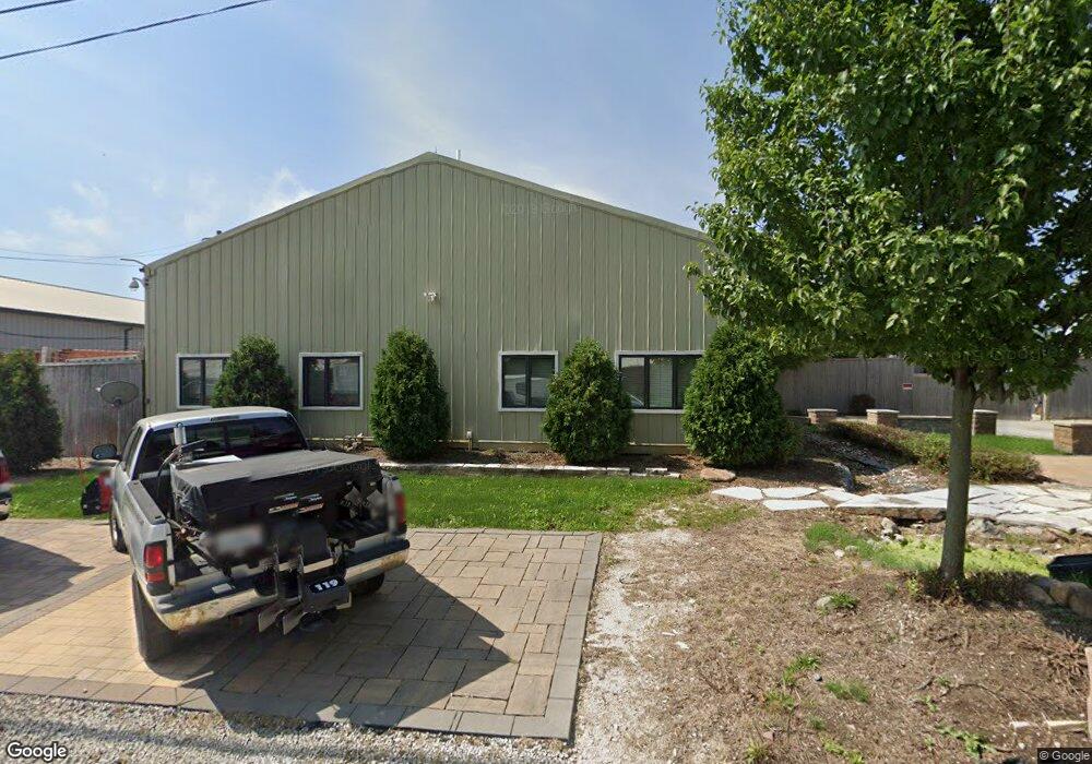
1039 Industry Rd Unit 2 New Lenox, IL 60451
Estimated Value: $606,475
--
Bed
--
Bath
--
Sq Ft
0.65
Acres
About This Home
This home is located at 1039 Industry Rd Unit 2, New Lenox, IL 60451 and is currently estimated at $606,475. 1039 Industry Rd Unit 2 is a home located in Will County with nearby schools including Bentley Elementary School, Arnold J Tyler School, and Alex M Martino Jr High School.
Ownership History
Date
Name
Owned For
Owner Type
Purchase Details
Closed on
May 20, 2019
Sold by
Nation One Landscaping
Bought by
Shoreline Llc Series 1
Current Estimated Value
Purchase Details
Closed on
Feb 27, 2007
Sold by
Pacetti William A and Pacetti Linda Sue
Bought by
Conrad Jason and Caldwell Brandon
Purchase Details
Closed on
Sep 18, 2004
Sold by
Pacetti William A and Pacetti Linda S
Bought by
Pacetti William A and Pacetti Linda Sue
Create a Home Valuation Report for This Property
The Home Valuation Report is an in-depth analysis detailing your home's value as well as a comparison with similar homes in the area
Home Values in the Area
Average Home Value in this Area
Purchase History
| Date | Buyer | Sale Price | Title Company |
|---|---|---|---|
| Shoreline Llc Series 1 | $150,000 | Attorney | |
| Conrad Jason | $400,000 | Ticor Title | |
| Pacetti William A | -- | Ticor Title |
Source: Public Records
Tax History Compared to Growth
Tax History
| Year | Tax Paid | Tax Assessment Tax Assessment Total Assessment is a certain percentage of the fair market value that is determined by local assessors to be the total taxable value of land and additions on the property. | Land | Improvement |
|---|---|---|---|---|
| 2024 | $4,431 | $56,626 | $20,639 | $35,987 |
| 2023 | $4,431 | $56,626 | $20,639 | $35,987 |
| 2022 | $4,657 | $55,832 | $19,845 | $35,987 |
| 2021 | $4,718 | $55,832 | $19,845 | $35,987 |
| 2020 | $4,834 | $55,832 | $19,845 | $35,987 |
| 2019 | $4,711 | $55,832 | $19,845 | $35,987 |
| 2018 | $4,742 | $55,443 | $19,456 | $35,987 |
| 2017 | $4,643 | $55,443 | $19,456 | $35,987 |
| 2016 | $4,639 | $55,443 | $19,456 | $35,987 |
| 2015 | $4,611 | $55,443 | $19,456 | $35,987 |
| 2014 | $4,611 | $55,443 | $19,456 | $35,987 |
| 2013 | $4,611 | $55,443 | $19,456 | $35,987 |
Source: Public Records
Map
Nearby Homes
- 920 Barnside Rd
- 1000 S Cedar Rd
- 203 Tonell Ave
- 329 Hancock Dr
- 00 NE Corner Cherry Hill Road and Moss Lane Rd
- LOT 8 W Laraway Rd
- 1990 Edgeview Dr
- 117 Walona Ave
- 1981 Stapleton Rd
- 805 Regent St
- 13255 W Laraway Rd
- 328 E Lincoln Hwy
- 911 Canongate Ln
- 604 Ogden Rd
- 315 S Pine St
- 400 W Joliet Hwy
- 1017 E Lincoln Hwy
- 2067 Edgeview Dr
- 575 Caledonia Dr
- 14620 W Laraway Rd
- 1039 Industry Rd
- 14027 W Illinois Hwy
- 538 E Illinois Hwy Unit C
- 538 E Illinois Hwy Unit D
- 538 E Illinois Hwy
- 538 E Illinois Hwy Unit B
- 1027 Industry Rd
- 1031 Industry Rd
- 1041 Industry Rd
- 540 E Illinois Hwy Unit A
- 540 E Illinois Hwy Unit B
- 1043 Industry Rd Unit 1027-4
- 1043 Industry Rd Unit 1027-43
- 1043 Industry Rd
- 13921 E Illinois Hwy Unit 3
- 13921 E Illinois Hwy
- 1005 Industry Rd
- 13919 E Illinois Hwy
- 13921 W Illinois Hwy
- 13917 W Illinois Hwy