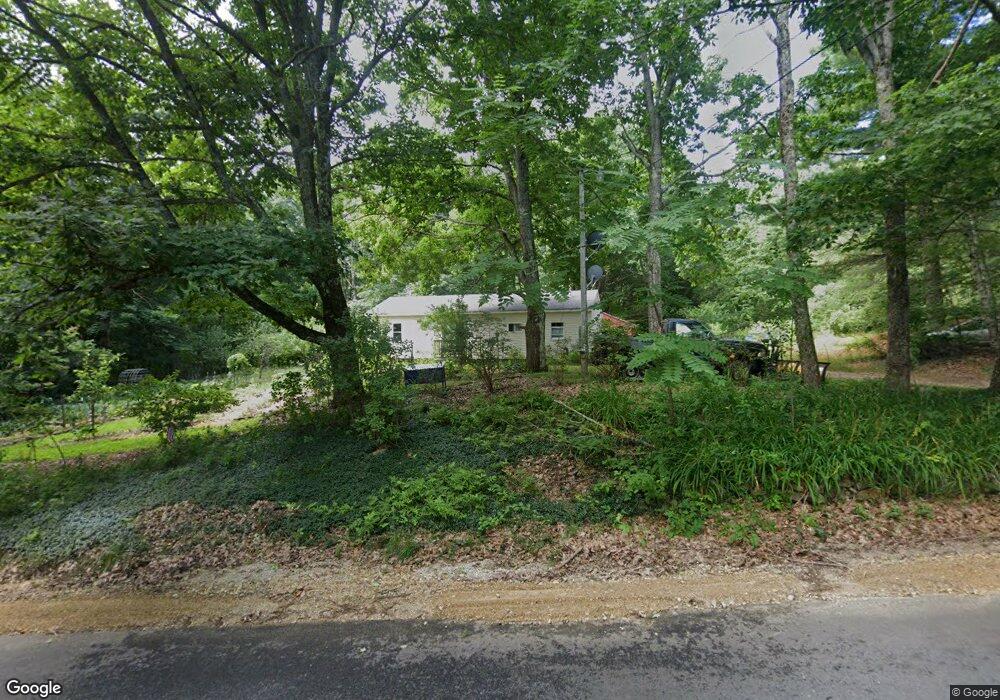
1039 Province Rd Barnstead, NH 03218
Estimated Value: $394,028 - $431,000
3
Beds
2
Baths
1,276
Sq Ft
$321/Sq Ft
Est. Value
About This Home
This home is located at 1039 Province Rd, Barnstead, NH 03218 and is currently estimated at $409,507, approximately $320 per square foot. 1039 Province Rd is a home with nearby schools including Barnstead Elementary School and Prospect Mountain High School.
Ownership History
Date
Name
Owned For
Owner Type
Purchase Details
Closed on
May 1, 2003
Sold by
Macleod Ernest L and Macleod Linda M
Bought by
Clark Patrick D and Clark Michelle E
Current Estimated Value
Home Financials for this Owner
Home Financials are based on the most recent Mortgage that was taken out on this home.
Original Mortgage
$144,900
Outstanding Balance
$63,114
Interest Rate
5.82%
Estimated Equity
$346,393
Purchase Details
Closed on
May 6, 2002
Sold by
Landry Robert D
Bought by
Macleod Ernest L and Macleod Linda M
Home Financials for this Owner
Home Financials are based on the most recent Mortgage that was taken out on this home.
Original Mortgage
$114,750
Interest Rate
7.13%
Create a Home Valuation Report for This Property
The Home Valuation Report is an in-depth analysis detailing your home's value as well as a comparison with similar homes in the area
Home Values in the Area
Average Home Value in this Area
Purchase History
| Date | Buyer | Sale Price | Title Company |
|---|---|---|---|
| Clark Patrick D | $144,900 | -- | |
| Macleod Ernest L | $127,500 | -- |
Source: Public Records
Mortgage History
| Date | Status | Borrower | Loan Amount |
|---|---|---|---|
| Open | Macleod Ernest L | $144,900 | |
| Previous Owner | Macleod Ernest L | $114,750 |
Source: Public Records
Tax History Compared to Growth
Tax History
| Year | Tax Paid | Tax Assessment Tax Assessment Total Assessment is a certain percentage of the fair market value that is determined by local assessors to be the total taxable value of land and additions on the property. | Land | Improvement |
|---|---|---|---|---|
| 2024 | $4,766 | $292,200 | $81,200 | $211,000 |
| 2023 | $4,193 | $292,200 | $81,200 | $211,000 |
| 2022 | $4,130 | $191,200 | $46,700 | $144,500 |
| 2021 | $4,199 | $191,200 | $46,700 | $144,500 |
| 2020 | $4,417 | $191,200 | $46,700 | $144,500 |
| 2019 | $4,365 | $191,200 | $46,700 | $144,500 |
| 2018 | $4,120 | $191,200 | $46,700 | $144,500 |
| 2017 | $3,998 | $146,500 | $35,200 | $111,300 |
| 2016 | $3,992 | $146,500 | $35,200 | $111,300 |
| 2015 | $3,977 | $146,500 | $35,200 | $111,300 |
| 2014 | $3,589 | $149,800 | $35,200 | $114,600 |
| 2013 | $3,520 | $149,800 | $35,200 | $114,600 |
Source: Public Records
Map
Nearby Homes
- 85 Province Rd
- 449 Tilton Hill Rd
- M2-l29-2 Province Rd
- 11 Gray Rd
- L33 Province Rd
- 4 Sandy Point Rd
- 4 Parade Cir
- 28 Sanderson Dr
- 572 S Barnstead Rd
- 81 Winant Rd
- R11 07 Clough Rd
- 99 Fairview Dr
- 93 Fairview Dr
- 109 Shackford Corner Rd
- 22-54 Red Oak Rd
- 4 Berry Ave
- 41 Pinepark Dr
- 110 Main St
- 18 Catamount Rd
- 7 Cram Ave
- 1051 Province Rd
- 1029 Province Rd
- L14 Province Rd
- L6 Province Rd
- L13 Province Rd
- L9 Province Rd Unit Tax map 3, lot 29-14
- L7 Province Rd
- L9 Province Rd
- L11 Province Rd
- 1014 Province Rd
- 1070 Province Rd
- 1007 Province Rd
- 999 Province Rd
- 994 Province Rd
- 693 Province Rd
- Lot 21 Province Rd
- 986 Province Rd
- 1088 Province Rd
- 1091 Province Rd
- 985 Province Rd