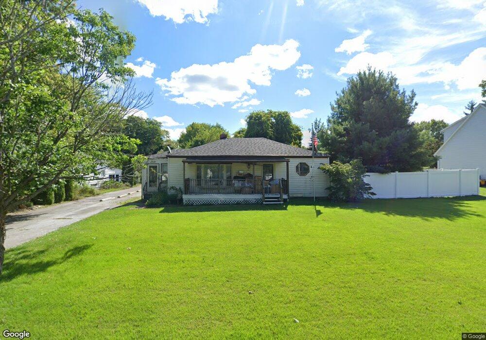
1039 S Main St Amherst, OH 44001
Estimated Value: $215,674 - $234,000
3
Beds
2
Baths
1,284
Sq Ft
$176/Sq Ft
Est. Value
About This Home
This home is located at 1039 S Main St, Amherst, OH 44001 and is currently estimated at $226,419, approximately $176 per square foot. 1039 S Main St is a home located in Lorain County with nearby schools including Powers Elementary School, Walter G. Nord Middle School, and Amherst Junior High School.
Ownership History
Date
Name
Owned For
Owner Type
Purchase Details
Closed on
Aug 14, 2023
Sold by
Hudak Marlene A
Bought by
Hudak Marlene A and Hudak Eleanor
Current Estimated Value
Home Financials for this Owner
Home Financials are based on the most recent Mortgage that was taken out on this home.
Original Mortgage
$86,487
Outstanding Balance
$83,541
Interest Rate
6.81%
Mortgage Type
FHA
Estimated Equity
$142,878
Create a Home Valuation Report for This Property
The Home Valuation Report is an in-depth analysis detailing your home's value as well as a comparison with similar homes in the area
Home Values in the Area
Average Home Value in this Area
Purchase History
| Date | Buyer | Sale Price | Title Company |
|---|---|---|---|
| Hudak Marlene A | -- | None Listed On Document |
Source: Public Records
Mortgage History
| Date | Status | Borrower | Loan Amount |
|---|---|---|---|
| Open | Hudak Marlene A | $86,487 |
Source: Public Records
Tax History Compared to Growth
Tax History
| Year | Tax Paid | Tax Assessment Tax Assessment Total Assessment is a certain percentage of the fair market value that is determined by local assessors to be the total taxable value of land and additions on the property. | Land | Improvement |
|---|---|---|---|---|
| 2024 | $2,538 | $62,836 | $12,026 | $50,810 |
| 2023 | $2,233 | $45,479 | $10,049 | $35,431 |
| 2022 | $2,144 | $45,479 | $10,049 | $35,431 |
| 2021 | $2,149 | $45,479 | $10,049 | $35,431 |
| 2020 | $2,108 | $39,590 | $8,750 | $30,840 |
| 2019 | $2,067 | $39,590 | $8,750 | $30,840 |
| 2018 | $2,042 | $39,590 | $8,750 | $30,840 |
| 2017 | $2,006 | $35,880 | $7,410 | $28,470 |
| 2016 | $2,022 | $35,880 | $7,410 | $28,470 |
| 2015 | $2,013 | $35,880 | $7,410 | $28,470 |
| 2014 | $1,890 | $33,530 | $6,920 | $26,610 |
| 2013 | $1,897 | $33,530 | $6,920 | $26,610 |
Source: Public Records
Map
Nearby Homes
- 335 Copper Creek
- 133 Ambleside Way
- 621 Van Oaks Dr
- 281 English Lakes Blvd Unit 67281
- V/L Middle Ridge Rd
- 658 Nicole Dr
- 8030 Pyle South Amherst Rd
- 748 Tarry Ln
- 814 Valley Dr
- 2176 Myla Way
- 2180 Myla Way
- 653 Brennan Dr
- 0 Stonebridge Dr
- 923 Longitude Ln
- 311 Oak St Unit 311
- 292 Westwoods
- 302 Westwoods
- 394 Long St
- 812 Bearing Ct
- 7055 Quarry Rd Unit 33
- 1029 S Main St
- 999 S Main St
- 989 S Main St
- 1030 S Main St
- 979 S Main St
- 601 Coventry Place
- 1020 S Main St
- 7575 Pyle South Amherst Rd
- 612 Coventry Place
- 969 S Main St
- 1000 S Main St
- 980 S Main St
- 949 S Main St
- 620 Coventry Place
- 603 Coventry Place
- 7595 Pyle South Amherst Rd
- 629 Coventry Place
- 939 S Main St
- 942 S Main St
- 607 Coventry Place