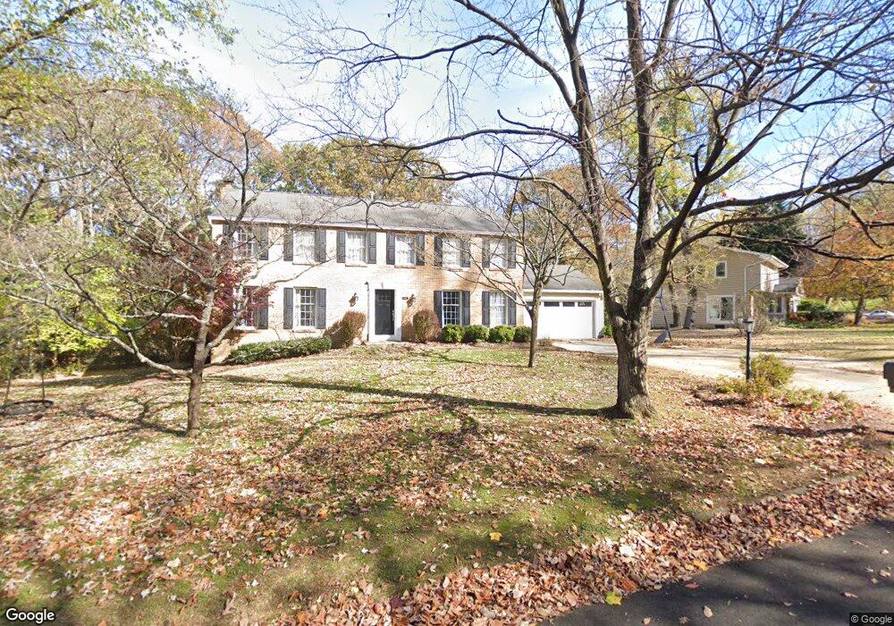
1039 Ulmstead Cir Arnold, MD 21012
Estimated Value: $870,137 - $951,000
About This Home
This home is located at 1039 Ulmstead Cir, Arnold, MD 21012 and is currently estimated at $915,034, approximately $378 per square foot. 1039 Ulmstead Cir is a home located in Anne Arundel County with nearby schools including Broadneck Elementary School, Magothy River Middle School, and Broadneck High School.
Ownership History
We collect this data history from publicly available records. To have your information removed, we recommend requesting removal directly through your county’s website.
Purchase Details
Home Financials for this Owner
Home Financials are based on the most recent Mortgage that was taken out on this home.Purchase Details
Purchase Details
Purchase Details
Home Values in the Area
Average Home Value in this Area
Purchase History
We collect this data history from publicly available records. To have your information removed, we recommend requesting removal directly through your county’s website.
| Date | Buyer | Sale Price | Title Company |
|---|---|---|---|
| $592,000 | -- | ||
| -- | -- | ||
| $530,000 | -- | ||
| -- | -- |
Mortgage History
We collect this data history from publicly available records. To have your information removed, we recommend requesting removal directly through your county’s website.
| Date | Status | Borrower | Loan Amount |
|---|---|---|---|
| Open | $473,600 |
Tax History
We collect this data history from publicly available records. To have your information removed, we recommend requesting removal directly through your county’s website.
| Year | Tax Paid | Tax Assessment Tax Assessment Total Assessment is a certain percentage of the fair market value that is determined by local assessors to be the total taxable value of land and additions on the property. | Land | Improvement |
|---|---|---|---|---|
| 2025 | $6,849 | $610,400 | -- | -- |
| 2024 | $6,849 | $579,600 | $316,500 | $263,100 |
| 2023 | $6,763 | $575,900 | $0 | $0 |
| 2022 | $6,410 | $572,200 | $0 | $0 |
| 2020 | $6,334 | $568,500 | $316,500 | $252,000 |
| 2019 | $6,339 | $568,500 | $316,500 | $252,000 |
| 2018 | $6,117 | $603,300 | $378,500 | $224,800 |
| 2017 | $6,287 | $597,000 | $0 | $0 |
| 2016 | -- | $590,700 | $0 | $0 |
| 2015 | -- | $584,400 | $0 | $0 |
| 2014 | -- | $563,867 | $0 | $0 |
Map
- 602 Bay Hills Dr
- 636 Bay Green Dr
- 504 Greenblades Ct
- 1174 Gator Ct Unit 219
- 632 Basin Way
- 893 Mallard Cir
- 613B Oakland Hills Ct Unit 201
- 978 Stonington Dr
- 982 Stonington Dr
- 452 Knottwood Ct
- 404 Alameda Pkwy
- 934 Shore Acres Rd
- 323 Ternwing Dr
- 472 Laurel Valley Ct
- 462 Colonial Ridge Ln
- 1109 Silverleaf Dr
- 715 Mashie Ct
- 1256 Crowell Ct
- 303 Ternwing Dr
- 306 Clifton Ave
- 1033 Ulmstead Cir
- 1027 Ulmstead Cir
- 1045 Ulmstead Cir
- 1022 Placid Ct
- 1020 Garywood Ln
- 1021 Ulmstead Cir
- 1034 Ulmstead Cir
- 1026 Garywood Ln
- 1028 Ulmstead Cir
- 1051 Ulmstead Cir
- 1024 Placid Ct
- 1046 Ulmstead Cir
- 1022 Ulmstead Cir
- 1052 Ulmstead Cir
- 1057 Ulmstead Cir
- 1040 Ulmstead Cir
- 1058 Ulmstead Cir
- 1021 Placid Ct
- 1026 Placid Ct
- 1064 Ulmstead Cir
Ask me questions while you tour the home.