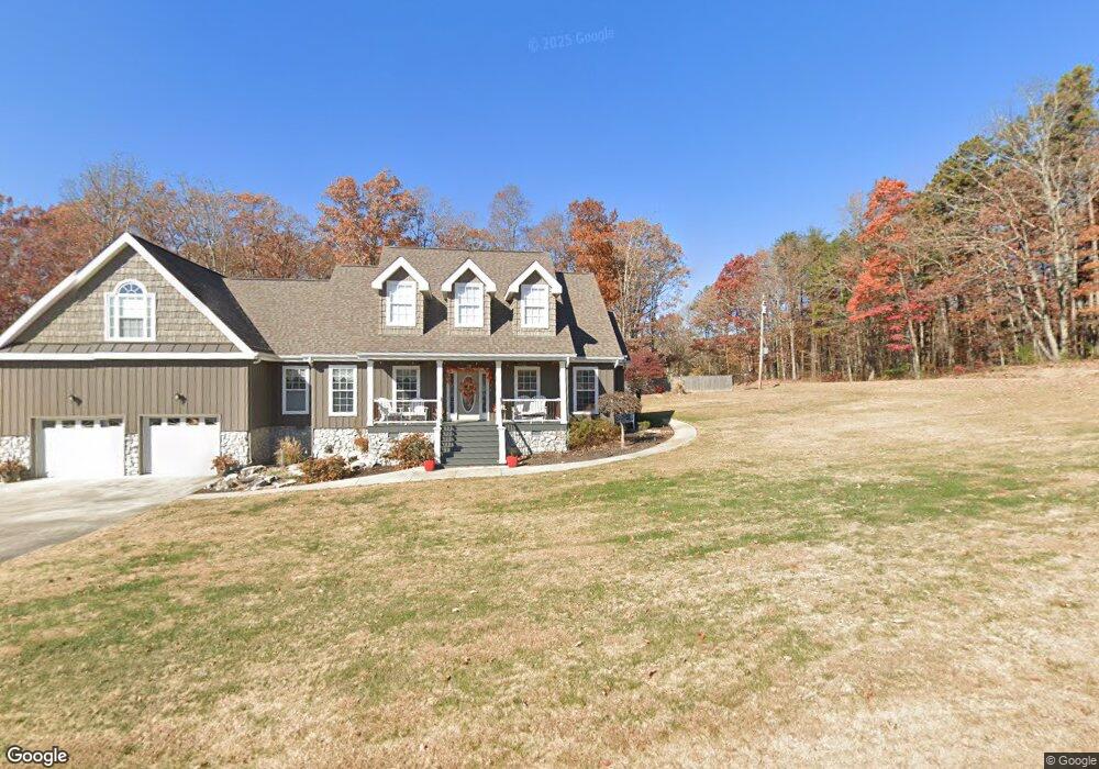
10391 Logstone Ln Soddy Daisy, TN 37379
Estimated Value: $446,472 - $689,000
--
Bed
1
Bath
2,428
Sq Ft
$236/Sq Ft
Est. Value
About This Home
This home is located at 10391 Logstone Ln, Soddy Daisy, TN 37379 and is currently estimated at $572,118, approximately $235 per square foot. 10391 Logstone Ln is a home located in Hamilton County.
Ownership History
Date
Name
Owned For
Owner Type
Purchase Details
Closed on
Sep 30, 2010
Sold by
Burrows Dana W
Bought by
The Larry W Spence Sr Revocable Trust and The Paula J Spence Revocable Trust
Current Estimated Value
Purchase Details
Closed on
Jul 14, 2009
Sold by
Spence Larry W and Spence Paula Janet
Bought by
Spence Larry W and Spence Paula J
Purchase Details
Closed on
Sep 23, 2008
Sold by
Burrows Dana W
Bought by
Spence Larry and Spence Janet
Home Financials for this Owner
Home Financials are based on the most recent Mortgage that was taken out on this home.
Original Mortgage
$160,000
Interest Rate
6.49%
Mortgage Type
Purchase Money Mortgage
Create a Home Valuation Report for This Property
The Home Valuation Report is an in-depth analysis detailing your home's value as well as a comparison with similar homes in the area
Home Values in the Area
Average Home Value in this Area
Purchase History
| Date | Buyer | Sale Price | Title Company |
|---|---|---|---|
| The Larry W Spence Sr Revocable Trust | -- | Century Title & Escrow Inc | |
| Spence Larry W | -- | None Available | |
| Spence Larry | $259,000 | Century Title & Escrow Inc |
Source: Public Records
Mortgage History
| Date | Status | Borrower | Loan Amount |
|---|---|---|---|
| Previous Owner | Spence Larry | $160,000 |
Source: Public Records
Tax History Compared to Growth
Tax History
| Year | Tax Paid | Tax Assessment Tax Assessment Total Assessment is a certain percentage of the fair market value that is determined by local assessors to be the total taxable value of land and additions on the property. | Land | Improvement |
|---|---|---|---|---|
| 2024 | $1,882 | $84,125 | $0 | $0 |
| 2023 | $1,882 | $84,125 | $0 | $0 |
| 2022 | $1,882 | $84,125 | $0 | $0 |
| 2021 | $1,882 | $84,125 | $0 | $0 |
| 2020 | $1,979 | $71,550 | $0 | $0 |
| 2019 | $1,979 | $71,550 | $0 | $0 |
| 2018 | $1,979 | $71,550 | $0 | $0 |
| 2017 | $1,979 | $71,550 | $0 | $0 |
| 2016 | $1,876 | $0 | $0 | $0 |
| 2015 | $1,876 | $67,850 | $0 | $0 |
| 2014 | $1,876 | $0 | $0 | $0 |
Source: Public Records
Map
Nearby Homes
- 10600 Skyridge Trail
- 3075 Poe Rd
- 2772 Mowbray Pike
- 2796 Mowbray Pike
- 2664 Mowbray Pike
- 2748 Mowbray Pike
- 2419 Welch Rd
- 9963 Huckleberry Ln
- 9844 Granny Walker Cemetery Rd
- 00000 Worley Rd
- 00 Worley Rd
- 9963 Huckelberry Ln
- 3069 Poe Rd
- 3087 Poe Rd
- 3086 Poe Rd
- 0 Worley Rd Unit RTC2943298
- 0 Worley Rd Unit RTC2943290
- 0 Worley Rd Unit 1516868
- 0 Worley Rd Unit 1516866
- 0 Worley Rd Unit RTC2928464
- 2336 Mowbray Pike
- 2322 Mowbray Pike
- 10370 Logstone Ln
- 10363 Logstone Ln
- 2402 Mowbray Pike
- 2330 Mowbray Pike
- 2405 Mowbray Pike
- 10328 Logstone Ln
- 2316 Mowbray Pike
- 2317 Mowbray Pike
- 2406 Mowbray Pike
- 10347 Logstone Ln
- 10333 Logstone Ln
- 10415 Grant Rd
- 2418 Mowbray Pike
- 2409 Mowbray Pike
- 10427 Grant Rd
- 2405 Whippersnapper Way
- 2424 Mowbray Pike
- 2302 Mowbray Pike