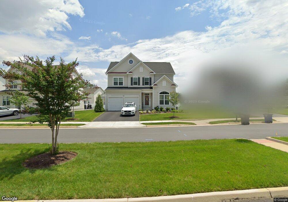
10393 Twin Leaf Dr Bristow, VA 20136
Estimated Value: $712,281 - $775,000
4
Beds
3
Baths
2,235
Sq Ft
$335/Sq Ft
Est. Value
About This Home
This home is located at 10393 Twin Leaf Dr, Bristow, VA 20136 and is currently estimated at $749,070, approximately $335 per square foot. 10393 Twin Leaf Dr is a home located in Prince William County with nearby schools including The Nokesville School, Brentsville District High School, and Linton Hall School.
Ownership History
Date
Name
Owned For
Owner Type
Purchase Details
Closed on
Aug 27, 2018
Sold by
Brookfield Vint Hill Llc
Bought by
Payne Valeria N
Current Estimated Value
Home Financials for this Owner
Home Financials are based on the most recent Mortgage that was taken out on this home.
Original Mortgage
$500,808
Outstanding Balance
$435,740
Interest Rate
4.49%
Mortgage Type
FHA
Estimated Equity
$313,330
Create a Home Valuation Report for This Property
The Home Valuation Report is an in-depth analysis detailing your home's value as well as a comparison with similar homes in the area
Home Values in the Area
Average Home Value in this Area
Purchase History
| Date | Buyer | Sale Price | Title Company |
|---|---|---|---|
| Payne Valeria N | $518,100 | Premier Title Inc |
Source: Public Records
Mortgage History
| Date | Status | Borrower | Loan Amount |
|---|---|---|---|
| Open | Payne Valeria N | $500,808 |
Source: Public Records
Tax History Compared to Growth
Tax History
| Year | Tax Paid | Tax Assessment Tax Assessment Total Assessment is a certain percentage of the fair market value that is determined by local assessors to be the total taxable value of land and additions on the property. | Land | Improvement |
|---|---|---|---|---|
| 2025 | $6,262 | $638,400 | $188,400 | $450,000 |
| 2024 | $6,262 | $629,700 | $185,700 | $444,000 |
| 2023 | $6,354 | $610,700 | $183,700 | $427,000 |
| 2022 | $6,062 | $537,100 | $160,400 | $376,700 |
| 2021 | $5,934 | $486,400 | $145,300 | $341,100 |
| 2020 | $7,115 | $459,000 | $143,100 | $315,900 |
| 2019 | $6,826 | $440,400 | $142,600 | $297,800 |
| 2018 | $1,718 | $142,300 | $142,300 | $0 |
| 2017 | $1,717 | $142,300 | $142,300 | $0 |
| 2016 | $679 | $56,800 | $56,800 | $0 |
| 2015 | $694 | $56,800 | $56,800 | $0 |
| 2014 | $694 | $56,800 | $56,800 | $0 |
Source: Public Records
Map
Nearby Homes
- 10512 Blazing Star Loop
- 12021 Spring Beauty Rd
- 12054 Nokesville Rd
- 10554 Andrew Humphreys Ct
- 10423 Rifle Rd
- 12151 Hayfield Ct
- 9819 Pear Tree Ct
- 12048 Elliots Oak Place
- 9846 Maitland Loop
- Hampton II Plan at Parkgate Estates
- 9656 Bedder Stone Place
- 9579 Scales Place
- 10045 Pentland Hills Way
- 9475 Sarah Mill Terrace
- 9244 Crestview Ridge Dr
- 10941 Samuel Trexler Dr
- 9478 Merrimont Trace Cir
- 9218 Dawkins Crest Cir
- 9256 Crestview Ridge Dr
- 12100 Brevard Park Ct
- 10403 Twin Leaf Dr
- 10389 Twin Leaf Dr
- 0 Golden Aster Ct Unit VAPW321942
- 10565 Blazing Star Loop
- 10569 Blazing Star Loop
- 10385 Twin Leaf Dr
- 10561 Blazing Star Loop
- 10573 Blazing Star Loop
- 12110 Aster Rd
- 10557 Blazing Star Loop
- 10381 Twin Leaf Dr
- 10396 Twin Leaf Dr
- 10392 Twin Leaf Dr
- 12115 Aster Rd
- 10388 Twin Leaf Dr
- 10553 Blazing Star Loop
- 12101 Aster Rd
- 10384 Twin Leaf Dr
- 10377 Twin Leaf Dr
- 10581 Blazing Star Loop