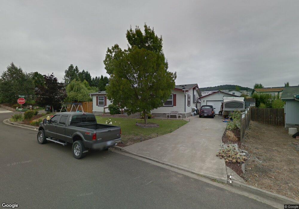
104 Adams Loop Roseburg, OR 97471
Green NeighborhoodEstimated Value: $312,000 - $340,774
3
Beds
2
Baths
1,945
Sq Ft
$166/Sq Ft
Est. Value
About This Home
This home is located at 104 Adams Loop, Roseburg, OR 97471 and is currently estimated at $322,925, approximately $166 per square foot. 104 Adams Loop is a home located in Douglas County with nearby schools including Sunnyslope Elementary School, John C. Fremont Middle School, and Roseburg High School.
Ownership History
Date
Name
Owned For
Owner Type
Purchase Details
Closed on
Apr 11, 2007
Sold by
Blanck Martin W and Blanck Carina Reeves
Bought by
Mitchell Kirk B and Mitchell Joann L
Current Estimated Value
Home Financials for this Owner
Home Financials are based on the most recent Mortgage that was taken out on this home.
Original Mortgage
$172,562
Outstanding Balance
$104,221
Interest Rate
6.13%
Mortgage Type
FHA
Estimated Equity
$218,704
Purchase Details
Closed on
Aug 3, 2006
Sold by
Blanck Tracy A and Blanck Martin W
Bought by
Blanck Martin W and Reeves Carina
Create a Home Valuation Report for This Property
The Home Valuation Report is an in-depth analysis detailing your home's value as well as a comparison with similar homes in the area
Home Values in the Area
Average Home Value in this Area
Purchase History
| Date | Buyer | Sale Price | Title Company |
|---|---|---|---|
| Mitchell Kirk B | $175,000 | First American Title Ins Co | |
| Blanck Martin W | $13,000 | None Available |
Source: Public Records
Mortgage History
| Date | Status | Borrower | Loan Amount |
|---|---|---|---|
| Open | Mitchell Kirk B | $172,562 |
Source: Public Records
Tax History Compared to Growth
Tax History
| Year | Tax Paid | Tax Assessment Tax Assessment Total Assessment is a certain percentage of the fair market value that is determined by local assessors to be the total taxable value of land and additions on the property. | Land | Improvement |
|---|---|---|---|---|
| 2024 | $1,796 | $191,946 | -- | -- |
| 2023 | $1,743 | $186,356 | $0 | $0 |
| 2022 | $1,693 | $180,929 | $0 | $0 |
| 2021 | $1,643 | $175,660 | $0 | $0 |
| 2020 | $1,659 | $170,544 | $0 | $0 |
| 2019 | $1,629 | $165,577 | $0 | $0 |
| 2018 | $1,591 | $160,755 | $0 | $0 |
| 2017 | $1,422 | $144,069 | $0 | $0 |
| 2016 | $1,372 | $137,395 | $0 | $0 |
| 2015 | $1,366 | $135,024 | $0 | $0 |
| 2014 | $1,379 | $136,560 | $0 | $0 |
| 2013 | -- | $144,171 | $0 | $0 |
Source: Public Records
Map
Nearby Homes
- 124 Aloha Ct
- 150 Maywood Ct
- 405 Corona Loop Rd
- 248 Corona Loop Rd
- 225 Corona Loop Rd
- 231 Owyhee Ln
- 193 Owyhee Ln
- 157 Creekside Ct
- 383 Little Valley Rd
- 275 Littlebrook Ln
- 145 Owyhee Ln Unit 58
- 134 Owyhee Ln
- 266 River Place Dr
- 133 Jessica Lynn Ln
- 129 Summerwood St
- 120 Littlebrook Ln
- 122 Kristi Lee Ln
- 601 Little Valley Rd
- 204 Rainbow Ridge Ave
- 150 Buena Vista Ln
- 329 Dark Horse St
- 122 Adams Loop
- 126 Adams Loop
- 134 Adams Loop
- 345 Dark Horse St
- 320 Dark Horse St
- 136 Adams Loop
- 304 Dark Horse St
- 330 Dark Horse St
- 135 Adams Loop
- 310 Monte Dr
- 316 Monte Dr
- 292 Dark Horse St
- 342 Dark Horse St
- 322 Monte Dr
- 150 Adams Loop
- 142 Adams Loop
- 145 Adams Loop
- 290 Monte Dr
- 290 Adams Loop