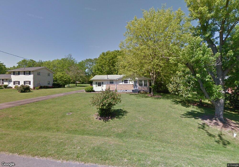
104 Arnette Dr Smyrna, TN 37167
Estimated Value: $289,033 - $366,000
--
Bed
2
Baths
1,540
Sq Ft
$222/Sq Ft
Est. Value
About This Home
This home is located at 104 Arnette Dr, Smyrna, TN 37167 and is currently estimated at $341,758, approximately $221 per square foot. 104 Arnette Dr is a home located in Rutherford County with nearby schools including Smyrna Primary School, Smyrna Middle School, and Smyrna High School.
Ownership History
Date
Name
Owned For
Owner Type
Purchase Details
Closed on
Jun 21, 2016
Bought by
Dye Jaime and Dye Josef
Current Estimated Value
Home Financials for this Owner
Home Financials are based on the most recent Mortgage that was taken out on this home.
Original Mortgage
$121,826
Outstanding Balance
$96,865
Interest Rate
3.54%
Estimated Equity
$244,893
Purchase Details
Closed on
Aug 7, 2009
Sold by
Hud Secretary Of
Bought by
Dye Josef Wade
Home Financials for this Owner
Home Financials are based on the most recent Mortgage that was taken out on this home.
Original Mortgage
$128,612
Interest Rate
5.19%
Purchase Details
Closed on
Aug 16, 2004
Sold by
Irvin Paul R
Bought by
Kenneth Green
Purchase Details
Closed on
Feb 21, 2001
Sold by
Bruce Britton G and Bruce Gayle C
Bought by
Irvin Paul R
Purchase Details
Closed on
Sep 13, 2000
Sold by
Hilliard Louise S
Bought by
Britton Gayle C
Create a Home Valuation Report for This Property
The Home Valuation Report is an in-depth analysis detailing your home's value as well as a comparison with similar homes in the area
Home Values in the Area
Average Home Value in this Area
Purchase History
| Date | Buyer | Sale Price | Title Company |
|---|---|---|---|
| Dye Jaime | -- | -- | |
| Dye Josef Wade | $126,500 | -- | |
| Kenneth Green | $103,000 | -- | |
| Irvin Paul R | $98,500 | -- | |
| Britton Gayle C | $77,500 | -- |
Source: Public Records
Mortgage History
| Date | Status | Borrower | Loan Amount |
|---|---|---|---|
| Open | Britton Gayle C | $121,826 | |
| Closed | Britton Gayle C | -- | |
| Previous Owner | Britton Gayle C | $128,612 |
Source: Public Records
Tax History Compared to Growth
Tax History
| Year | Tax Paid | Tax Assessment Tax Assessment Total Assessment is a certain percentage of the fair market value that is determined by local assessors to be the total taxable value of land and additions on the property. | Land | Improvement |
|---|---|---|---|---|
| 2025 | $1,609 | $66,975 | $13,750 | $53,225 |
| 2024 | $1,609 | $66,975 | $13,750 | $53,225 |
| 2023 | $1,609 | $66,975 | $13,750 | $53,225 |
| 2022 | $1,434 | $66,975 | $13,750 | $53,225 |
| 2021 | $1,501 | $51,400 | $8,750 | $42,650 |
| 2020 | $1,501 | $51,400 | $8,750 | $42,650 |
| 2019 | $1,501 | $51,400 | $8,750 | $42,650 |
| 2018 | $1,439 | $51,400 | $0 | $0 |
| 2017 | $1,173 | $32,900 | $0 | $0 |
| 2016 | $1,173 | $32,900 | $0 | $0 |
| 2015 | $1,173 | $32,900 | $0 | $0 |
| 2014 | $818 | $32,900 | $0 | $0 |
| 2013 | -- | $23,250 | $0 | $0 |
Source: Public Records
Map
Nearby Homes
- 108 McNickle Dr
- 201 Bane Dr
- 1547 Repton Rd
- 205 Bane Dr
- 203 McNickle Dr
- 116 Avondale Dr
- 3011 Denny Brooke Ln
- 303 Davis Park Dr
- 104 Belaire Dr
- 3040 Denny Brooke Ln
- 104 Evanmeade Dr
- 403 Acorn Ct
- 213 Stewarts Landing Cir
- 211 Stewarts Landing Cir
- 340 Stewarts Landing Cir
- 131 Tedder Blvd
- 106 Halfrunner Way Unit 4
- 104 Halfrunner Way Unit 3
- 102 Halfrunner Way Unit 2
- 100 Halfrunner Way Unit 1
- 102 Arnette Dr
- 106 Arnette Dr
- 105 Sutterlin Dr
- 103 Sutterlin Dr
- 108 Arnette Dr
- 112 Bane Dr
- 101 Sutterlin Dr
- 110 Bane Dr
- 103 Arnette Dr
- 107 Sutterlin Dr
- 105 Arnette Dr
- 101 Arnette Dr
- 107 Arnette Dr
- 114 Bane Dr
- 111 Hutchinson Dr
- 113 Hutchinson Dr
- 109 Arnette Dr
- 109 Hutchinson Dr
- 116 Bane Dr
- 204 Hager Dr