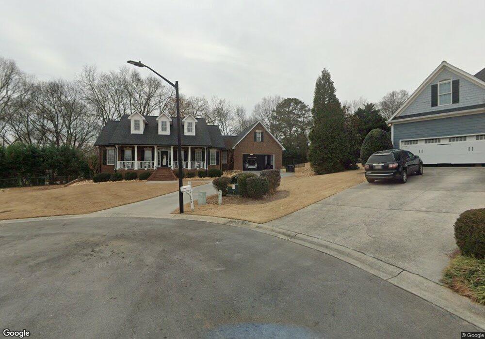
104 Bob White Cir Calhoun, GA 30701
Estimated Value: $402,000 - $590,382
3
Beds
3
Baths
2,315
Sq Ft
$226/Sq Ft
Est. Value
About This Home
This home is located at 104 Bob White Cir, Calhoun, GA 30701 and is currently estimated at $522,596, approximately $225 per square foot. 104 Bob White Cir is a home located in Gordon County with nearby schools including Calhoun Primary School, Calhoun Elementary School, and Calhoun Middle School.
Ownership History
Date
Name
Owned For
Owner Type
Purchase Details
Closed on
Dec 11, 2006
Sold by
Fuller Charles E and Fuller Kay G
Bought by
Cote Brenda and Cote Timothy
Current Estimated Value
Home Financials for this Owner
Home Financials are based on the most recent Mortgage that was taken out on this home.
Original Mortgage
$314,900
Interest Rate
6.31%
Mortgage Type
New Conventional
Purchase Details
Closed on
Oct 17, 2001
Sold by
Hyde Susan
Bought by
Fuller Charles E and Fuller Kay G
Purchase Details
Closed on
Mar 15, 2001
Sold by
Tecron Inc
Bought by
Hyde Susan
Create a Home Valuation Report for This Property
The Home Valuation Report is an in-depth analysis detailing your home's value as well as a comparison with similar homes in the area
Home Values in the Area
Average Home Value in this Area
Purchase History
| Date | Buyer | Sale Price | Title Company |
|---|---|---|---|
| Cote Brenda | $319,900 | -- | |
| Fuller Charles E | $259,500 | -- | |
| Hyde Susan | $31,500 | -- |
Source: Public Records
Mortgage History
| Date | Status | Borrower | Loan Amount |
|---|---|---|---|
| Closed | Cote Brenda | $314,900 |
Source: Public Records
Tax History Compared to Growth
Tax History
| Year | Tax Paid | Tax Assessment Tax Assessment Total Assessment is a certain percentage of the fair market value that is determined by local assessors to be the total taxable value of land and additions on the property. | Land | Improvement |
|---|---|---|---|---|
| 2024 | $3,752 | $156,680 | $10,360 | $146,320 |
| 2023 | $4,120 | $147,200 | $10,360 | $136,840 |
| 2022 | $1,295 | $138,120 | $10,360 | $127,760 |
| 2021 | $3,465 | $117,040 | $10,360 | $106,680 |
| 2020 | $3,530 | $118,280 | $10,360 | $107,920 |
| 2019 | $3,525 | $118,280 | $10,360 | $107,920 |
| 2018 | $1,046 | $110,640 | $10,360 | $100,280 |
| 2017 | $1,017 | $105,480 | $10,360 | $95,120 |
| 2016 | $1,020 | $105,480 | $10,360 | $95,120 |
| 2015 | $1,016 | $103,760 | $10,360 | $93,400 |
| 2014 | $979 | $101,406 | $10,360 | $91,046 |
Source: Public Records
Map
Nearby Homes
- 107 Bobwhite Dr
- 105 Bobwhite Dr
- 104 Bobwhite Dr
- 212 Sherwood Dr
- 229 Hillcrest Dr
- 198 Hillcrest Dr
- 202 Montclair Dr
- 136 Boston Rd
- 114 Vinings Way SE
- 107 Savoy Place SE
- 220 Lenox Rd SE
- 156 Fair Oak Ln
- 162 Oakleigh Ct
- 187 Asbury Cir
- 1208 Jewel Ct
- 173 Oakleigh Dr
- 0 Resaca Lafayette Rd Unit 7113987
- 00 Resaca Lafayette Rd
- 133 Asbury Cir
- 103 Bob White Cir
- 102 Bob White Cir
- 102 Hunters Point
- 108 Quail Run Dr
- 180 Hunters Point
- 100 Hunters Point
- 100 Bob White Cir
- 25 Quail Run Dr
- 104 Highland Ct
- 100 Bob White Dr
- 0 Bobwhite Dr
- 104 Hunters Point
- 100 Bobwhite Dr
- 107 Quail Run Dr
- 105 Quail Run Dr
- 112 Quail Run Dr
- 100 Clubhouse Dr
- 105 Highland Ct
- 102 Bob White Dr
- 104 Quail Run Dr