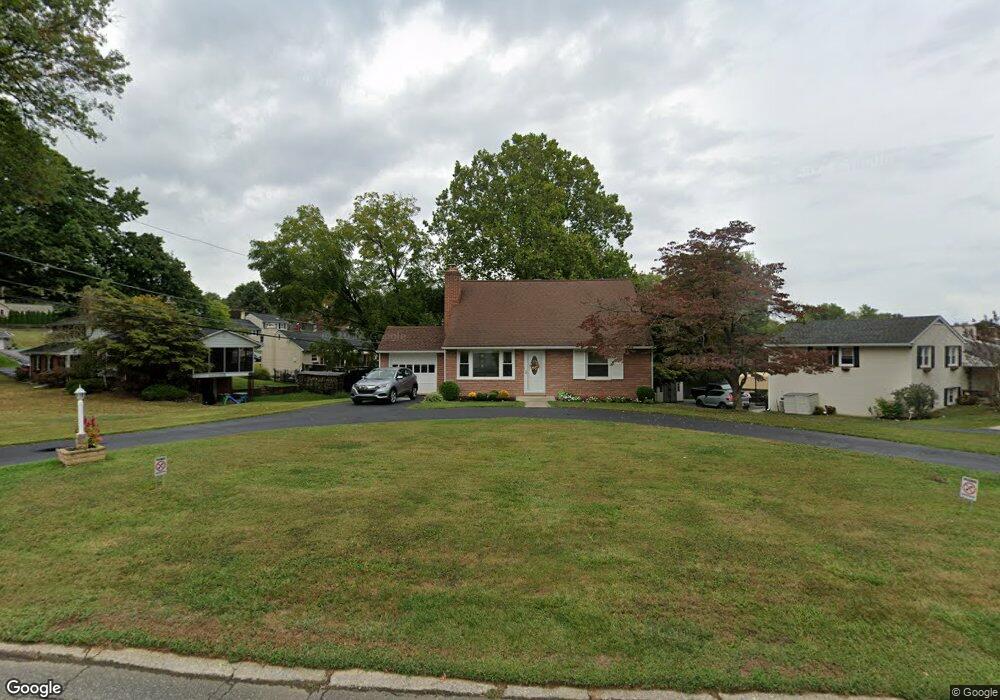
104 Brookside Rd Newtown Square, PA 19073
Estimated Value: $588,291 - $660,000
3
Beds
2
Baths
1,848
Sq Ft
$341/Sq Ft
Est. Value
About This Home
This home is located at 104 Brookside Rd, Newtown Square, PA 19073 and is currently estimated at $630,073, approximately $340 per square foot. 104 Brookside Rd is a home located in Delaware County with nearby schools including Culbertson Elementary School, Paxon Hollow Middle School, and Marple Newtown Senior High School.
Ownership History
Date
Name
Owned For
Owner Type
Purchase Details
Closed on
Aug 14, 2003
Sold by
Anderson Paul and Anderson Lynne A
Bought by
Billingslea Robert T and Billingslea Virginia M
Current Estimated Value
Home Financials for this Owner
Home Financials are based on the most recent Mortgage that was taken out on this home.
Original Mortgage
$70,000
Outstanding Balance
$30,601
Interest Rate
5.52%
Mortgage Type
Purchase Money Mortgage
Estimated Equity
$599,472
Purchase Details
Closed on
Jan 21, 2000
Sold by
Anderson Paul
Bought by
Anderson Paul and Anderson Lynne A
Purchase Details
Closed on
Jun 3, 1998
Sold by
Hartranft Helen M
Bought by
Anderson Paul
Home Financials for this Owner
Home Financials are based on the most recent Mortgage that was taken out on this home.
Original Mortgage
$151,200
Interest Rate
7.02%
Create a Home Valuation Report for This Property
The Home Valuation Report is an in-depth analysis detailing your home's value as well as a comparison with similar homes in the area
Home Values in the Area
Average Home Value in this Area
Purchase History
| Date | Buyer | Sale Price | Title Company |
|---|---|---|---|
| Billingslea Robert T | $315,000 | Fidelity National Title Insu | |
| Anderson Paul | -- | Commonwealth Land Title Ins | |
| Anderson Paul | $189,000 | Commonwealth Land Title Ins |
Source: Public Records
Mortgage History
| Date | Status | Borrower | Loan Amount |
|---|---|---|---|
| Open | Billingslea Robert T | $70,000 | |
| Previous Owner | Anderson Paul | $151,200 | |
| Closed | Billingslea Robert T | $200,000 |
Source: Public Records
Tax History
| Year | Tax Paid | Tax Assessment Tax Assessment Total Assessment is a certain percentage of the fair market value that is determined by local assessors to be the total taxable value of land and additions on the property. | Land | Improvement |
|---|---|---|---|---|
| 2025 | $6,119 | $367,690 | $106,080 | $261,610 |
| 2024 | $6,119 | $367,690 | $106,080 | $261,610 |
| 2023 | $5,926 | $367,690 | $106,080 | $261,610 |
| 2022 | $5,796 | $367,690 | $106,080 | $261,610 |
| 2021 | $8,861 | $367,690 | $106,080 | $261,610 |
| 2020 | $4,855 | $176,990 | $68,080 | $108,910 |
| 2019 | $4,778 | $176,990 | $68,080 | $108,910 |
| 2018 | $4,726 | $176,990 | $0 | $0 |
| 2017 | $4,710 | $176,990 | $0 | $0 |
| 2016 | $971 | $176,990 | $0 | $0 |
| 2015 | $971 | $176,990 | $0 | $0 |
| 2014 | $971 | $176,990 | $0 | $0 |
Source: Public Records
Map
Nearby Homes
- 204 3rd Ave
- 14 Valley View Ln
- 212 Aronimink Dr
- 334 Foxtail Ln Unit 22D
- 326 Squire Dr Unit 21C
- 31 Barren Rd
- 120 Hunt Club Ln
- 10 Fox Chase Cir
- 23 Newtown Woods Rd
- 204 Media Line Rd
- 220 Charles Ellis Dr
- 337 Horseshoe Trail
- 303 Squire Dr
- 691 Media Line Rd
- 615 Wiltshire Ln Unit 140
- 312 Belpaire Ct Unit 312
- 104 Eagle Dr
- 105 Eagle Dr
- 103 Eagle Dr
- 107 Eagle Dr
- 106 Brookside Rd
- 102 Brookside Rd
- 119 Ashley Rd
- 105 Brookside Rd
- 108 Brookside Rd
- 121 Ashley Rd
- 103 Brookside Rd
- 107 Brookside Rd
- 109 Brookside Rd
- 115 Ashley Rd
- 111 Brookside Rd
- 123 Ashley Rd
- 110 Brookside Rd
- 113 Brookside Rd
- 110 Ashley Rd
- 111 Ashley Rd
- 116 Ashley Rd
- 118 Ashley Rd
- 3519 Woodcrest Ave
- 3521 Woodcrest Ave