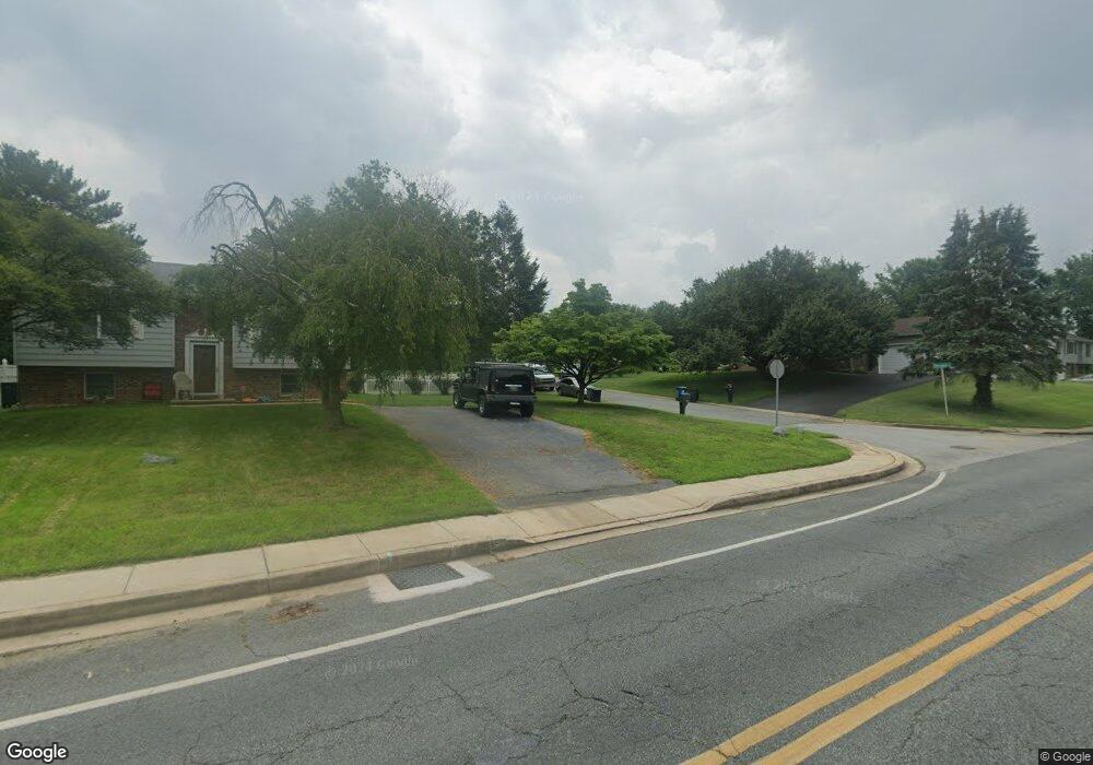
104 Chessman Cir Elkton, MD 21921
Estimated Value: $284,304 - $334,000
--
Bed
1
Bath
1,080
Sq Ft
$287/Sq Ft
Est. Value
About This Home
This home is located at 104 Chessman Cir, Elkton, MD 21921 and is currently estimated at $310,326, approximately $287 per square foot. 104 Chessman Cir is a home located in Cecil County with nearby schools including Thomson Estates Elementary School, Elkton Middle School, and Elkton High School.
Ownership History
Date
Name
Owned For
Owner Type
Purchase Details
Closed on
Nov 30, 1999
Sold by
Federal Home Loan Mortgage Corporation
Bought by
Reilly Ella M and Reilly Dorothy M
Current Estimated Value
Purchase Details
Closed on
Jun 18, 1999
Sold by
Foreacre Clifford L and Foreacre Sharon
Bought by
Federal Home Loan Mortgage Corporation
Purchase Details
Closed on
Mar 13, 1987
Sold by
Schneider Bruce
Bought by
Foreacre Clifford L and Foreacre Sharon
Home Financials for this Owner
Home Financials are based on the most recent Mortgage that was taken out on this home.
Original Mortgage
$65,900
Interest Rate
9.05%
Create a Home Valuation Report for This Property
The Home Valuation Report is an in-depth analysis detailing your home's value as well as a comparison with similar homes in the area
Home Values in the Area
Average Home Value in this Area
Purchase History
| Date | Buyer | Sale Price | Title Company |
|---|---|---|---|
| Reilly Ella M | $92,000 | -- | |
| Federal Home Loan Mortgage Corporation | $106,000 | -- | |
| Foreacre Clifford L | $13,500 | -- |
Source: Public Records
Mortgage History
| Date | Status | Borrower | Loan Amount |
|---|---|---|---|
| Previous Owner | Foreacre Clifford L | $65,900 | |
| Closed | Reilly Ella M | -- |
Source: Public Records
Tax History Compared to Growth
Tax History
| Year | Tax Paid | Tax Assessment Tax Assessment Total Assessment is a certain percentage of the fair market value that is determined by local assessors to be the total taxable value of land and additions on the property. | Land | Improvement |
|---|---|---|---|---|
| 2025 | $3,190 | $192,533 | $0 | $0 |
| 2024 | $2,664 | $174,200 | $53,300 | $120,900 |
| 2023 | $2,285 | $171,567 | $0 | $0 |
| 2022 | $2,976 | $168,933 | $0 | $0 |
| 2021 | $2,917 | $166,300 | $53,300 | $113,000 |
| 2020 | $2,916 | $163,000 | $0 | $0 |
| 2019 | $2,857 | $159,700 | $0 | $0 |
| 2018 | $2,798 | $156,400 | $73,300 | $83,100 |
| 2017 | $2,787 | $155,767 | $0 | $0 |
| 2016 | $2,608 | $155,133 | $0 | $0 |
| 2015 | $2,608 | $154,500 | $0 | $0 |
| 2014 | $2,621 | $154,500 | $0 | $0 |
Source: Public Records
Map
Nearby Homes
- 106 Normira Ave
- 206 Whitehall Rd
- 114 Creswell Ave
- 103 State St
- 4 Saint Pats Cir
- 0 E Pulaski Hwy
- 114 Saint Louis Dr
- 17 Kent Rd
- 110 Delaware Ave
- 0 Delaware Ave Unit MDCC2018992
- 5 Thyme St
- 0 W Main St Unit MDCC2016174
- 115 Bethel St
- 413 Melbourne Blvd
- 113 Erin Ct
- 12 Heather Ct
- 112 Courtney Dr
- 112 Ben Blvd
- 155 E Village Rd
- 434 Buttonwoods Rd
- 106 Chessman Cir
- 125 Hearth Stone Dr
- 123 Hearth Stone Dr
- 127 Hearth Stone Dr
- 102 Chessman Cir
- 108 Chessman Cir
- 121 Hearth Stone Dr
- 129 Hearth Stone Dr
- 123 Whitehall Rd
- 119 Whitehall Rd
- 105 Hearth Stone Dr
- 131 Hearth Stone Dr
- 103 Hearth Stone Dr
- 117 Whitehall Rd
- 107 Hearth Stone Dr
- 117 Hearth Stone Dr
- 128 Hearth Stone Dr
- 126 Hearth Stone Dr
- 130 Hearth Stone Dr