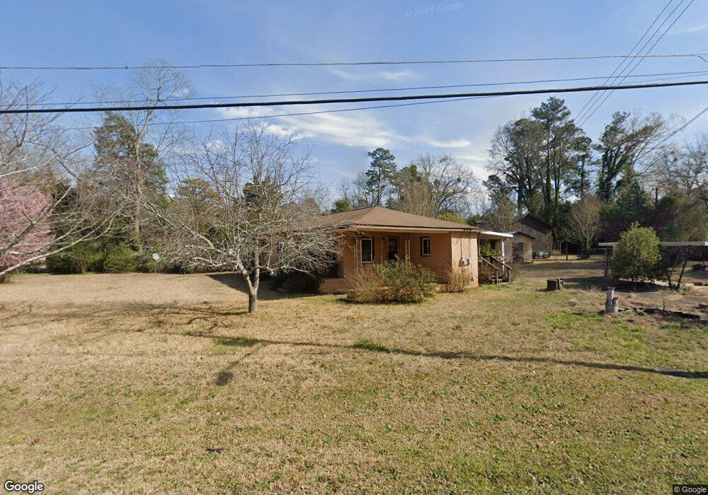
104 Dorn St Grovetown, GA 30813
Estimated Value: $136,000 - $200,000
3
Beds
1
Bath
966
Sq Ft
$172/Sq Ft
Est. Value
About This Home
This home is located at 104 Dorn St, Grovetown, GA 30813 and is currently estimated at $165,972, approximately $171 per square foot. 104 Dorn St is a home located in Columbia County with nearby schools including Grovetown Elementary School, Grovetown Middle School, and Grovetown High School.
Ownership History
Date
Name
Owned For
Owner Type
Purchase Details
Closed on
Mar 26, 2023
Sold by
Warren Stanley G
Bought by
Dukes Marsha L
Current Estimated Value
Purchase Details
Closed on
Dec 8, 2008
Sold by
Long Judith Banks
Bought by
Warren Stanley G
Home Financials for this Owner
Home Financials are based on the most recent Mortgage that was taken out on this home.
Original Mortgage
$55,000
Interest Rate
6.1%
Mortgage Type
New Conventional
Create a Home Valuation Report for This Property
The Home Valuation Report is an in-depth analysis detailing your home's value as well as a comparison with similar homes in the area
Home Values in the Area
Average Home Value in this Area
Purchase History
| Date | Buyer | Sale Price | Title Company |
|---|---|---|---|
| Dukes Marsha L | -- | -- | |
| Warren Stanley G | $55,000 | -- |
Source: Public Records
Mortgage History
| Date | Status | Borrower | Loan Amount |
|---|---|---|---|
| Previous Owner | Warren Stanley G | $55,000 |
Source: Public Records
Tax History Compared to Growth
Tax History
| Year | Tax Paid | Tax Assessment Tax Assessment Total Assessment is a certain percentage of the fair market value that is determined by local assessors to be the total taxable value of land and additions on the property. | Land | Improvement |
|---|---|---|---|---|
| 2025 | $1,116 | $39,859 | $17,404 | $22,455 |
| 2024 | $1,180 | $40,010 | $17,204 | $22,806 |
| 2023 | $1,180 | $35,274 | $16,304 | $18,970 |
| 2022 | $257 | $33,761 | $16,304 | $17,457 |
| 2021 | $199 | $26,127 | $9,404 | $16,723 |
| 2020 | $201 | $26,331 | $9,404 | $16,927 |
| 2019 | $192 | $24,414 | $6,704 | $17,710 |
| 2018 | $195 | $24,405 | $6,704 | $17,701 |
| 2017 | $171 | $24,805 | $6,804 | $18,001 |
| 2016 | $142 | $20,630 | $6,780 | $13,850 |
| 2015 | $156 | $22,326 | $7,680 | $14,646 |
| 2014 | $149 | $21,322 | $7,680 | $13,642 |
Source: Public Records
Map
Nearby Homes
- 201 Williams St
- 406 Williams St
- 100 Buck Ave
- 102 Walton Dr
- 104 Bennett St
- 100 Walton Dr
- 106 Bennett St
- 116 Bennett St
- 106 Walton Dr
- 4917 Cavan Place
- 118 Bennett St
- 321 Railroad Ave
- 141/137 Lewiston Rd
- 211 Whiskey Rd
- 213 Whiskey Rd
- 1100 Durban Dr
- 4907 Selkirk Way
- 218 Harvestwood Dr
- 936 Bryan Cir
- 132 Summerfield Cir
- 302 2nd Ave
- 105 Dorn St
- 304 2nd Ave
- 301 E Robinson Ave
- 12345 None
- 4711 Brownfield Ln
- 1607 Points Rd
- 432 Fordham Rd
- 428 Fordham Rd
- 1800 Landing Dr Unit 1A
- 1812 Landing Dr Unit 2B
- 1810 Landing Dr Unit 2A
- 208 2nd Ave
- 301 2nd Ave
- 303 2nd Ave
- 303 E Robinson Ave
- 209 2nd Ave
- 101 Dorn St
- 209 E Robinson Ave
- 206 2nd Ave