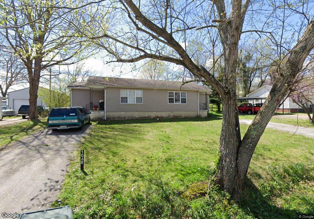
104 E Ray St Dickson, TN 37055
Estimated Value: $198,000 - $230,000
Studio
2
Baths
1,224
Sq Ft
$179/Sq Ft
Est. Value
About This Home
This home is located at 104 E Ray St, Dickson, TN 37055 and is currently estimated at $218,847, approximately $178 per square foot. 104 E Ray St is a home located in Dickson County with nearby schools including Centennial Elementary School, Dickson Middle School, and Dickson County High School.
Ownership History
Date
Name
Owned For
Owner Type
Purchase Details
Closed on
Sep 12, 2018
Sold by
Dean Darrell
Bought by
Miller Bradley Alan
Current Estimated Value
Purchase Details
Closed on
Apr 24, 2008
Sold by
Haley Steven R
Bought by
Dean Darrell
Purchase Details
Closed on
Dec 30, 1997
Sold by
Heritage Investments Llc
Bought by
Heritage Investments Llc
Home Financials for this Owner
Home Financials are based on the most recent Mortgage that was taken out on this home.
Original Mortgage
$139,960
Interest Rate
7.18%
Purchase Details
Closed on
Oct 1, 1992
Bought by
Mary Bissinger C and Mary Jewel
Purchase Details
Closed on
Apr 1, 1988
Bought by
Johnson Robert B
Purchase Details
Closed on
Mar 17, 1977
Bought by
Williams Stroud and Williams Dottie
Create a Home Valuation Report for This Property
The Home Valuation Report is an in-depth analysis detailing your home's value as well as a comparison with similar homes in the area
Home Values in the Area
Average Home Value in this Area
Purchase History
| Date | Buyer | Sale Price | Title Company |
|---|---|---|---|
| Miller Bradley Alan | $105,000 | -- | |
| Dean Darrell | $73,097 | -- | |
| Dean Darrell | $69,177 | -- | |
| Heritage Investments Llc | $174,950 | -- | |
| Mary Bissinger C | $39,900 | -- | |
| Johnson Robert B | $39,000 | -- | |
| Williams Stroud | -- | -- |
Source: Public Records
Mortgage History
| Date | Status | Borrower | Loan Amount |
|---|---|---|---|
| Previous Owner | Williams Stroud | $139,960 |
Source: Public Records
Tax History
| Year | Tax Paid | Tax Assessment Tax Assessment Total Assessment is a certain percentage of the fair market value that is determined by local assessors to be the total taxable value of land and additions on the property. | Land | Improvement |
|---|---|---|---|---|
| 2025 | -- | $56,880 | $20,920 | $35,960 |
| 2024 | -- | $56,880 | $20,920 | $35,960 |
| 2023 | $1,178 | $37,720 | $12,440 | $25,280 |
| 2022 | $1,178 | $37,720 | $12,440 | $25,280 |
| 2021 | $1,178 | $37,720 | $12,440 | $25,280 |
| 2020 | $1,178 | $37,720 | $12,440 | $25,280 |
| 2019 | $1,178 | $37,720 | $12,440 | $25,280 |
| 2018 | $964 | $26,400 | $7,280 | $19,120 |
| 2017 | $964 | $26,400 | $7,280 | $19,120 |
| 2016 | $964 | $26,400 | $7,280 | $19,120 |
| 2015 | $1,024 | $26,400 | $7,280 | $19,120 |
| 2014 | $1,024 | $26,400 | $7,280 | $19,120 |
Source: Public Records
Map
Nearby Homes
- 110 Mccreary Heights
- 100 Oak Dr
- 0 Truform Way Unit RTC3139035
- 414 W College St
- 500 Church St
- 202 W College St Unit 4
- 402 W Railroad St
- 103 Freeman Ave
- 0 Henslee Dr Spring St Unit RTC3128657
- 701 W 5th St
- 0 Country Club Dr Unit 26
- 402 S Mulberry St
- 909 W 1st St
- 129 Ironhorse Way
- 0 Hardin Ave
- 103 Batey Cir
- 210 Hardin Ave
- 1035 Northside Dr
- 0 Highway 46 Unit RTC2944647
- 404 Masters Way
- 102 E Ray St
- 106 E Ray St
- 108 E Ray St
- 101 Oak Ave Unit B
- 101 Oak Ave Unit A
- 101 Oak Ave
- 220 Mccreary Heights
- 218 Mccreary Heights
- 216 Mccreary Heights
- 103 Oak Ave
- 110 E Ray St
- 102 Oak Ave
- 214 Mccreary Heights
- 104 Oak Ave
- 210 Mccreary Heights
- 105 Oak Ave
- 107 E Ray St
- 106 Oak Ave
- 230 Mccreary Heights
- 208 Mccreary Heights
Your Personal Tour Guide
Ask me questions while you tour the home.