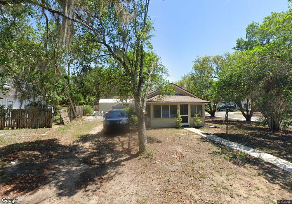
104 E Taylor Ave Eustis, FL 32726
Estimated Value: $134,765 - $216,000
2
Beds
1
Bath
781
Sq Ft
$208/Sq Ft
Est. Value
About This Home
This home is located at 104 E Taylor Ave, Eustis, FL 32726 and is currently estimated at $162,691, approximately $208 per square foot. 104 E Taylor Ave is a home located in Lake County with nearby schools including Eustis Heights Elementary School, Eustis Middle School, and Eustis High School.
Ownership History
Date
Name
Owned For
Owner Type
Purchase Details
Closed on
Dec 31, 2009
Sold by
Fannie Mae
Bought by
Sirek Alexander E
Current Estimated Value
Purchase Details
Closed on
Nov 2, 2009
Sold by
Monteleone Michael and Monteleone Briana
Bought by
Federal National Mortgage Association
Purchase Details
Closed on
Oct 20, 2009
Sold by
Monteleone Michael
Bought by
Wells Fargo Bank Na
Purchase Details
Closed on
Nov 13, 2007
Sold by
Monteleone Briana
Bought by
Monteleone Michael
Purchase Details
Closed on
Dec 16, 2005
Sold by
Sperrey Elizabeth
Bought by
Monteleone Michael and Monteleone Briana
Home Financials for this Owner
Home Financials are based on the most recent Mortgage that was taken out on this home.
Original Mortgage
$75,000
Interest Rate
6.29%
Mortgage Type
Fannie Mae Freddie Mac
Purchase Details
Closed on
Nov 14, 1997
Sold by
Boyette Carl B and Boyette Jana W
Bought by
Sperrey Elizabeth
Home Financials for this Owner
Home Financials are based on the most recent Mortgage that was taken out on this home.
Original Mortgage
$28,300
Interest Rate
7.27%
Create a Home Valuation Report for This Property
The Home Valuation Report is an in-depth analysis detailing your home's value as well as a comparison with similar homes in the area
Home Values in the Area
Average Home Value in this Area
Purchase History
| Date | Buyer | Sale Price | Title Company |
|---|---|---|---|
| Sirek Alexander E | $21,500 | First American Title | |
| Federal National Mortgage Association | -- | Attorney | |
| Wells Fargo Bank Na | -- | Attorney | |
| Monteleone Michael | -- | None Available | |
| Monteleone Michael | $75,000 | Apple Title Ltd | |
| Sperrey Elizabeth | $32,000 | -- |
Source: Public Records
Mortgage History
| Date | Status | Borrower | Loan Amount |
|---|---|---|---|
| Previous Owner | Monteleone Michael | $75,000 | |
| Previous Owner | Sperrey Elizabeth | $28,300 |
Source: Public Records
Tax History
| Year | Tax Paid | Tax Assessment Tax Assessment Total Assessment is a certain percentage of the fair market value that is determined by local assessors to be the total taxable value of land and additions on the property. | Land | Improvement |
|---|---|---|---|---|
| 2026 | $1,555 | $102,716 | $38,363 | $64,353 |
| 2025 | $1,451 | $102,373 | $38,363 | $64,010 |
| 2024 | $1,451 | $102,373 | $38,363 | $64,010 |
| 2023 | $1,451 | $100,415 | $38,363 | $62,052 |
| 2022 | $1,377 | $96,578 | $34,526 | $62,052 |
| 2021 | $1,113 | $65,537 | $0 | $0 |
| 2020 | $1,038 | $56,409 | $0 | $0 |
| 2019 | $994 | $56,409 | $0 | $0 |
| 2018 | $797 | $37,268 | $0 | $0 |
| 2017 | $743 | $34,663 | $0 | $0 |
| 2016 | $713 | $32,821 | $0 | $0 |
| 2015 | $719 | $32,281 | $0 | $0 |
| 2014 | $712 | $31,790 | $0 | $0 |
Source: Public Records
Map
Nearby Homes
- 301 E Atwater Ave
- 105 W Golf Links Ave
- 102 W Saint Louis Ave
- 1215 Morin St
- 436 E Atwater Ave
- 507 Firewood Ave
- 203 E Lakeview Ave
- 1033 S Grove St
- 1300 Saint Andrews Blvd
- 322 Palm Ave
- 615 Briarcliff Rd
- 118 W Chesley Ave
- 1122 Virginia Ct
- 1111 South St
- 1021 Titcomb St
- 504 Ambassador Ave
- 860 S Grove St
- 206 Osceola Ave
- 0 S Mary St
- 312 Osceola Ave
- 116 E Taylor Ave
- 1623 S Eustis St
- 22 E Taylor Ave
- 105 E Taylor Ave
- 1612 S Eustis St
- 124 E Taylor Ave
- 101 E Quayle Ave
- 1626 S Grove St
- 1528 S Grove St
- 1628 S Grove St
- 0 E Quayle Ave
- 1601 S Bay St
- 1522 S Grove St
- 0 S Grove St
- 1520 S Grove St
- 110 E Quayle Ave
- 102 E Quayle Ave
- 108 E Quayle Ave
- 1601 S Grove St
- 1519 S Eustis St
Your Personal Tour Guide
Ask me questions while you tour the home.