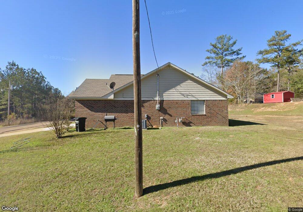
104 Huntington Ln Hazlehurst, MS 39083
Estimated Value: $128,000 - $175,000
3
Beds
2
Baths
1,641
Sq Ft
$94/Sq Ft
Est. Value
About This Home
This home is located at 104 Huntington Ln, Hazlehurst, MS 39083 and is currently estimated at $154,279, approximately $94 per square foot. 104 Huntington Ln is a home with nearby schools including Hazlehurst Middle School and Hazlehurst High School.
Ownership History
Date
Name
Owned For
Owner Type
Purchase Details
Closed on
Mar 17, 2023
Sold by
Ellis Davin D and Ellis Ebony C
Bought by
Ellis Devin D
Current Estimated Value
Home Financials for this Owner
Home Financials are based on the most recent Mortgage that was taken out on this home.
Original Mortgage
$138,380
Outstanding Balance
$121,896
Interest Rate
5.51%
Mortgage Type
FHA
Estimated Equity
$32,383
Purchase Details
Closed on
Jul 14, 2017
Sold by
East Ridge Development Llc
Bought by
Ellis Devin D and Virgil Ebony C
Home Financials for this Owner
Home Financials are based on the most recent Mortgage that was taken out on this home.
Original Mortgage
$124,742
Interest Rate
3.91%
Mortgage Type
New Conventional
Create a Home Valuation Report for This Property
The Home Valuation Report is an in-depth analysis detailing your home's value as well as a comparison with similar homes in the area
Home Values in the Area
Average Home Value in this Area
Purchase History
| Date | Buyer | Sale Price | Title Company |
|---|---|---|---|
| Ellis Devin D | -- | -- | |
| Ellis Devin D | $128,600 | None Available |
Source: Public Records
Mortgage History
| Date | Status | Borrower | Loan Amount |
|---|---|---|---|
| Open | Ellis Devin D | $138,380 | |
| Previous Owner | Ellis Devin D | $124,742 |
Source: Public Records
Tax History Compared to Growth
Tax History
| Year | Tax Paid | Tax Assessment Tax Assessment Total Assessment is a certain percentage of the fair market value that is determined by local assessors to be the total taxable value of land and additions on the property. | Land | Improvement |
|---|---|---|---|---|
| 2025 | $971 | $11,991 | $0 | $0 |
| 2024 | $971 | $10,403 | $0 | $0 |
| 2023 | $948 | $10,403 | $0 | $0 |
| 2022 | $975 | $10,403 | $0 | $0 |
| 2021 | $950 | $10,403 | $0 | $0 |
| 2020 | $901 | $9,926 | $0 | $0 |
| 2019 | $899 | $9,926 | $0 | $0 |
| 2018 | $915 | $9,926 | $0 | $0 |
| 2017 | $37 | $506 | $0 | $0 |
| 2016 | $37 | $303 | $0 | $0 |
| 2015 | -- | $303 | $0 | $0 |
| 2014 | -- | $303 | $0 | $0 |
Source: Public Records
Map
Nearby Homes
- 744 Georgetown St
- 613 Georgetown St
- 3010 Georgetown St
- 3048 Georgetown St
- 0 E Whitworth St
- 1004 Bethesda Rd
- 209 Downing St
- 330 S Extension St
- 0 Carlisle St
- 3064 E Whitworth St
- 0 Dentville Rd Unit 24270197
- 0 Dentville Rd Unit 4118373
- 1015 Herbert Ln
- 1142 Henley Cir
- 3152 Old Natchez Rd
- 3200 Tower Rd
- 21032 Us-51
- 0 Whitetown Ln
- 4 Whitetown Ln
- 1 Whitetown Ln
- 106 Huntington Ln
- 127 Hamilton Dr
- 181 Scot St
- 123 Hamilton Dr
- 131 Hamilton Dr
- 189 Scot St
- 105 Huntington Ln
- 119 Hamilton Dr
- 135 Hamilton Dr
- 115 Hamilton Dr
- 0 Scott St Unit 255130
- 0 Scott St Unit 1255130
- 111 Hamilton Dr
- 328 E Whitworth St
- 107 Hamilton Dr
- 194 Scot St
- 303 E Whitworth St
- 324 E Whitworth St
- 101 Hamilton Dr
- 102 Hamilton Dr