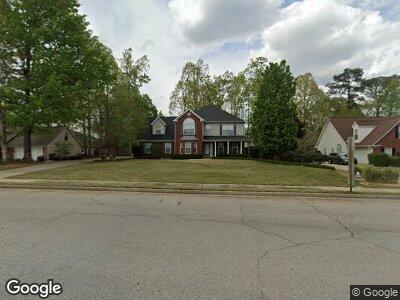
104 Moss Pointe Dr McDonough, GA 30253
Estimated Value: $339,000 - $374,000
3
Beds
3
Baths
2,366
Sq Ft
$149/Sq Ft
Est. Value
About This Home
This home is located at 104 Moss Pointe Dr, McDonough, GA 30253 and is currently estimated at $351,794, approximately $148 per square foot. 104 Moss Pointe Dr is a home located in Henry County with nearby schools including Union Grove Middle School, Union Grove High School, and Hickory Flat Elementary School.
Ownership History
Date
Name
Owned For
Owner Type
Purchase Details
Closed on
May 23, 2008
Sold by
Blanchard Ichristopher E
Bought by
Simpson Bradford B and Simpson Gina H
Current Estimated Value
Home Financials for this Owner
Home Financials are based on the most recent Mortgage that was taken out on this home.
Original Mortgage
$183,549
Outstanding Balance
$118,422
Interest Rate
6%
Mortgage Type
FHA
Purchase Details
Closed on
Apr 18, 2005
Sold by
Peachtree Homes Inc
Bought by
Blanchard Christopher E
Home Financials for this Owner
Home Financials are based on the most recent Mortgage that was taken out on this home.
Original Mortgage
$163,710
Interest Rate
5.88%
Mortgage Type
New Conventional
Create a Home Valuation Report for This Property
The Home Valuation Report is an in-depth analysis detailing your home's value as well as a comparison with similar homes in the area
Home Values in the Area
Average Home Value in this Area
Purchase History
| Date | Buyer | Sale Price | Title Company |
|---|---|---|---|
| Simpson Bradford B | $185,000 | -- | |
| Blanchard Christopher E | $181,900 | -- |
Source: Public Records
Mortgage History
| Date | Status | Borrower | Loan Amount |
|---|---|---|---|
| Open | Simpson Bradford B | $183,549 | |
| Previous Owner | Blanchard Christopher E | $163,710 |
Source: Public Records
Tax History Compared to Growth
Tax History
| Year | Tax Paid | Tax Assessment Tax Assessment Total Assessment is a certain percentage of the fair market value that is determined by local assessors to be the total taxable value of land and additions on the property. | Land | Improvement |
|---|---|---|---|---|
| 2024 | $4,384 | $129,640 | $18,000 | $111,640 |
| 2023 | $4,116 | $136,000 | $18,000 | $118,000 |
| 2022 | $3,613 | $109,680 | $16,000 | $93,680 |
| 2021 | $3,111 | $88,440 | $12,000 | $76,440 |
| 2020 | $2,976 | $82,720 | $10,800 | $71,920 |
| 2019 | $2,720 | $75,240 | $10,800 | $64,440 |
| 2018 | $2,605 | $70,360 | $10,000 | $60,360 |
| 2016 | $2,417 | $65,400 | $10,000 | $55,400 |
| 2015 | $2,189 | $58,120 | $8,000 | $50,120 |
| 2014 | $2,154 | $56,720 | $8,000 | $48,720 |
Source: Public Records
Map
Nearby Homes
- 124 Crown Walk
- 129 Crown Walk
- 318 Summit View Dr Unit 3
- 245 Astoria Way
- 736 Mesa Rd
- 508 Cascade Walk
- 126 Country Acres Ct
- 230 Acorn Ct Unit 2
- 321 Whitney Ln
- 142 Gillson Dr
- 360 Campground Rd
- 98 Country Acres Ct
- 1181 Paramount Dr
- 160 Glenmore Ln
- 203 Brannan Rd
- 101 Westminster Way
- 1739A Highway 42
- 209 Braemar Ct
- 337 Inverness Ave
- 113 Glenmore Ln
- 104 Moss Pointe Dr
- 108 Moss Pointe Dr
- 100 Moss Pointe Dr
- 410 Whitney Ln
- 406 Whitney Ln
- 0 Paige Ct
- 112 Moss Pointe Dr
- 101 Moss Pointe Dr Unit 1
- 101 Moss Pointe Dr
- 402 Whitney Ln
- 415 Whitney Ln
- 116 Moss Pointe Dr
- 115 Moss Pointe Dr
- 605 Paige Ct
- 201 Whitney Ln
- 409 Whitney Ln
- 205 Whitney Ln
- 405 Whitney Ln
- 608 Paige Ct
- 604 Paige Ct