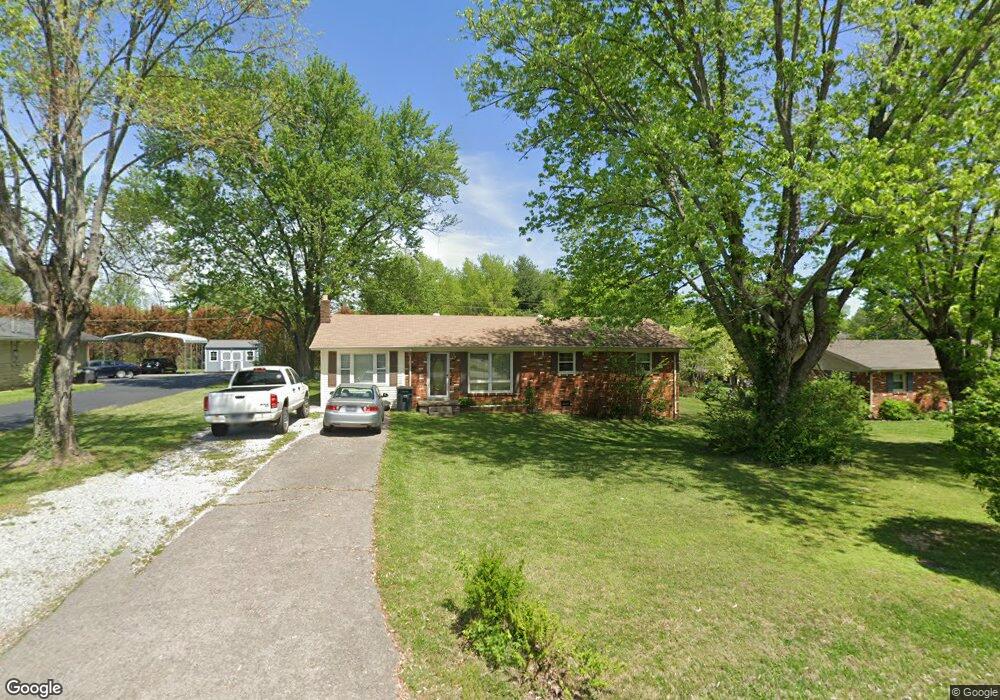
104 Mulberry Dr Lafayette, TN 37083
Estimated Value: $193,251 - $233,000
--
Bed
1
Bath
1,485
Sq Ft
$147/Sq Ft
Est. Value
About This Home
This home is located at 104 Mulberry Dr, Lafayette, TN 37083 and is currently estimated at $217,813, approximately $146 per square foot. 104 Mulberry Dr is a home located in Macon County with nearby schools including Macon Christian Academy.
Ownership History
Date
Name
Owned For
Owner Type
Purchase Details
Closed on
Nov 19, 2018
Sold by
Macon County
Bought by
Lazarou Dean and Ferrante Lazarou Mary
Current Estimated Value
Home Financials for this Owner
Home Financials are based on the most recent Mortgage that was taken out on this home.
Original Mortgage
$81,600
Outstanding Balance
$71,751
Interest Rate
4.8%
Mortgage Type
Purchase Money Mortgage
Estimated Equity
$146,062
Purchase Details
Closed on
Oct 6, 1961
Bought by
Johns Raymond and Johns Lourine
Create a Home Valuation Report for This Property
The Home Valuation Report is an in-depth analysis detailing your home's value as well as a comparison with similar homes in the area
Home Values in the Area
Average Home Value in this Area
Purchase History
| Date | Buyer | Sale Price | Title Company |
|---|---|---|---|
| Lazarou Dean | $96,000 | Benchmark Title Company | |
| Johns Raymond | -- | -- |
Source: Public Records
Mortgage History
| Date | Status | Borrower | Loan Amount |
|---|---|---|---|
| Open | Lazarou Dean | $81,600 |
Source: Public Records
Tax History Compared to Growth
Tax History
| Year | Tax Paid | Tax Assessment Tax Assessment Total Assessment is a certain percentage of the fair market value that is determined by local assessors to be the total taxable value of land and additions on the property. | Land | Improvement |
|---|---|---|---|---|
| 2024 | $664 | $41,775 | $4,125 | $37,650 |
| 2023 | $785 | $41,775 | $0 | $0 |
| 2022 | $664 | $21,100 | $2,625 | $18,475 |
| 2021 | $637 | $20,550 | $2,625 | $17,925 |
| 2020 | $637 | $20,550 | $2,625 | $17,925 |
| 2019 | $637 | $20,550 | $2,625 | $17,925 |
| 2018 | $589 | $20,550 | $2,625 | $17,925 |
| 2017 | $565 | $17,275 | $2,000 | $15,275 |
| 2016 | $545 | $17,275 | $2,000 | $15,275 |
| 2015 | $544 | $17,275 | $2,000 | $15,275 |
| 2014 | $544 | $17,270 | $0 | $0 |
Source: Public Records
Map
Nearby Homes
- 54 Ferguson Hill Rd
- 315 Ferguson Hill Rd
- 608 Days Rd
- 665 Ferguson Hill Rd
- 219 Rose St
- 213 Chamberlain Ave
- 0 Hartsville Rd
- 0 Wooten Ave
- 108 Young Ave
- 21 Highway 52 E
- 22 Highway 52 E
- 1 Highway 52 E
- 130 Mazie Dr
- 515 Greenwood Dr
- 306 Cassie Dr
- 625 Mag A Mor Dr
- 0 Days Rd
- 903 Days Rd
- 0 Short St Unit RTC2889648
- 519 Swanee St
- 102 Mulberry Dr
- 106 Mulberry Dr
- 100 Mulberry Dr
- 103 Mulberry Dr
- 101 Mulberry Dr
- 105 Mulberry Dr
- 96 Ferguson Hill Rd
- 108 Mulberry Dr Unit A
- 108 Mulberry Dr
- 812 Red Boiling Springs Rd
- 107 Mulberry Dr
- 116 Ferguson Hill Rd
- 110 Mulberry Dr
- 106 Cothron Dr
- 104 Cothron Dr
- 109 Mulberry Dr
- 108 Cothron Dr
- 900 Red Boiling Springs Rd
- 102 Cothron Dr
- 808 Red Boiling Springs Rd