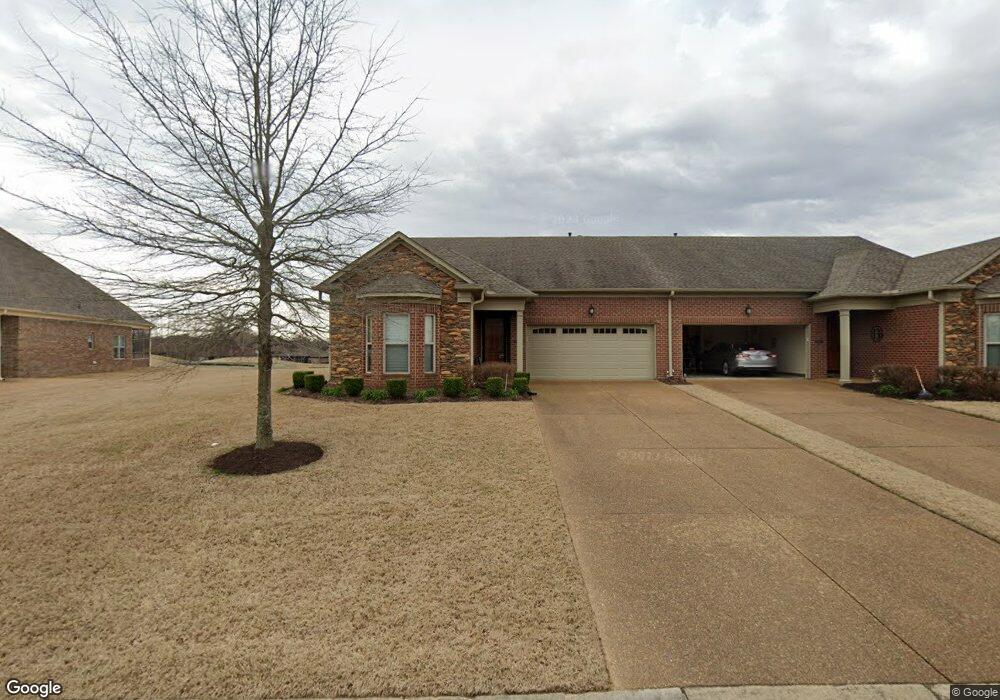
104 Saint Andrews Dr Oakland, TN 38060
Estimated Value: $291,000 - $325,000
3
Beds
2
Baths
1,599
Sq Ft
$192/Sq Ft
Est. Value
About This Home
This home is located at 104 Saint Andrews Dr, Oakland, TN 38060 and is currently estimated at $306,713, approximately $191 per square foot. 104 Saint Andrews Dr is a home located in Fayette County with nearby schools including Oakland Elementary School, West Junior High School, and Fayette Ware Comprehensive High School.
Ownership History
Date
Name
Owned For
Owner Type
Purchase Details
Closed on
Jul 18, 2019
Sold by
Patrick Patsy
Bought by
Stone William H and Stone Jane M
Current Estimated Value
Purchase Details
Closed on
Jun 12, 2017
Sold by
Conti Rober E
Bought by
Patrick Patsy
Purchase Details
Closed on
Aug 5, 2014
Sold by
Patton Howell Pamela
Bought by
Howell Pamela Patton Trustee
Purchase Details
Closed on
Mar 21, 2013
Sold by
Swan Development Grp Llc
Bought by
Howell Pamela Patton
Purchase Details
Closed on
Nov 16, 2011
Sold by
Swan Development Grp Llc
Bought by
Conti Robert E
Home Financials for this Owner
Home Financials are based on the most recent Mortgage that was taken out on this home.
Original Mortgage
$157,762
Interest Rate
4.17%
Mortgage Type
Commercial
Create a Home Valuation Report for This Property
The Home Valuation Report is an in-depth analysis detailing your home's value as well as a comparison with similar homes in the area
Home Values in the Area
Average Home Value in this Area
Purchase History
| Date | Buyer | Sale Price | Title Company |
|---|---|---|---|
| Stone William H | $229,900 | Delta Title Services Llc | |
| Patrick Patsy | $206,000 | None Available | |
| Howell Pamela Patton Trustee | -- | -- | |
| Howell Pamela Patton | $190,500 | -- | |
| Conti Robert E | $197,202 | -- |
Source: Public Records
Mortgage History
| Date | Status | Borrower | Loan Amount |
|---|---|---|---|
| Previous Owner | Conti Robert E | $157,762 |
Source: Public Records
Tax History Compared to Growth
Tax History
| Year | Tax Paid | Tax Assessment Tax Assessment Total Assessment is a certain percentage of the fair market value that is determined by local assessors to be the total taxable value of land and additions on the property. | Land | Improvement |
|---|---|---|---|---|
| 2024 | $1,422 | $55,025 | $10,000 | $45,025 |
| 2023 | $1,422 | $55,025 | $0 | $0 |
| 2022 | $943 | $55,025 | $10,000 | $45,025 |
| 2021 | $943 | $55,025 | $10,000 | $45,025 |
| 2020 | $767 | $55,025 | $10,000 | $45,025 |
| 2019 | $1,033 | $50,900 | $7,500 | $43,400 |
| 2018 | $1,056 | $50,900 | $7,500 | $43,400 |
| 2017 | $900 | $50,600 | $7,500 | $43,100 |
| 2016 | $880 | $46,225 | $5,625 | $40,600 |
| 2015 | $880 | $46,225 | $5,625 | $40,600 |
| 2014 | $880 | $46,225 | $5,625 | $40,600 |
Source: Public Records
Map
Nearby Homes
- 22 Doral Loop
- 175 Saint Andrews Dr
- 217 Saint Andrews Dr Unit 55-C
- 205 Saint Andrews Dr
- Callahan Plan at Fair Oaks - Villas at Fair Oaks
- Clark Plan at Fair Oaks - Villas at Fair Oaks
- Gibson Plan at Fair Oaks - Villas at Fair Oaks
- 290 Saint Andrews Dr
- 300 Saint Andrews Dr
- 325 Saint Andrews Dr
- 360 Saint Andrews Dr
- 235 Fairoaks Dr
- 15 Hughetta St
- 200 Hughetta St S
- 205 Hughetta St S
- 160 Aberdeen Dr
- 000 Hwy 64
- 65 Birkdale Dr
- 75 Fairoaks Dr
- 195 Hughetta St S
- 104 Saint Andrews Dr Unit 104E
- 102 Saint Andrews Dr
- 31 St Andrews Way
- 110 Saint Andrews Dr
- 95 St Andrews Way Unit 60-A1
- 95 St Andrews Way
- 95 Saint Andrews Dr
- 114 Saint Andrews Dr
- 95 St Andrews Dr Unit 95
- 72 Saint Andrews Dr
- 97 Saint Andrews Dr
- 49 Saint Andrews Dr
- 49 St Andrews Dr
- 127 Saint Andrews Dr
- 44 Saint Andrews Dr
- 20 Doral Loop
- 145 Saint Andrews Dr
- 145 St Andrews Way Unit 58-D
- 145 St Andrews Way
- 30 Doral Loop