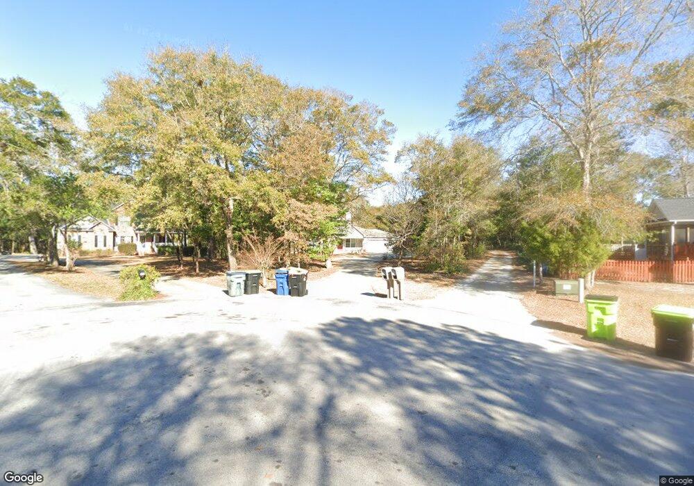
104 Shady Path Cedar Point, NC 28584
Estimated Value: $526,489 - $582,000
4
Beds
3
Baths
2,092
Sq Ft
$268/Sq Ft
Est. Value
About This Home
This home is located at 104 Shady Path, Cedar Point, NC 28584 and is currently estimated at $560,122, approximately $267 per square foot. 104 Shady Path is a home located in Carteret County with nearby schools including White Oak Elementary School, Broad Creek Middle School, and Croatan High School.
Ownership History
Date
Name
Owned For
Owner Type
Purchase Details
Closed on
Jan 16, 2012
Sold by
Mohorn Sterling Gary and Mohorn Llewellyn B
Bought by
Mohorn Sterling Gary and Mohorn Llewellyn B
Current Estimated Value
Purchase Details
Closed on
Jan 9, 2012
Sold by
Mohorn Sterling Gary and Mohorn Llewellyn B
Bought by
Collins Kimberly A and The Sterling Gary & Llewellyn B Mohorn I
Purchase Details
Closed on
Jun 28, 2011
Sold by
Wodey Richard Allen and Wodey Michele P
Bought by
Mohorn Sterling Gary
Purchase Details
Closed on
Jan 10, 2003
Purchase Details
Closed on
Jan 12, 2001
Create a Home Valuation Report for This Property
The Home Valuation Report is an in-depth analysis detailing your home's value as well as a comparison with similar homes in the area
Home Values in the Area
Average Home Value in this Area
Purchase History
| Date | Buyer | Sale Price | Title Company |
|---|---|---|---|
| Mohorn Sterling Gary | -- | None Available | |
| Collins Kimberly A | -- | None Available | |
| Mohorn Sterling Gary | $80,000 | None Available | |
| Mohorn Sterling Gary | $80,000 | None Available | |
| -- | $29,400 | -- | |
| -- | -- | -- |
Source: Public Records
Tax History
| Year | Tax Paid | Tax Assessment Tax Assessment Total Assessment is a certain percentage of the fair market value that is determined by local assessors to be the total taxable value of land and additions on the property. | Land | Improvement |
|---|---|---|---|---|
| 2025 | $2,396 | $519,424 | $167,570 | $351,854 |
| 2024 | $1,836 | $281,451 | $83,861 | $197,590 |
| 2023 | $1,753 | $281,451 | $83,861 | $197,590 |
| 2022 | $1,669 | $281,451 | $83,861 | $197,590 |
| 2021 | $1,669 | $281,451 | $83,861 | $197,590 |
| 2020 | $1,734 | $281,451 | $83,861 | $197,590 |
| 2019 | $1,504 | $261,281 | $55,683 | $205,598 |
| 2017 | $1,306 | $261,281 | $55,683 | $205,598 |
| 2016 | $1,306 | $261,281 | $55,683 | $205,598 |
| 2015 | $1,275 | $261,281 | $55,683 | $205,598 |
| 2014 | $1,470 | $306,460 | $99,418 | $207,042 |
Source: Public Records
Map
Nearby Homes
- 208 Shoreline Dr
- 110 Casey Ct
- 109 Sunburst Cir
- 129 Sunset Dr
- 100 Lighthouse Ln Unit D3
- 200 Lighthouse Ln Unit A1
- 300 Lighthouse Ln Unit A-1
- 0 State 24
- 105 Deerfield Ct
- 174 Jones St
- 100 Lookout Ridge
- 121 Fawn Creek Ct
- 107 Magens Way
- 202 Royal Oaks Ct
- 128 Little Bay Dr
- 650 Cedar Point Blvd Unit C31
- 650 Cedar Point Blvd Unit B25
- 201 Coastline Cir
- 1204 Cedar Point Blvd Unit 6
- 1204 Cedar Point Blvd Unit 73
- 102 Shady Path
- 106 Shady Path
- 206 Shoreline Dr
- 204 Shoreline Dr
- 108 Shady Path
- 110 Shady Path
- 202 Shoreline Dr
- 210 Shoreline Dr
- 200 Shoreline Dr
- 111 Shady Path
- 103 Shady Path
- 110 Shoreline Dr
- 212 Shoreline Dr
- 101 Sunburst Cir
- 100 Walston Dr
- 107 Shady Path
- 109 Shady Path
- 102 Sand Lot Curve
- 100 Casey Ct
- 102 Sandlot Curve
Your Personal Tour Guide
Ask me questions while you tour the home.
