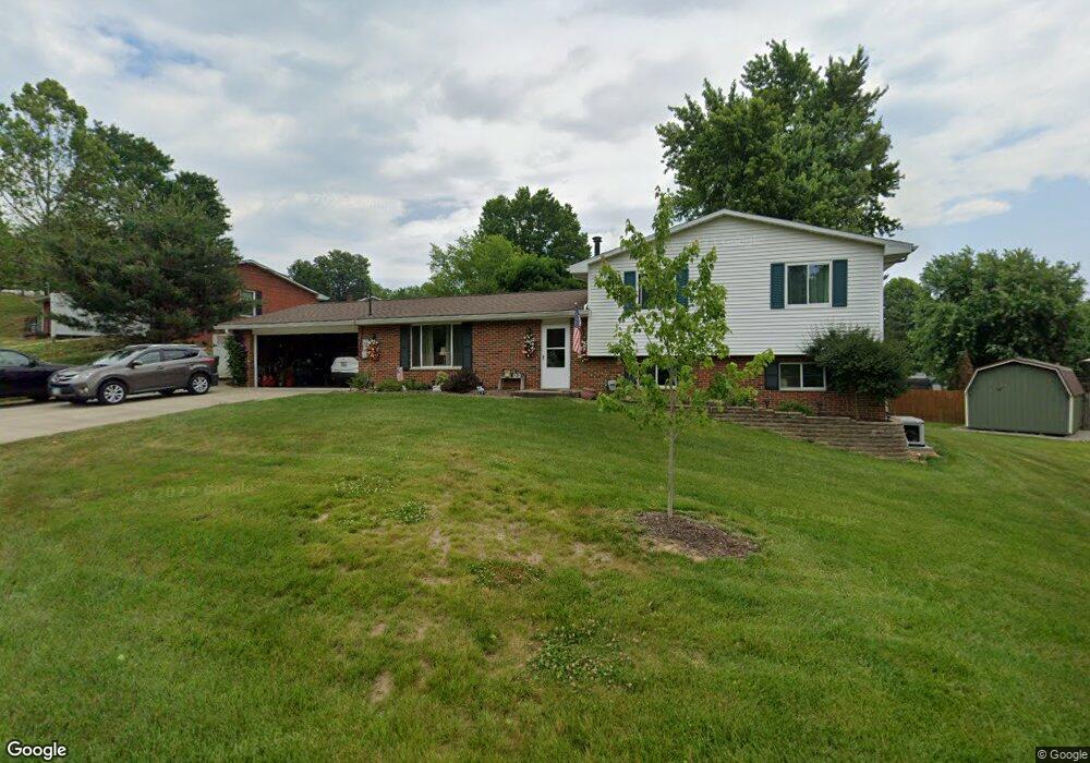
104 Skyvue Cir Marietta, OH 45750
Estimated Value: $269,000 - $302,000
3
Beds
3
Baths
1,854
Sq Ft
$152/Sq Ft
Est. Value
About This Home
This home is located at 104 Skyvue Cir, Marietta, OH 45750 and is currently estimated at $282,217, approximately $152 per square foot. 104 Skyvue Cir is a home located in Washington County with nearby schools including Marietta High School.
Ownership History
Date
Name
Owned For
Owner Type
Purchase Details
Closed on
Aug 21, 2006
Sold by
Stanforth William Kirby and Stanforth Angela P
Bought by
Forbes G Randall and Forbes Melissa S
Current Estimated Value
Home Financials for this Owner
Home Financials are based on the most recent Mortgage that was taken out on this home.
Original Mortgage
$110,400
Outstanding Balance
$8,982
Interest Rate
6.83%
Mortgage Type
Purchase Money Mortgage
Estimated Equity
$273,235
Purchase Details
Closed on
Aug 17, 2006
Sold by
Estate Of Mary A Teer
Bought by
Teer Walter F
Home Financials for this Owner
Home Financials are based on the most recent Mortgage that was taken out on this home.
Original Mortgage
$110,400
Outstanding Balance
$8,982
Interest Rate
6.83%
Mortgage Type
Purchase Money Mortgage
Estimated Equity
$273,235
Purchase Details
Closed on
Jun 19, 2001
Bought by
Stanforth William Kirky
Purchase Details
Closed on
Mar 28, 1994
Purchase Details
Closed on
Feb 16, 1994
Create a Home Valuation Report for This Property
The Home Valuation Report is an in-depth analysis detailing your home's value as well as a comparison with similar homes in the area
Home Values in the Area
Average Home Value in this Area
Purchase History
| Date | Buyer | Sale Price | Title Company |
|---|---|---|---|
| Forbes G Randall | $138,000 | None Available | |
| Teer Walter F | -- | Title First Marietta | |
| Stanforth William Kirky | $120,000 | -- | |
| -- | $79,000 | -- | |
| -- | -- | -- |
Source: Public Records
Mortgage History
| Date | Status | Borrower | Loan Amount |
|---|---|---|---|
| Open | Forbes G Randall | $110,400 |
Source: Public Records
Tax History Compared to Growth
Tax History
| Year | Tax Paid | Tax Assessment Tax Assessment Total Assessment is a certain percentage of the fair market value that is determined by local assessors to be the total taxable value of land and additions on the property. | Land | Improvement |
|---|---|---|---|---|
| 2024 | $2,758 | $77,790 | $7,250 | $70,540 |
| 2023 | $2,758 | $77,790 | $7,250 | $70,540 |
| 2022 | $2,732 | $77,790 | $7,250 | $70,540 |
| 2021 | $2,308 | $61,540 | $7,360 | $54,180 |
| 2020 | $2,320 | $61,540 | $7,360 | $54,180 |
| 2019 | $2,315 | $61,540 | $7,360 | $54,180 |
| 2018 | $2,260 | $58,140 | $6,400 | $51,740 |
| 2017 | $2,254 | $58,140 | $6,400 | $51,740 |
| 2016 | $3,940 | $58,140 | $6,400 | $51,740 |
| 2015 | $2,135 | $52,380 | $6,520 | $45,860 |
| 2014 | $3,514 | $51,770 | $6,520 | $45,250 |
| 2013 | $2,277 | $51,770 | $6,520 | $45,250 |
Source: Public Records
Map
Nearby Homes
- 149 Rauch Dr
- 902 Pike St
- 169 Morris Loop Rd
- 1585 County Road 9
- 145 Cornerstone Dr
- 904 Pike St
- 470 & 480 County House Ln
- 470 County House Ln
- 106 Briargate Dr
- 133 Brant Dr
- 1615 Browns Rd
- 102 Morningside Dr
- 19 Sherman Dr
- 939 Pike St
- 27345 State Route 7
- 122 Buells Cir
- 3205 Ohio 26
- 303 1/2 Ingleside Ave
- 150 Wells Ave
- 161 Woodland Ave