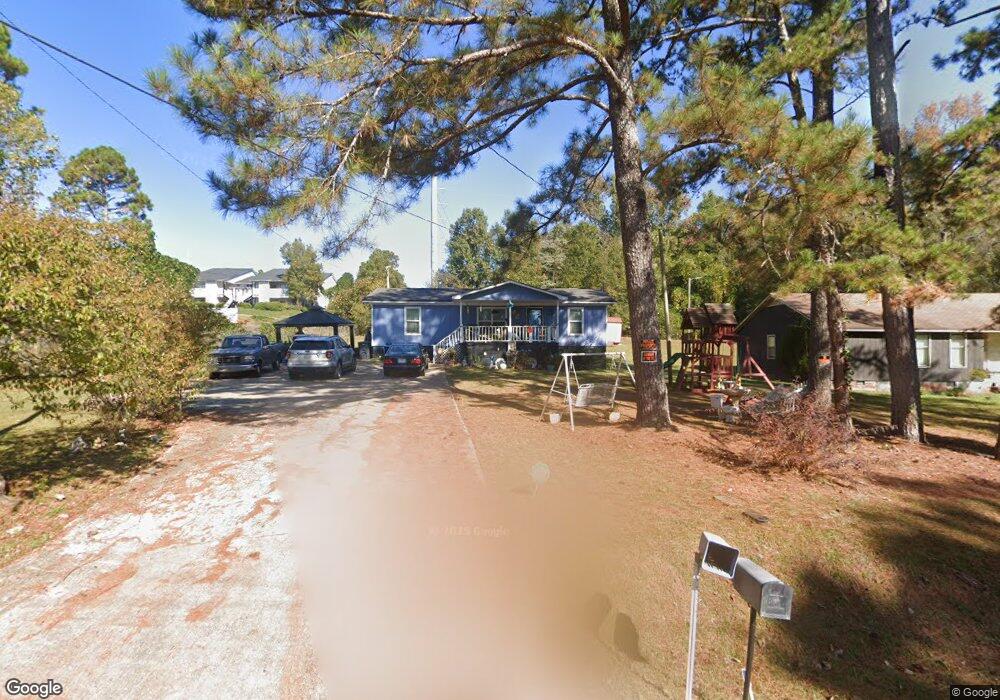
104 Swanson Dr Lagrange, GA 30240
Estimated Value: $134,822 - $201,000
3
Beds
2
Baths
1,128
Sq Ft
$150/Sq Ft
Est. Value
About This Home
This home is located at 104 Swanson Dr, Lagrange, GA 30240 and is currently estimated at $168,706, approximately $149 per square foot. 104 Swanson Dr is a home located in Troup County with nearby schools including Ethel W. Kight Elementary School, Hollis Hand Elementary School, and Franklin Forest Elementary School.
Ownership History
Date
Name
Owned For
Owner Type
Purchase Details
Closed on
Jun 5, 2012
Sold by
Mallory Mtg Trust
Bought by
Dowell Terrance
Current Estimated Value
Purchase Details
Closed on
Oct 13, 2009
Sold by
Malloy Mtg
Bought by
Malloy Mtg
Purchase Details
Closed on
Jun 1, 1993
Sold by
Thomas Discount Co
Bought by
Willie H Williams
Purchase Details
Closed on
May 14, 1993
Sold by
Annie Garrison
Bought by
Thomas Discount Co
Purchase Details
Closed on
Jun 10, 1988
Bought by
Annie Garrison
Purchase Details
Closed on
Jan 1, 1988
Purchase Details
Closed on
Jun 7, 1983
Purchase Details
Closed on
Dec 28, 1979
Purchase Details
Closed on
Oct 26, 1978
Purchase Details
Closed on
Sep 25, 1978
Purchase Details
Closed on
Jan 1, 1970
Create a Home Valuation Report for This Property
The Home Valuation Report is an in-depth analysis detailing your home's value as well as a comparison with similar homes in the area
Home Values in the Area
Average Home Value in this Area
Purchase History
| Date | Buyer | Sale Price | Title Company |
|---|---|---|---|
| Dowell Terrance | -- | -- | |
| Malloy Mtg | -- | -- | |
| Malloy Mtg | -- | -- | |
| Willie H Williams | $45,300 | -- | |
| Thomas Discount Co | -- | -- | |
| Annie Garrison | $34,000 | -- | |
| -- | -- | -- | |
| -- | -- | -- | |
| -- | -- | -- | |
| -- | -- | -- | |
| -- | -- | -- | |
| -- | -- | -- |
Source: Public Records
Tax History Compared to Growth
Tax History
| Year | Tax Paid | Tax Assessment Tax Assessment Total Assessment is a certain percentage of the fair market value that is determined by local assessors to be the total taxable value of land and additions on the property. | Land | Improvement |
|---|---|---|---|---|
| 2024 | $635 | $33,240 | $3,240 | $30,000 |
| 2023 | $35 | $29,120 | $3,240 | $25,880 |
| 2022 | $499 | $27,840 | $3,240 | $24,600 |
| 2021 | $492 | $26,252 | $3,240 | $23,012 |
| 2020 | $492 | $26,252 | $3,240 | $23,012 |
| 2019 | $486 | $26,052 | $3,240 | $22,812 |
| 2018 | $423 | $23,972 | $3,240 | $20,732 |
| 2017 | $423 | $23,972 | $3,240 | $20,732 |
| 2016 | $192 | $16,272 | $3,256 | $13,016 |
| 2015 | $194 | $16,272 | $3,256 | $13,016 |
| 2014 | $492 | $16,272 | $3,256 | $13,016 |
| 2013 | -- | $16,272 | $3,256 | $13,016 |
Source: Public Records
Map
Nearby Homes
- 101 Crown St Unit LOT 5
- 102 Crown St Unit LOT 1
- The Rhodes Plan at Crown Street Cottages
- The Truitt Plan at Crown Street Cottages
- The Callaway Plan at Crown Street Cottages
- 802 Monroe St
- 0 Unit 10514554
- 167 S Kight Dr
- 141 Avery Dr
- 205 Grady St
- 608 Wilburn Ave
- 610 Wilburn Ave
- 119 Jones St
- 107 Clark St
- 212 Aster Way
- 202 Parker Ln
- 211 Moores Hill
- 0 Moores Hill
- 102 Parker St
- 109 Garfield St
- 96 Swanson Dr
- 103 Swanson Dr
- 86 Swanson Dr
- 78 Swanson Dr
- 79 Swanson Dr
- 56 Swanson Dr
- 55 Swanson Dr
- 46 Swanson Dr
- 39 Swanson Dr
- 119 Old Airport Rd
- 112 Gordon Commercial Dr
- 137 Parker Place
- 125 Parker Place
- 100 Gordon Commercial Dr
- 29 Swanson Dr
- 106 Old Airport Rd
- 104 Old Airport Rd
- 98 Gordon Commercial Dr
- 102 Old Airport Rd
- 4783 Hammett Rd