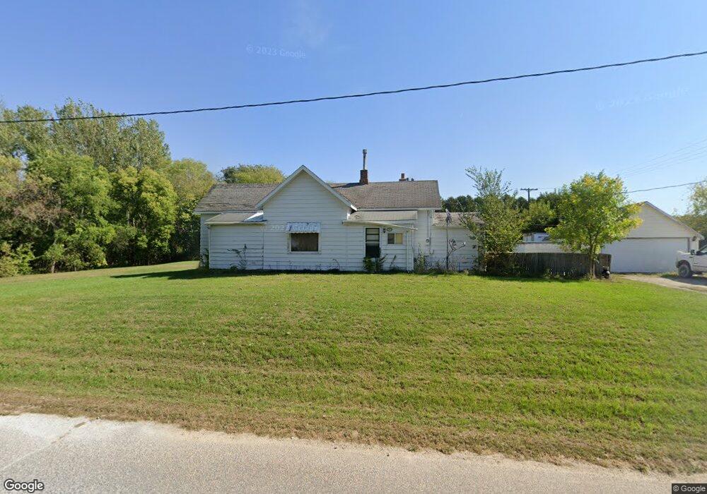
104 West St Brandon, IA 52210
Estimated Value: $87,040 - $226,000
2
Beds
1
Bath
770
Sq Ft
$181/Sq Ft
Est. Value
About This Home
This home is located at 104 West St, Brandon, IA 52210 and is currently estimated at $139,510, approximately $181 per square foot. 104 West St is a home located in Buchanan County with nearby schools including West Elementary School, East Elementary School, and Independence Junior/Senior High School.
Ownership History
Date
Name
Owned For
Owner Type
Purchase Details
Closed on
Sep 29, 2011
Sold by
Erger Michelle R
Bought by
Erger Donald D
Current Estimated Value
Purchase Details
Closed on
Apr 12, 2010
Sold by
Boyer Farms Inc
Bought by
Erger Donald E and Erger Michelle R
Home Financials for this Owner
Home Financials are based on the most recent Mortgage that was taken out on this home.
Original Mortgage
$56,800
Interest Rate
5.01%
Mortgage Type
Purchase Money Mortgage
Create a Home Valuation Report for This Property
The Home Valuation Report is an in-depth analysis detailing your home's value as well as a comparison with similar homes in the area
Home Values in the Area
Average Home Value in this Area
Purchase History
| Date | Buyer | Sale Price | Title Company |
|---|---|---|---|
| Erger Donald D | -- | None Available | |
| Erger Donald E | $65,000 | None Available |
Source: Public Records
Mortgage History
| Date | Status | Borrower | Loan Amount |
|---|---|---|---|
| Closed | Erger Donald E | $56,800 |
Source: Public Records
Tax History Compared to Growth
Tax History
| Year | Tax Paid | Tax Assessment Tax Assessment Total Assessment is a certain percentage of the fair market value that is determined by local assessors to be the total taxable value of land and additions on the property. | Land | Improvement |
|---|---|---|---|---|
| 2025 | $1,078 | $75,350 | $10,810 | $64,540 |
| 2024 | $1,078 | $64,130 | $9,650 | $54,480 |
| 2023 | $982 | $64,130 | $9,650 | $54,480 |
| 2022 | $892 | $50,510 | $7,660 | $42,850 |
| 2021 | $896 | $50,510 | $7,660 | $42,850 |
| 2020 | $896 | $46,930 | $6,960 | $39,970 |
| 2019 | $908 | $46,930 | $6,960 | $39,970 |
| 2018 | $876 | $45,490 | $6,960 | $38,530 |
| 2017 | $946 | $45,490 | $6,960 | $38,530 |
| 2016 | $926 | $47,730 | $4,970 | $42,760 |
| 2015 | $926 | $47,730 | $4,970 | $42,760 |
| 2014 | $948 | $47,730 | $4,970 | $42,760 |
Source: Public Records
Map
Nearby Homes
- 705 South St
- 0 25th Ave
- 0 Tbd 325th St
- 2831 52nd St
- 54th St
- TBD 54th St
- 215 Traer St
- 302 Lewis St
- 306 2nd St
- 0 Garling Rd
- PARCEL "A" LOCA 55th St
- 5454 22nd Ave Unit 65 & 66
- 5454 22nd Ave Unit Lot 24
- 2492 55th St
- Na
- 00 Garling Rd
- 13518 King Rd
- 0 31st Ave
- 0 51st St Ln Unit 2508608
- 5589 22nd Avenue Trail