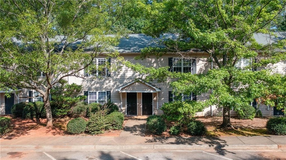
104 Westchester Cir Unit 4 Athens, GA 30606
Estimated payment $1,284/month
Highlights
- Open-Concept Dining Room
- View of Trees or Woods
- Walk-In Closet
- Clarke Central High School Rated A-
- White Kitchen Cabinets
- Patio
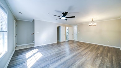
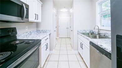
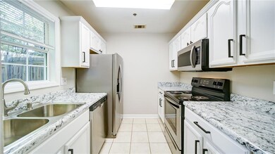
About This Home
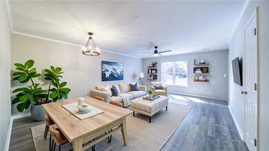
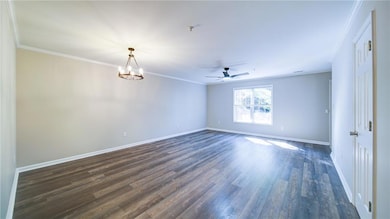
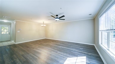
Welcome to low-maintenance living on Athens' growing Westside! This 3-bedroom, 2.5-bathroom condo in Plantation West offers a smart investment opportunity or a perfect future home in one of the city's most rapidly developing corridors. Fresh paint, updated light fixtures, and a freshly-updated kitchen! Enjoy a roommate-friendly layout with all bedrooms upstairs, a spacious great room, and a convenient laundry closet. The kitchen also comes equipped with stainless steel appliances. Assigned parking, a privacy fence, and public utilities make everyday living easy. Located just minutes from both Jefferson and Atlanta Highway Publix locations, you're close to shopping, dining, and hotspots like The Oglethorpe Garage. Schedule your showing today—don't miss your chance to own a solid piece of West Athens real estate!
Listing Agent
Keller Williams Realty Community Partners License #444371 Listed on: 07/10/2025

Townhouse Details
Home Type
- Townhome
Est. Annual Taxes
- $2,423
Year Built
- Built in 2002
Lot Details
- 436 Sq Ft Lot
- Two or More Common Walls
- Landscaped
- Back Yard Fenced
HOA Fees
- $110 Monthly HOA Fees
Home Design
- Slab Foundation
- Shingle Roof
- Composition Roof
- Vinyl Siding
Interior Spaces
- 1,200 Sq Ft Home
- 2-Story Property
- Roommate Plan
- Ceiling Fan
- Open-Concept Dining Room
- Views of Woods
Kitchen
- Self-Cleaning Oven
- Electric Range
- Microwave
- Dishwasher
- Laminate Countertops
- White Kitchen Cabinets
Flooring
- Carpet
- Tile
- Vinyl
Bedrooms and Bathrooms
- 3 Bedrooms
- Walk-In Closet
- Shower Only
Laundry
- Laundry Room
- Laundry on main level
Home Security
Parking
- 2 Parking Spaces
- Parking Lot
- Assigned Parking
Outdoor Features
- Patio
- Rain Gutters
Schools
- Oglethorpe Avenue Elementary School
- Burney-Harris-Lyons Middle School
- Clarke Central High School
Utilities
- Central Heating and Cooling System
- Underground Utilities
- 110 Volts
- Electric Water Heater
- High Speed Internet
- Phone Available
- Cable TV Available
Listing and Financial Details
- Assessor Parcel Number 072D5 A004
Community Details
Overview
- 6 Units
- Plantation West Subdivision
Security
- Fire and Smoke Detector
- Fire Sprinkler System
Map
Home Values in the Area
Average Home Value in this Area
Tax History
| Year | Tax Paid | Tax Assessment Tax Assessment Total Assessment is a certain percentage of the fair market value that is determined by local assessors to be the total taxable value of land and additions on the property. | Land | Improvement |
|---|---|---|---|---|
| 2025 | $2,493 | $80,276 | $8,000 | $72,276 |
| 2024 | $2,493 | $77,530 | $8,000 | $69,530 |
| 2023 | $2,423 | $72,926 | $8,000 | $64,926 |
| 2022 | $1,376 | $43,127 | $8,000 | $35,127 |
| 2021 | $1,339 | $39,719 | $8,000 | $31,719 |
| 2020 | $1,240 | $36,808 | $8,000 | $28,808 |
| 2019 | $1,013 | $29,824 | $6,400 | $23,424 |
| 2018 | $373 | $20,979 | $4,000 | $16,979 |
| 2017 | $340 | $20,002 | $4,000 | $16,002 |
| 2016 | $169 | $14,964 | $4,000 | $10,964 |
| 2015 | $167 | $14,913 | $4,000 | $10,913 |
| 2014 | $203 | $15,926 | $4,000 | $11,926 |
Property History
| Date | Event | Price | List to Sale | Price per Sq Ft |
|---|---|---|---|---|
| 12/03/2025 12/03/25 | Price Changed | $185,000 | 0.0% | $154 / Sq Ft |
| 10/28/2025 10/28/25 | For Rent | $1,800 | 0.0% | -- |
| 10/22/2025 10/22/25 | Price Changed | $195,000 | -2.5% | $163 / Sq Ft |
| 09/18/2025 09/18/25 | Price Changed | $200,000 | -2.4% | $167 / Sq Ft |
| 09/08/2025 09/08/25 | Price Changed | $205,000 | -2.4% | $171 / Sq Ft |
| 07/10/2025 07/10/25 | For Sale | $210,000 | -- | $175 / Sq Ft |
Purchase History
| Date | Type | Sale Price | Title Company |
|---|---|---|---|
| Deed | $29,900 | -- | |
| Deed | $50,400 | -- | |
| Deed | $92,300 | -- |
Mortgage History
| Date | Status | Loan Amount | Loan Type |
|---|---|---|---|
| Previous Owner | $87,685 | New Conventional |
Source: First Multiple Listing Service (FMLS)
MLS Number: 7613532
APN: 072D5-A-004
![]() Listings identified with the FMLS IDX logo come from FMLS and are held by brokerage firms other than the owner of this website. The listing brokerage is identified in any listing details. Information is deemed reliable but is not guaranteed. If you believe any FMLS listing contains material that infringes your copyrighted work please visit www.fmls.com/dmca to review our DMCA policy and learn how to submit a takedown request. © 2025 First Multiple Listing Service, Inc.
Listings identified with the FMLS IDX logo come from FMLS and are held by brokerage firms other than the owner of this website. The listing brokerage is identified in any listing details. Information is deemed reliable but is not guaranteed. If you believe any FMLS listing contains material that infringes your copyrighted work please visit www.fmls.com/dmca to review our DMCA policy and learn how to submit a takedown request. © 2025 First Multiple Listing Service, Inc.
Disclaimer: Certain information contained herein is derived from information provided by parties other than Homes.com. All information provided is deemed reliable, but is not guaranteed to be accurate and should be independently verified.
- 130 Cole Manor Dr
- 110 Chalfont Dr Unit 6
- 100 Chalfont Dr Unit C
- 100 Chalfont Dr Unit E
- 275 Westchester Cir
- 205 Westchester Dr
- 1 Hanover Place
- 600 Mitchell Bridge Rd Unit 15
- 180 Chalfont Ln Unit 6
- 180 Sherwood Dr
- 340 Sarah Dr
- 888 Horizon Blvd
- 700 Mitchell Bridge Rd
- 417 Carrie Ct
- 185 Landor Dr
- 161 Pinecrest Terrace
- 970 Oglethorpe Ave
- 355 The Preserve Dr
- 955 Oglethorpe Ave
- 150 Chateau Terrace