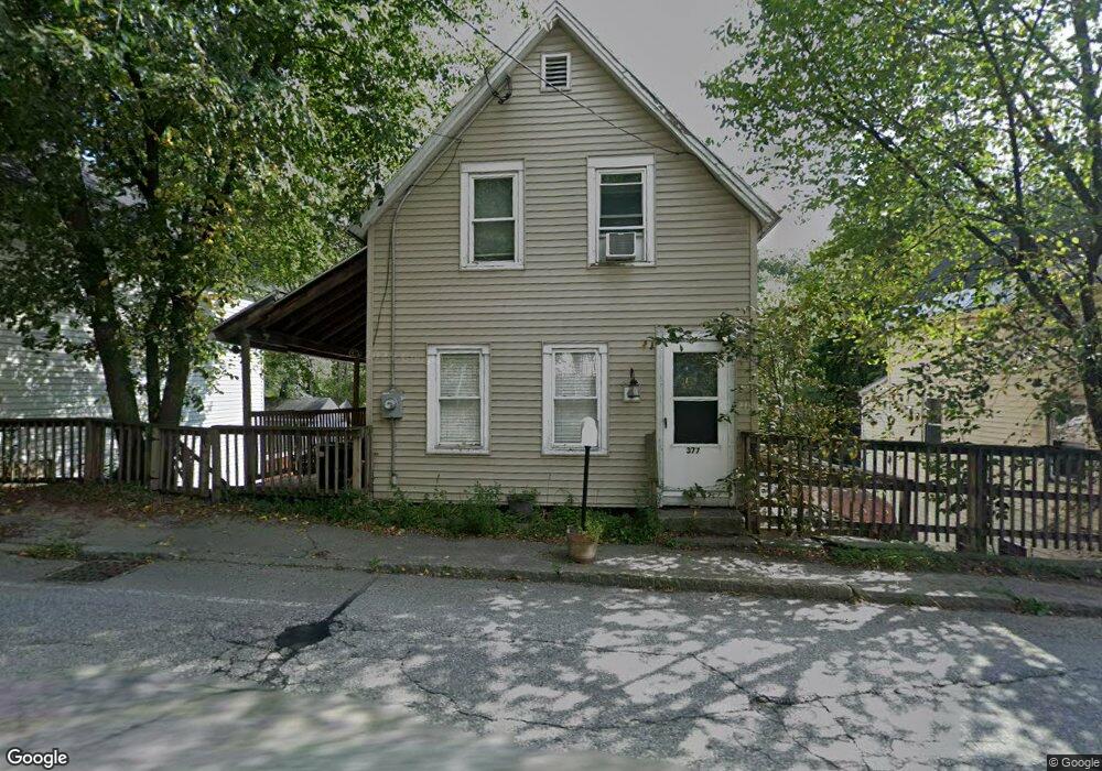
104 Wilton Rd Wilton, NH 03086
Estimated Value: $293,326 - $317,000
2
Beds
1
Bath
756
Sq Ft
$407/Sq Ft
Est. Value
About This Home
This home is located at 104 Wilton Rd, Wilton, NH 03086 and is currently estimated at $307,582, approximately $406 per square foot. 104 Wilton Rd is a home with nearby schools including Jacques Memorial Elementary School, Heron Pond Elementary School, and Milford Middle School.
Ownership History
Date
Name
Owned For
Owner Type
Purchase Details
Closed on
May 29, 1998
Sold by
Madsen Angelena
Bought by
Lesiuk Michael J
Current Estimated Value
Home Financials for this Owner
Home Financials are based on the most recent Mortgage that was taken out on this home.
Original Mortgage
$51,973
Interest Rate
7.12%
Mortgage Type
Purchase Money Mortgage
Create a Home Valuation Report for This Property
The Home Valuation Report is an in-depth analysis detailing your home's value as well as a comparison with similar homes in the area
Home Values in the Area
Average Home Value in this Area
Purchase History
| Date | Buyer | Sale Price | Title Company |
|---|---|---|---|
| Lesiuk Michael J | $52,000 | -- |
Source: Public Records
Mortgage History
| Date | Status | Borrower | Loan Amount |
|---|---|---|---|
| Open | Lesiuk Michael J | $73,834 | |
| Closed | Lesiuk Michael J | $51,973 |
Source: Public Records
Tax History Compared to Growth
Tax History
| Year | Tax Paid | Tax Assessment Tax Assessment Total Assessment is a certain percentage of the fair market value that is determined by local assessors to be the total taxable value of land and additions on the property. | Land | Improvement |
|---|---|---|---|---|
| 2024 | $3,981 | $168,200 | $78,000 | $90,200 |
| 2023 | $3,729 | $168,200 | $78,000 | $90,200 |
| 2022 | $3,497 | $168,200 | $78,000 | $90,200 |
| 2021 | $3,540 | $175,700 | $85,500 | $90,200 |
| 2020 | $0 | $160,300 | $64,100 | $96,200 |
| 2019 | $4,163 | $160,300 | $64,100 | $96,200 |
| 2018 | $4,159 | $142,300 | $64,100 | $78,200 |
| 2017 | $6,725 | $142,300 | $64,100 | $78,200 |
| 2016 | $6,458 | $142,300 | $64,100 | $78,200 |
| 2015 | $3,750 | $131,300 | $67,500 | $63,800 |
| 2014 | $3,584 | $131,300 | $67,500 | $63,800 |
| 2013 | $3,541 | $131,300 | $67,500 | $63,800 |
Source: Public Records
Map
Nearby Homes
- 134 Falcon Ridge Rd Unit 23
- 8 Maple St
- F-88-7 Aria Hill Dr
- F-88-12 Aria Hill Dr
- F-88-11 Aria Hill Dr
- F-88-10 Aria Hill Dr
- Lot F-88-9 Aria Hill Dr
- 25 Burns Hill Rd
- 44 Burns Hill Rd
- 30 Robbins Rd
- 18 Richfield Way
- 415 Savage Rd
- F/88-5 McGettigan Rd
- F/88-4 McGettigan Rd
- 344 Elm St Unit 14
- 344 Elm St Unit 16
- 294 Mason Rd
- 43 Boxwood Cir
- Lots 4 & 7 Gibbons & Robbins Rd
- 32 Larch Rd