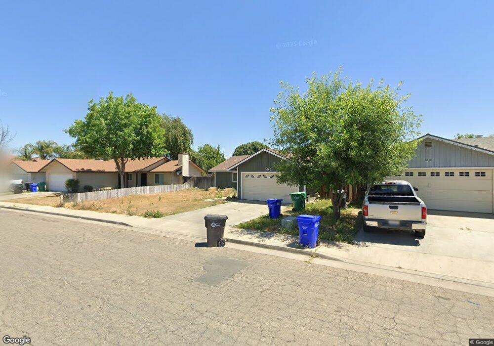
1040 Birch Dr Porterville, CA 93257
Porterville Northwest NeighborhoodEstimated Value: $287,763 - $330,000
3
Beds
3
Baths
1,140
Sq Ft
$277/Sq Ft
Est. Value
About This Home
This home is located at 1040 Birch Dr, Porterville, CA 93257 and is currently estimated at $315,441, approximately $276 per square foot. 1040 Birch Dr is a home located in Tulare County with nearby schools including Oak Grove Elementary School, Burton Middle School, and Monache High School.
Ownership History
Date
Name
Owned For
Owner Type
Purchase Details
Closed on
Mar 1, 2019
Sold by
Sharpe Street Sherry Ann
Bought by
Sharpe Street Sherry Ann and Sharpe Robert Allen
Current Estimated Value
Purchase Details
Closed on
Sep 21, 2012
Sold by
Sharpe Volna Marie
Bought by
The Nola V Brown Irrevocable A Trust
Purchase Details
Closed on
Sep 13, 1993
Sold by
Brown Robert A and Brown Nola V
Bought by
The Brown Living Trust
Create a Home Valuation Report for This Property
The Home Valuation Report is an in-depth analysis detailing your home's value as well as a comparison with similar homes in the area
Home Values in the Area
Average Home Value in this Area
Purchase History
| Date | Buyer | Sale Price | Title Company |
|---|---|---|---|
| Sharpe Street Sherry Ann | -- | None Available | |
| The Nola V Brown Irrevocable A Trust | -- | None Available | |
| The Brown Living Trust | -- | -- |
Source: Public Records
Tax History Compared to Growth
Tax History
| Year | Tax Paid | Tax Assessment Tax Assessment Total Assessment is a certain percentage of the fair market value that is determined by local assessors to be the total taxable value of land and additions on the property. | Land | Improvement |
|---|---|---|---|---|
| 2025 | $1,076 | $102,402 | $30,621 | $71,781 |
| 2024 | $1,076 | $100,395 | $30,021 | $70,374 |
| 2023 | $1,037 | $98,428 | $29,433 | $68,995 |
| 2022 | $1,018 | $96,499 | $28,856 | $67,643 |
| 2021 | $1,021 | $94,607 | $28,290 | $66,317 |
| 2020 | $1,003 | $93,637 | $28,000 | $65,637 |
| 2019 | $1,002 | $91,801 | $27,451 | $64,350 |
| 2018 | $958 | $90,001 | $26,913 | $63,088 |
| 2017 | $942 | $88,236 | $26,385 | $61,851 |
| 2016 | $898 | $86,506 | $25,868 | $60,638 |
| 2015 | $866 | $85,206 | $25,479 | $59,727 |
| 2014 | $866 | $83,537 | $24,980 | $58,557 |
Source: Public Records
Map
Nearby Homes
- 1041 Greenfield Dr
- 1681 W Wall Ln
- 1691 Terry Ct
- 1750 W Terry Cir
- 1644 Mccomb Ave
- 1121 N Lindale Way
- 1076 N Beverly St
- 1857 W Westfield Ave
- 1245 Atkins St
- 1926 W Nancy Ave
- 1045 N Westside St
- 1370 Lindale Place
- 0 Pioneer Ave Unit 233651
- 1690 Memory Ln
- 1730 W Grand Ave
- 1450 W Brian Ln
- 595 N Salisbury St
- 1555 Verdugo Place
- 700 N Prospect St
- 2164 W San Lucia Ct
- 1030 Birch Dr
- 1030 Birch Dr
- 1050 Birch Dr
- 1060 Birch Dr
- 1031 Greenfield Dr
- 1051 Greenfield Dr
- 1051 Birch Dr
- 1051 Birch Dr
- 1031 Birch Dr
- 1031 Birch Dr
- 1070 Birch Dr
- 1651 W Sandra Ave
- 1061 Greenfield Dr
- 1661 Sandra Ave
- 1061 Birch Dr
- 1651 Sandra Ave
- 1641 Sandra Ave
- 1671 Sandra Ave
- 1071 Birch Dr
- 1071 Greenfield Dr