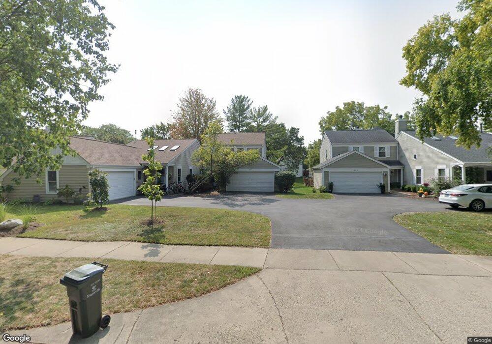
1040 Devonshire Ave Naperville, IL 60540
Green Acres NeighborhoodEstimated Value: $416,000 - $437,000
3
Beds
1
Bath
1,450
Sq Ft
$295/Sq Ft
Est. Value
About This Home
This home is located at 1040 Devonshire Ave, Naperville, IL 60540 and is currently estimated at $427,676, approximately $294 per square foot. 1040 Devonshire Ave is a home located in DuPage County with nearby schools including Elmwood Elementary School, Lincoln Jr. High School, and Naperville Central High School.
Ownership History
Date
Name
Owned For
Owner Type
Purchase Details
Closed on
Nov 9, 2001
Sold by
Dorsey Keith D
Bought by
Brahill Michael J
Current Estimated Value
Purchase Details
Closed on
Oct 22, 1999
Sold by
Alfinito John P and Alfinito Brenda C
Bought by
Dorsey Keith D
Home Financials for this Owner
Home Financials are based on the most recent Mortgage that was taken out on this home.
Original Mortgage
$168,865
Interest Rate
7.78%
Mortgage Type
FHA
Create a Home Valuation Report for This Property
The Home Valuation Report is an in-depth analysis detailing your home's value as well as a comparison with similar homes in the area
Home Values in the Area
Average Home Value in this Area
Purchase History
| Date | Buyer | Sale Price | Title Company |
|---|---|---|---|
| Brahill Michael J | $206,000 | Chicago Title Insurance Co | |
| Dorsey Keith D | $170,000 | -- |
Source: Public Records
Mortgage History
| Date | Status | Borrower | Loan Amount |
|---|---|---|---|
| Previous Owner | Dorsey Keith D | $168,865 |
Source: Public Records
Tax History
| Year | Tax Paid | Tax Assessment Tax Assessment Total Assessment is a certain percentage of the fair market value that is determined by local assessors to be the total taxable value of land and additions on the property. | Land | Improvement |
|---|---|---|---|---|
| 2024 | $4,074 | $118,825 | $41,556 | $77,269 |
| 2023 | $4,310 | $106,770 | $37,340 | $69,430 |
| 2022 | $4,615 | $105,300 | $36,570 | $68,730 |
| 2021 | $4,624 | $101,540 | $35,260 | $66,280 |
| 2020 | $4,609 | $101,540 | $35,260 | $66,280 |
| 2019 | $4,682 | $96,580 | $33,540 | $63,040 |
| 2018 | $5,100 | $88,910 | $30,660 | $58,250 |
| 2017 | $4,977 | $85,890 | $29,620 | $56,270 |
| 2016 | $4,836 | $82,430 | $28,430 | $54,000 |
| 2015 | $5,171 | $78,260 | $26,990 | $51,270 |
| 2014 | $5,161 | $75,920 | $26,000 | $49,920 |
| 2013 | $4,763 | $76,450 | $26,180 | $50,270 |
Source: Public Records
Map
Nearby Homes
- 1095 Devonshire Ave
- 7S146 Wild Cherry Rd
- 417 River Bluff Cir
- 1210 Lawnmeadow Ln
- 7S410 Arbor Dr
- 611 Clover Ct
- 511 Aurora Ave Unit 606
- 509 Aurora Ave Unit 616
- 1099 W Jefferson Ave
- 332 S River Rd
- 610 W Jefferson Ave
- 731 S River Rd
- 1161 Banyon Ct
- 1112 Candlenut Dr
- 816 S River Rd
- 411 W Jefferson Ave
- 840 Mobile Ct
- 854 Raintree Dr
- 216 S Whispering Hills Dr
- 1336 Chestnut Ridge Dr
- 1044 Devonshire Ave
- 1036 Devonshire Ave
- 1048 Devonshire Ave
- 1032 Devonshire Ave
- 1052 Devonshire Ave
- 1028 Devonshire Ave
- 1024 Devonshire Ave
- 1013 Oswego Rd
- 1019 Oswego Rd
- 1060 Devonshire Ave
- 1007 Oswego Rd
- 1041 Devonshire Ave Unit 2
- 1031 Oswego Rd Unit 1
- 1045 Devonshire Ave
- 1037 Devonshire Ave
- 1037 Oswego Rd
- 1049 Devonshire Ave
- 1043 Oswego Rd Unit 1
- 1064 Devonshire Ave
- 1033 Devonshire Ave Unit 2
Your Personal Tour Guide
Ask me questions while you tour the home.