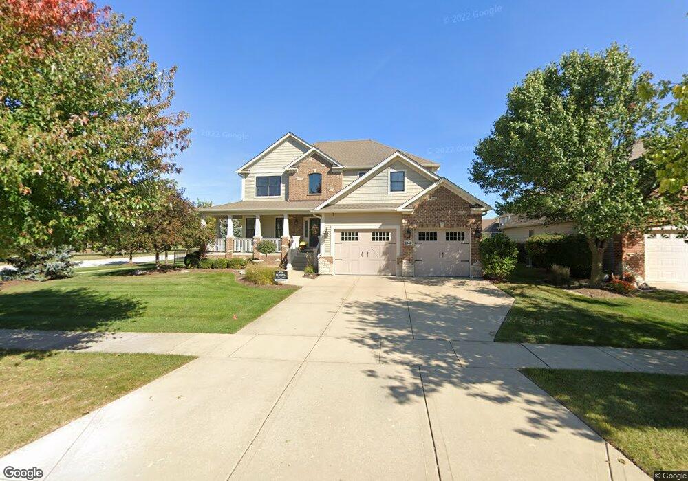
1040 Independence Ave Elburn, IL 60119
Estimated Value: $505,434 - $589,000
3
Beds
2
Baths
2,800
Sq Ft
$192/Sq Ft
Est. Value
About This Home
This home is located at 1040 Independence Ave, Elburn, IL 60119 and is currently estimated at $537,109, approximately $191 per square foot. 1040 Independence Ave is a home located in Kane County with nearby schools including Kaneland Blackberry Creek Elementary School, Harter Middle School, and Kaneland Senior High School.
Ownership History
Date
Name
Owned For
Owner Type
Purchase Details
Closed on
May 24, 2010
Sold by
Brandonisio Dina and Brandonisio Dino
Bought by
Brandonisio Dino M and Brandonisio Lindsay A
Current Estimated Value
Home Financials for this Owner
Home Financials are based on the most recent Mortgage that was taken out on this home.
Original Mortgage
$268,000
Outstanding Balance
$180,420
Interest Rate
5.14%
Mortgage Type
New Conventional
Estimated Equity
$356,689
Purchase Details
Closed on
Oct 3, 2007
Sold by
Lowden Homes Llc
Bought by
Brandonisio Dino and Brandonisio Dina
Home Financials for this Owner
Home Financials are based on the most recent Mortgage that was taken out on this home.
Original Mortgage
$63,000
Interest Rate
6.49%
Mortgage Type
Purchase Money Mortgage
Create a Home Valuation Report for This Property
The Home Valuation Report is an in-depth analysis detailing your home's value as well as a comparison with similar homes in the area
Home Values in the Area
Average Home Value in this Area
Purchase History
| Date | Buyer | Sale Price | Title Company |
|---|---|---|---|
| Brandonisio Dino M | -- | Fox Title Company | |
| Brandonisio Dino | $84,000 | Chicago Title Insurance Co |
Source: Public Records
Mortgage History
| Date | Status | Borrower | Loan Amount |
|---|---|---|---|
| Open | Brandonisio Dino M | $268,000 | |
| Closed | Brandonisio Dino | $63,000 |
Source: Public Records
Tax History Compared to Growth
Tax History
| Year | Tax Paid | Tax Assessment Tax Assessment Total Assessment is a certain percentage of the fair market value that is determined by local assessors to be the total taxable value of land and additions on the property. | Land | Improvement |
|---|---|---|---|---|
| 2024 | $12,066 | $148,565 | $17,164 | $131,401 |
| 2023 | $11,632 | $134,084 | $15,491 | $118,593 |
| 2022 | $12,224 | $134,522 | $14,217 | $120,305 |
| 2021 | $11,783 | $128,753 | $13,607 | $115,146 |
| 2020 | $11,570 | $125,735 | $13,288 | $112,447 |
| 2019 | $11,579 | $123,889 | $13,093 | $110,796 |
| 2018 | $11,418 | $119,998 | $13,093 | $106,905 |
| 2017 | $11,422 | $118,634 | $12,944 | $105,690 |
| 2016 | $12,172 | $122,716 | $12,602 | $110,114 |
| 2015 | -- | $112,708 | $8,711 | $103,997 |
| 2014 | -- | $108,971 | $11,167 | $97,804 |
| 2013 | -- | $108,971 | $11,167 | $97,804 |
Source: Public Records
Map
Nearby Homes
- 1192 Beed Ave
- 1121 Lance Ave
- 1473 Anderson Rd
- 1311 Spalding Ave
- 1382 Independence Ave
- 1430 Souders Ave
- 1122 Motz St
- 1133 Sears Cir
- 951 Kindberg Ct
- 43W556 Kenmar Ct
- ES Aspen Plan at Elburn Station - The Village Homes
- ES Potomac Plan at Elburn Station - The Village Homes
- ES Mackinaw Plan at Elburn Station - The Village Homes
- ES Frisco Plan at Elburn Station - The Village Homes
- 16 Derek Dr
- 12 Derek Dr
- 6 Derek Dr
- 5 Derek Dr
- 4 Derek Dr
- 11 Derek Dr
- 1055 Lakin Ave
- Lot 948 Independence Ave
- 1073 Lakin Ave
- 1076 Independence Ave Unit 10
- 1059 Independence Ave
- 953 Lakin Ave
- 949 Lakin Ave
- 951 Lakin Ave
- 1087 Lakin Ave
- 1082 Independence Ave
- 1063 Independence Ave Unit 10
- 1091 Lakin Ave
- 968 Independence Ave
- 1074 Lakin Ave
- 1077 Independence Ave
- 1090 Independence Ave
- 1088 Lakin Ave
- 1087 Independence Ave
- 951 Independence Ave
- 1448 Blackberry Creek Dr