Estimated Value: $268,000 - $393,000
--
Bed
2
Baths
1,920
Sq Ft
$180/Sq Ft
Est. Value
About This Home
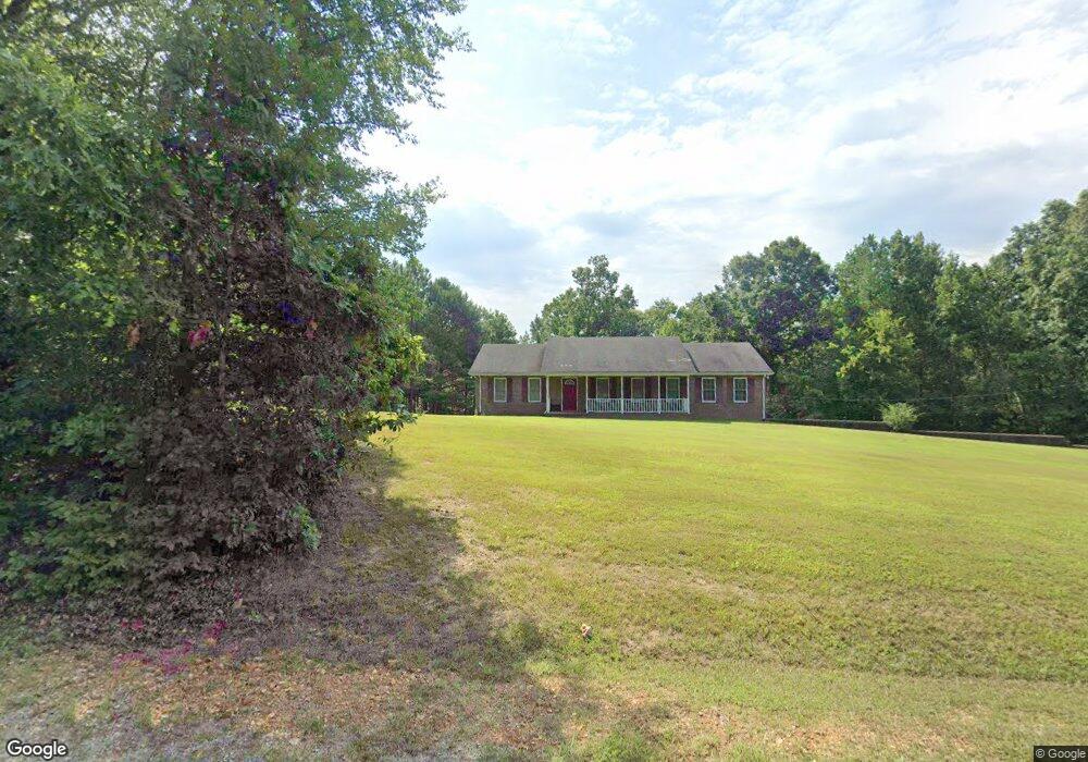
This home is located at 1040 Old Highway 79 Unit 1040, Dover, TN 37058 and is currently estimated at $345,607, approximately $180 per square foot. 1040 Old Highway 79 Unit 1040 is a home located in Stewart County with nearby schools including North Stewart Elementary School, Stewart County Middle School, and Stewart County High School.
Ownership History
Date
Name
Owned For
Owner Type
Purchase Details
Closed on
Dec 23, 1999
Bought by
Greenhill Bart E and Greenhill Tammy
Current Estimated Value
Purchase Details
Closed on
Apr 29, 1999
Bought by
Swift Dale and Swift Rita
Purchase Details
Closed on
Nov 29, 1995
Bought by
Dill Donald M and Dill H0lli
Purchase Details
Closed on
Jun 21, 1984
Bought by
Smith Townsend B and Smith Ellen J
Purchase Details
Closed on
Apr 23, 1982
Purchase Details
Closed on
Nov 14, 1981
Purchase Details
Closed on
Aug 29, 1980
Purchase Details
Closed on
Nov 19, 1977
Create a Home Valuation Report for This Property
The Home Valuation Report is an in-depth analysis detailing your home's value as well as a comparison with similar homes in the area
Home Values in the Area
Average Home Value in this Area
Purchase History
| Date | Buyer | Sale Price | Title Company |
|---|---|---|---|
| Greenhill Bart E | $20,000 | -- | |
| Swift Dale | $11,000 | -- | |
| Dill Donald M | $117,900 | -- | |
| Smith Townsend B | -- | -- | |
| -- | -- | -- | |
| -- | -- | -- | |
| -- | -- | -- | |
| -- | -- | -- |
Source: Public Records
Tax History Compared to Growth
Tax History
| Year | Tax Paid | Tax Assessment Tax Assessment Total Assessment is a certain percentage of the fair market value that is determined by local assessors to be the total taxable value of land and additions on the property. | Land | Improvement |
|---|---|---|---|---|
| 2024 | $1,280 | $86,100 | $11,800 | $74,300 |
| 2023 | $1,210 | $51,250 | $7,875 | $43,375 |
| 2022 | $1,210 | $51,250 | $7,875 | $43,375 |
| 2021 | $1,210 | $51,250 | $7,875 | $43,375 |
| 2020 | $1,253 | $51,250 | $7,875 | $43,375 |
| 2019 | $1,253 | $49,175 | $7,875 | $41,300 |
| 2018 | $1,253 | $49,175 | $7,875 | $41,300 |
| 2017 | $1,253 | $49,175 | $7,875 | $41,300 |
| 2016 | $1,253 | $49,175 | $7,875 | $41,300 |
| 2015 | $1,215 | $49,175 | $7,875 | $41,300 |
| 2014 | $1,159 | $49,175 | $7,875 | $41,300 |
| 2013 | $1,159 | $46,922 | $0 | $0 |
Source: Public Records
Map
Nearby Homes
- 909 Old Highway 79
- 330 Durwachter Rd
- 0A Patricia Cir
- 275 Patricia Cir
- 210 Patricia Cir
- 154 Crains Landing Rd
- 1551 Old Highway 79 Unit 1551
- 129 Bagsby Hill Ln
- 135 Bagsby Hill Ln
- 0 Wildlife Rd
- 29 Long Creek Estates
- 196 Wildlife Rd
- 0 Refuge Rd S
- 0 Wildlife Ln
- 234 Bazzie Dock Rd
- 102 Colson Rd
- 124 Norris Hancock Rd
- 118 Colson Rd
- 210 Patrick Dr
- 242 Barn Circle Rd
- 125 Bellwood Hollow Rd
- 1045 Old Highway 79 Unit 586
- 1045 Old Highway 79 Unit 1045
- 1 Mallard Dr
- 1046 Old Highway 79
- 1086 Old Highway 79 Unit 1077
- 1086 Old Highway 79
- 0 Mallard Dr Unit 1890582
- 0 Mallard Dr Unit 1868108
- 0 Mallard Dr Unit 1601345
- 0 Mallard Dr Unit 1600919
- 0 Mallard Dr Unit 95
- 0 Mallard Dr Unit 121152
- 0 Mallard Dr Unit RTC1508853
- 0 Mallard Dr Unit 2087881
- 1061 Old Highway 79 Unit 1061
- 910 Old Highway 79
- 1076 Old Highway 79 Unit 1076
- 79 Mallard Dr
- 79 Old Highway 79 Hwy