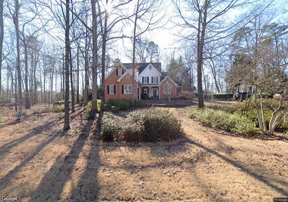
1040 Power Ridge Place Bogart, GA 30622
Estimated Value: $549,701 - $688,000
4
Beds
3
Baths
2,695
Sq Ft
$224/Sq Ft
Est. Value
About This Home
This home is located at 1040 Power Ridge Place, Bogart, GA 30622 and is currently estimated at $603,425, approximately $223 per square foot. 1040 Power Ridge Place is a home located in Oconee County with nearby schools including Rocky Branch Elementary School, Malcom Bridge Middle School, and North Oconee High School.
Ownership History
Date
Name
Owned For
Owner Type
Purchase Details
Closed on
Nov 16, 2009
Sold by
Dirr Michael A
Bought by
Brassard William K
Current Estimated Value
Purchase Details
Closed on
Dec 31, 2004
Sold by
Manus Judy Mccall
Bought by
Dirr Michael A
Purchase Details
Closed on
Feb 18, 2003
Sold by
Manus Richard C
Bought by
Manus Judy Mccall
Purchase Details
Closed on
Jul 13, 1999
Sold by
Jl Baker Building
Bought by
Manus Richard C
Create a Home Valuation Report for This Property
The Home Valuation Report is an in-depth analysis detailing your home's value as well as a comparison with similar homes in the area
Home Values in the Area
Average Home Value in this Area
Purchase History
| Date | Buyer | Sale Price | Title Company |
|---|---|---|---|
| Brassard William K | $237,500 | -- | |
| Brassard William K | $237,500 | -- | |
| Dirr Michael A | $289,900 | -- | |
| Dirr Michael A | $289,900 | -- | |
| Manus Judy Mccall | -- | -- | |
| Manus Richard C | $244,500 | -- |
Source: Public Records
Tax History Compared to Growth
Tax History
| Year | Tax Paid | Tax Assessment Tax Assessment Total Assessment is a certain percentage of the fair market value that is determined by local assessors to be the total taxable value of land and additions on the property. | Land | Improvement |
|---|---|---|---|---|
| 2024 | $3,294 | $175,853 | $30,000 | $145,853 |
| 2023 | $3,294 | $156,648 | $20,000 | $136,648 |
| 2022 | $2,997 | $139,544 | $20,000 | $119,544 |
| 2021 | $2,974 | $128,481 | $20,000 | $108,481 |
| 2020 | $2,856 | $123,190 | $20,000 | $103,190 |
| 2019 | $2,767 | $119,372 | $20,000 | $99,372 |
| 2018 | $2,651 | $112,008 | $20,000 | $92,008 |
| 2017 | $2,608 | $110,182 | $20,000 | $90,182 |
| 2016 | $2,493 | $105,323 | $20,000 | $85,323 |
| 2015 | $2,448 | $103,407 | $22,000 | $81,407 |
| 2014 | $2,414 | $99,937 | $22,000 | $77,937 |
| 2013 | -- | $93,382 | $22,000 | $71,382 |
Source: Public Records
Map
Nearby Homes
- 1145 Summerfield Ln
- 1180 Summerfield Ln
- 1120 Liberty Ln
- 4100 Monroe Hwy
- 4400 Monroe Hwy Unit PARCEL 1-7
- 00 Ruth Jackson Rd
- 0 Ruth Jackson Rd Unit 10582108
- 3240 Monroe Hwy
- 1181 Pete Dickens Rd
- 1327 Eisenhower Ave
- 1250 Pete Dickens Rd
- 1665 Eisenhower Ave
- 2479 Eisenhower Ave
- 1640 Madison Ct
- 2736 Eisenhower Ave
- 1050 Cobblestone Ln
- 1101 Derby Ln
- 3041 Monroe Hwy
- 1131 Holcomb Ct
- 115 Holcomb Ct
- 0 Holcomb Ct
- 1091 Holcomb Ct
- 1060 Power Ridge Place
- 1110 Holcomb Ct
- 1140 Glenwood Ln
- 1061 Power Ridge Place
- 1130 Holcomb Ct
- 1090 Holcomb Ct
- 1071 Holcomb Ct
- 1080 Glenwood Ln
- 1150 Holcomb Ct
- 1131 Glenwood Ln
- 1150 Glenwood Ln
- 1070 Holcomb Ct
- 1141 Glenwood Ln
- 1161 Holcomb Ct
- 1111 Glenwood Ln
- 1061 Holcomb Ct