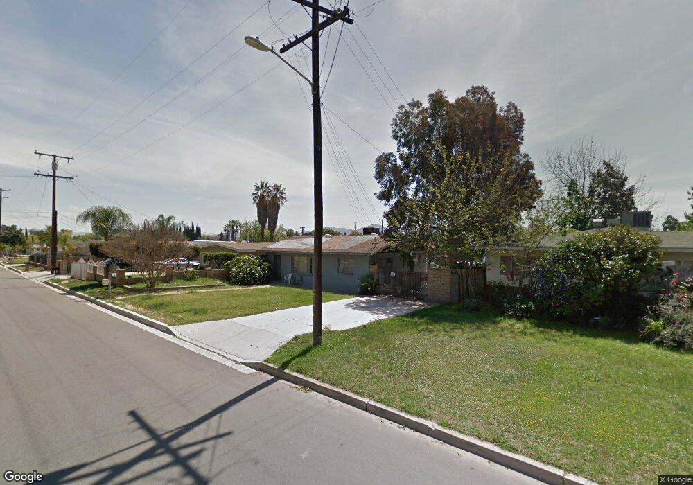
1040 Stevenson St Colton, CA 92324
Estimated Value: $303,000 - $414,000
2
Beds
1
Bath
925
Sq Ft
$411/Sq Ft
Est. Value
About This Home
This home is located at 1040 Stevenson St, Colton, CA 92324 and is currently estimated at $379,723, approximately $410 per square foot. 1040 Stevenson St is a home located in San Bernardino County with nearby schools including Paul Rogers Elementary School, Colton Middle School, and Colton High School.
Ownership History
Date
Name
Owned For
Owner Type
Purchase Details
Closed on
Apr 1, 2015
Sold by
Nunez Leo D
Bought by
Starlite Mgmt Viii Lp
Current Estimated Value
Purchase Details
Closed on
Jul 22, 2010
Sold by
Nunez Leo D
Bought by
Hsbc Bank Usa Na
Purchase Details
Closed on
Jun 6, 2000
Sold by
Nunez Leo D
Bought by
Nunez Leo D
Home Financials for this Owner
Home Financials are based on the most recent Mortgage that was taken out on this home.
Original Mortgage
$67,150
Interest Rate
10.25%
Create a Home Valuation Report for This Property
The Home Valuation Report is an in-depth analysis detailing your home's value as well as a comparison with similar homes in the area
Home Values in the Area
Average Home Value in this Area
Purchase History
| Date | Buyer | Sale Price | Title Company |
|---|---|---|---|
| Starlite Mgmt Viii Lp | $136,500 | None Available | |
| Hsbc Bank Usa Na | $78,000 | Accommodation | |
| Nunez Leo D | -- | Fidelity National Title |
Source: Public Records
Mortgage History
| Date | Status | Borrower | Loan Amount |
|---|---|---|---|
| Previous Owner | Nunez Leo D | $67,150 |
Source: Public Records
Tax History Compared to Growth
Tax History
| Year | Tax Paid | Tax Assessment Tax Assessment Total Assessment is a certain percentage of the fair market value that is determined by local assessors to be the total taxable value of land and additions on the property. | Land | Improvement |
|---|---|---|---|---|
| 2025 | $2,178 | $168,260 | $50,478 | $117,782 |
| 2024 | $2,178 | $164,961 | $49,488 | $115,473 |
| 2023 | $2,178 | $161,727 | $48,518 | $113,209 |
| 2022 | $2,145 | $158,556 | $47,567 | $110,989 |
| 2021 | $2,180 | $155,447 | $46,634 | $108,813 |
| 2020 | $2,185 | $153,853 | $46,156 | $107,697 |
| 2019 | $2,130 | $150,836 | $45,251 | $105,585 |
| 2018 | $1,940 | $147,879 | $44,364 | $103,515 |
| 2017 | $1,872 | $144,979 | $43,494 | $101,485 |
| 2016 | $2,230 | $142,136 | $42,641 | $99,495 |
| 2015 | $731 | $61,588 | $12,676 | $48,912 |
| 2014 | $699 | $60,382 | $12,428 | $47,954 |
Source: Public Records
Map
Nearby Homes
- 1065 Stevenson St Unit A & B
- 1012 Long Beach Dr
- 941 W F St
- 1145 Bonita Dr
- 805 Valencia Dr
- 711 N Meridian Ave
- 1549 Agate St
- 1765 Alston Ave
- 495 W C St
- 464 W E St
- 2250 W Mill St Unit 53
- 2250 W Mill #70 St
- 467 W G St
- 385 W F St
- 1736 Pennsylvania Ave
- 881 S Lamarr St
- 725 W K St
- 3004 Cardamon St
- 140 N 4th St
- 2686 W Mill St Unit 91
- 1038 Stevenson St
- 1048 Stevenson St
- 1036 Stevenson St
- 1051 Orange St
- 1180 Cypress Ave
- 945 Orange St
- 1049 Orange St
- 935 Orange St
- 1040 Orange St
- 1034 Stevenson St
- 1041 Stevenson St
- 1045 Stevenson St
- 925 Orange St
- 1033 Stevenson St
- 1037 Stevenson St
- 1032 Stevenson St
- 1053 Stevenson St
- 958 Orange St
- 1031 Stevenson St
- 1058 Stevenson St