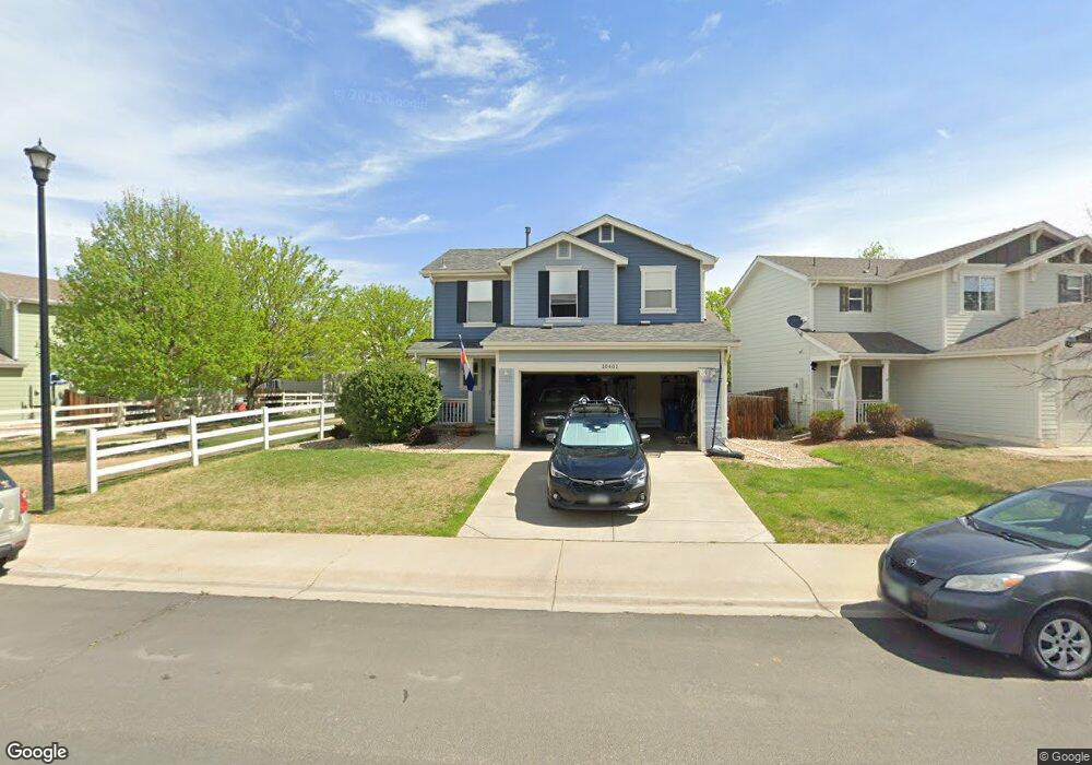
10401 Butte Dr Longmont, CO 80504
Estimated Value: $421,000 - $444,000
3
Beds
2
Baths
1,371
Sq Ft
$314/Sq Ft
Est. Value
About This Home
This home is located at 10401 Butte Dr, Longmont, CO 80504 and is currently estimated at $429,890, approximately $313 per square foot. 10401 Butte Dr is a home located in Weld County with nearby schools including Centennial Elementary School, Coal Ridge Middle School, and Mead High School.
Ownership History
Date
Name
Owned For
Owner Type
Purchase Details
Closed on
Jan 26, 2012
Sold by
Maki Ann and Maki Nate
Bought by
Maki Ann and Maki Nathanael
Current Estimated Value
Home Financials for this Owner
Home Financials are based on the most recent Mortgage that was taken out on this home.
Original Mortgage
$127,500
Outstanding Balance
$87,810
Interest Rate
4%
Mortgage Type
New Conventional
Estimated Equity
$342,080
Purchase Details
Closed on
Sep 22, 2009
Sold by
Aldermen John A and Aldermen Kylin M
Bought by
Maki Nate and Maki Ann
Home Financials for this Owner
Home Financials are based on the most recent Mortgage that was taken out on this home.
Original Mortgage
$130,500
Interest Rate
5.36%
Mortgage Type
New Conventional
Create a Home Valuation Report for This Property
The Home Valuation Report is an in-depth analysis detailing your home's value as well as a comparison with similar homes in the area
Home Values in the Area
Average Home Value in this Area
Purchase History
| Date | Buyer | Sale Price | Title Company |
|---|---|---|---|
| Maki Ann | -- | Fidelity National Title Insu | |
| Maki Nate | $145,000 | Utc Colorado |
Source: Public Records
Mortgage History
| Date | Status | Borrower | Loan Amount |
|---|---|---|---|
| Open | Maki Ann | $127,500 | |
| Closed | Maki Nate | $130,500 |
Source: Public Records
Tax History Compared to Growth
Tax History
| Year | Tax Paid | Tax Assessment Tax Assessment Total Assessment is a certain percentage of the fair market value that is determined by local assessors to be the total taxable value of land and additions on the property. | Land | Improvement |
|---|---|---|---|---|
| 2025 | $2,416 | $26,840 | $5,380 | $21,460 |
| 2024 | $2,416 | $26,840 | $5,380 | $21,460 |
| 2023 | $2,317 | $29,710 | $5,820 | $23,890 |
| 2022 | $2,034 | $21,590 | $4,450 | $17,140 |
| 2021 | $2,072 | $22,210 | $4,580 | $17,630 |
| 2020 | $1,999 | $21,610 | $3,040 | $18,570 |
| 2019 | $2,022 | $21,610 | $3,040 | $18,570 |
| 2018 | $1,618 | $17,500 | $3,020 | $14,480 |
| 2017 | $1,553 | $17,500 | $3,020 | $14,480 |
| 2016 | $1,321 | $14,800 | $2,150 | $12,650 |
| 2015 | $1,278 | $14,800 | $2,150 | $12,650 |
| 2014 | $982 | $11,390 | $1,990 | $9,400 |
Source: Public Records
Map
Nearby Homes
- 10592 Butte Dr
- 10688 Durango Place
- 10691 Durango Place
- 10910 Turner Blvd Unit 127
- 10910 Turner Blvd Unit 203
- 10752 County Road 7
- 0 Del Camino Business Park Lot 1 Unit 986024
- 4616 Tilbury Ct
- 9746 County Road 7
- 10555 Aspen St Unit 198
- 10529 Bald Eagle Cir Unit 394
- 10529 Bald Eagle Cir
- 10684 Aspen St Unit 72
- 10684 Aspen St
- 3545 Cottonwood Cir
- 4795 Audrey St Unit 260
- 4768 Silverleaf Ave
- 10597 Bald Eagle Cir Unit 244
- 10611 Barron Cir Unit 426
- 10574 Bald Eagle Cir
- 10403 Butte Dr
- 10410 Durango Place
- 10572 Butte Dr
- 10405 Butte Dr
- 10412 Durango Place
- 10573 Durango Place
- 10407 Butte Dr
- 10574 Butte Dr
- 10402 Butte Dr
- 10400 Butte Dr
- 10414 Durango Place
- 10575 Durango Place
- 10404 Butte Dr
- 10406 Butte Dr
- 10569 Butte Dr
- 10408 Butte Dr
- 10409 Butte Dr
- 10576 Butte Dr
- 10416 Durango Place
- 10571 Butte Dr